Charleston Peninsula 3x3x3 Study
Civic Design Opportunities
Our 260-page design report is the culmination of over 3 years of collaboration, exploration and civic design advocacy with US Army Corps of Engineers (USACE), the City’s Chief Resiliency Officer, and various internal and external design-based teams. The Civic Design Opportunities report is an urban design response to the USCAE Tentatively Selected Plan (TSP), an expansion of the visual impact exercise described in Appendix A of the USACE draft report and the Waggonner & Ball Discovery Report, and a tool for use in the next phase of the project to ensure the storm surge barrier fits into the urban fabric of the Charleston peninsula. The work is not intended, nor should be used as, a basis for opposition to the project, but does reveal the complex road ahead and important opportunities for negotiating key public space and city-building factors, such as alignment, design, materiality, streetscape, future development, open space, etc.


The Civic Design Opportunities report contains a compilation of issues, opportunities and ideas for the proposed perimeter protection system. These are presented in three general sections:
Project Context - Overview of the TSP and overarching issues of design using a series of peninsula maps with supportive graphics,
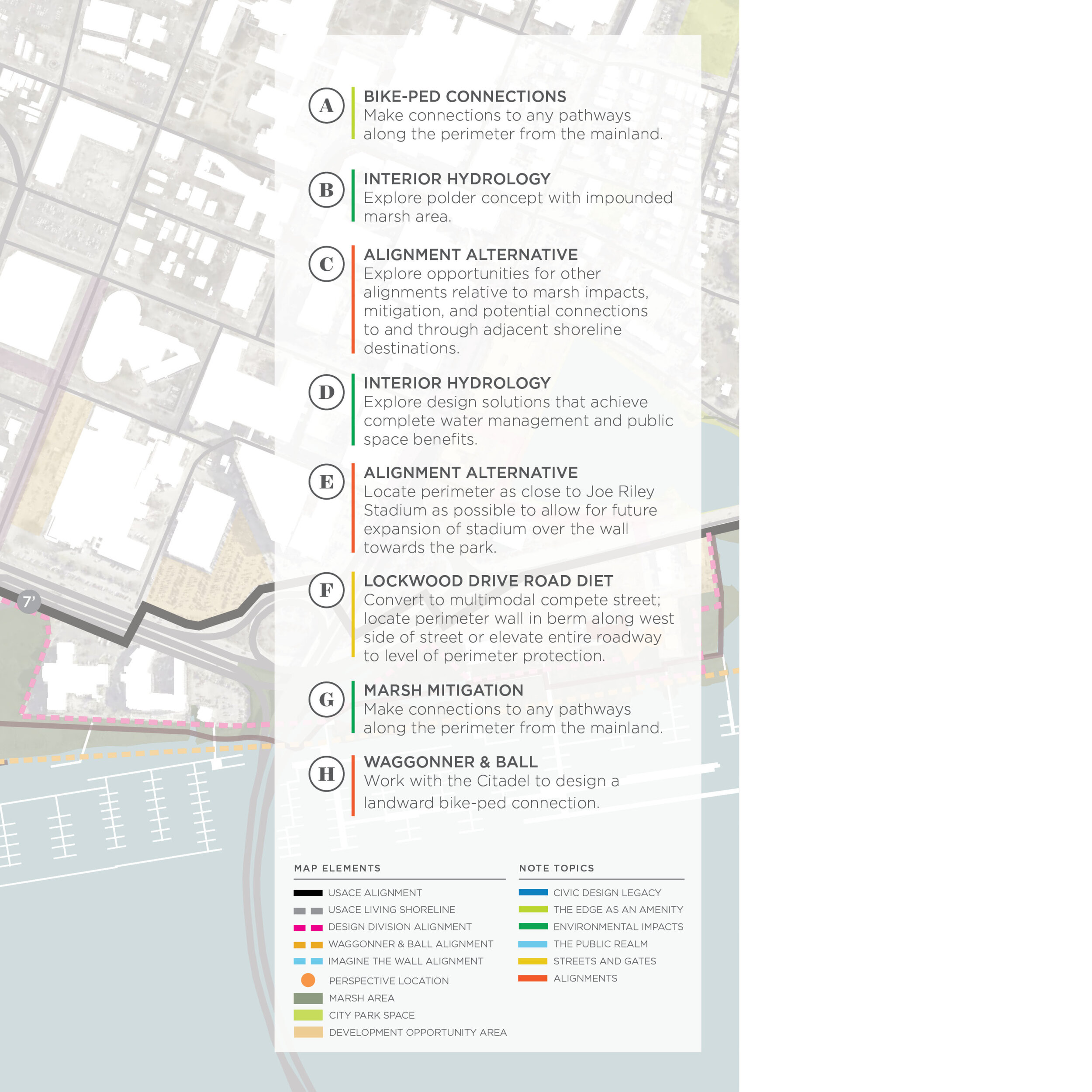
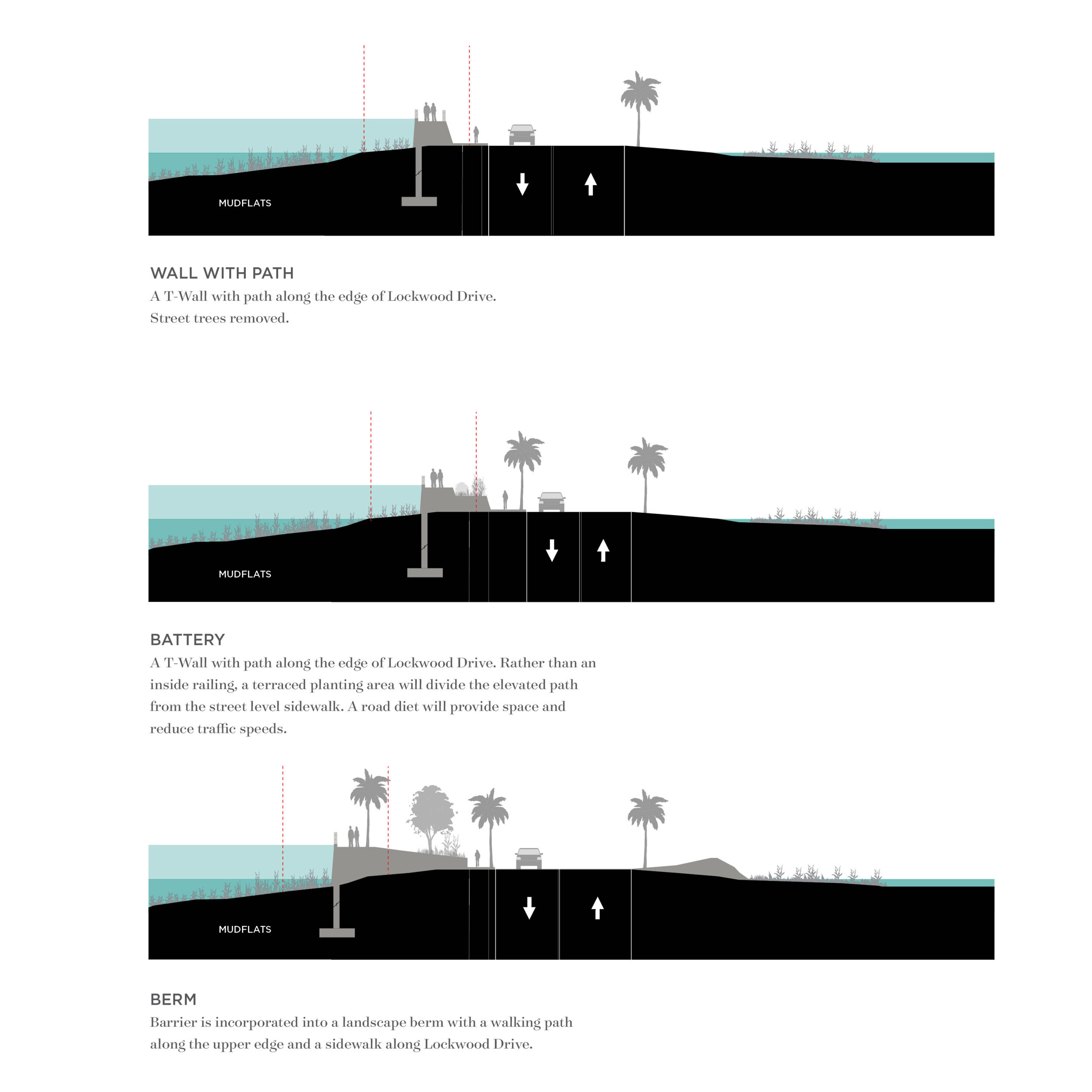
Key Topics - Expansive narrative surrounding 6 key topics ranging from an assertion of Charleston’s civic design values to issues surrounding gates, streets, environmental features and the public realm,
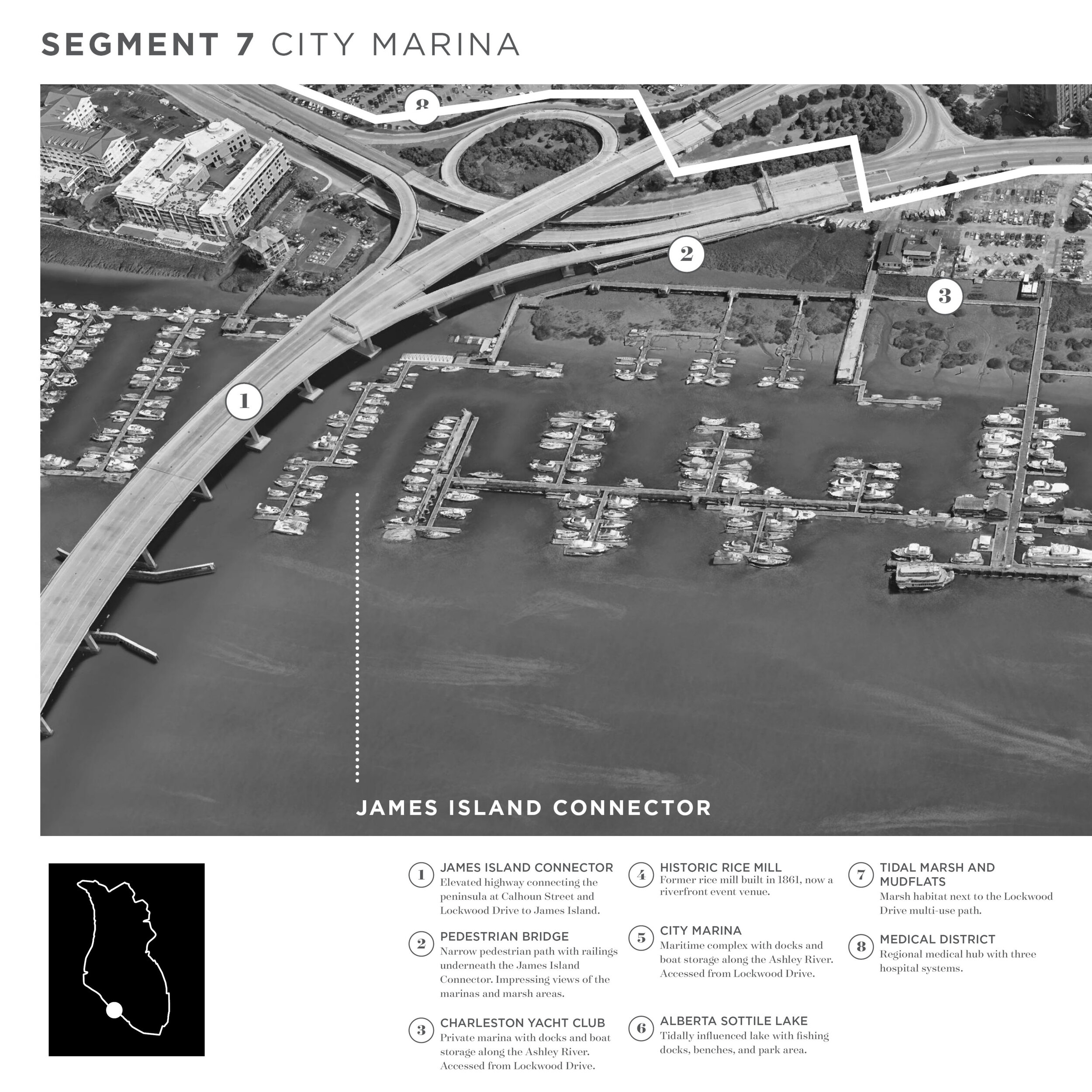
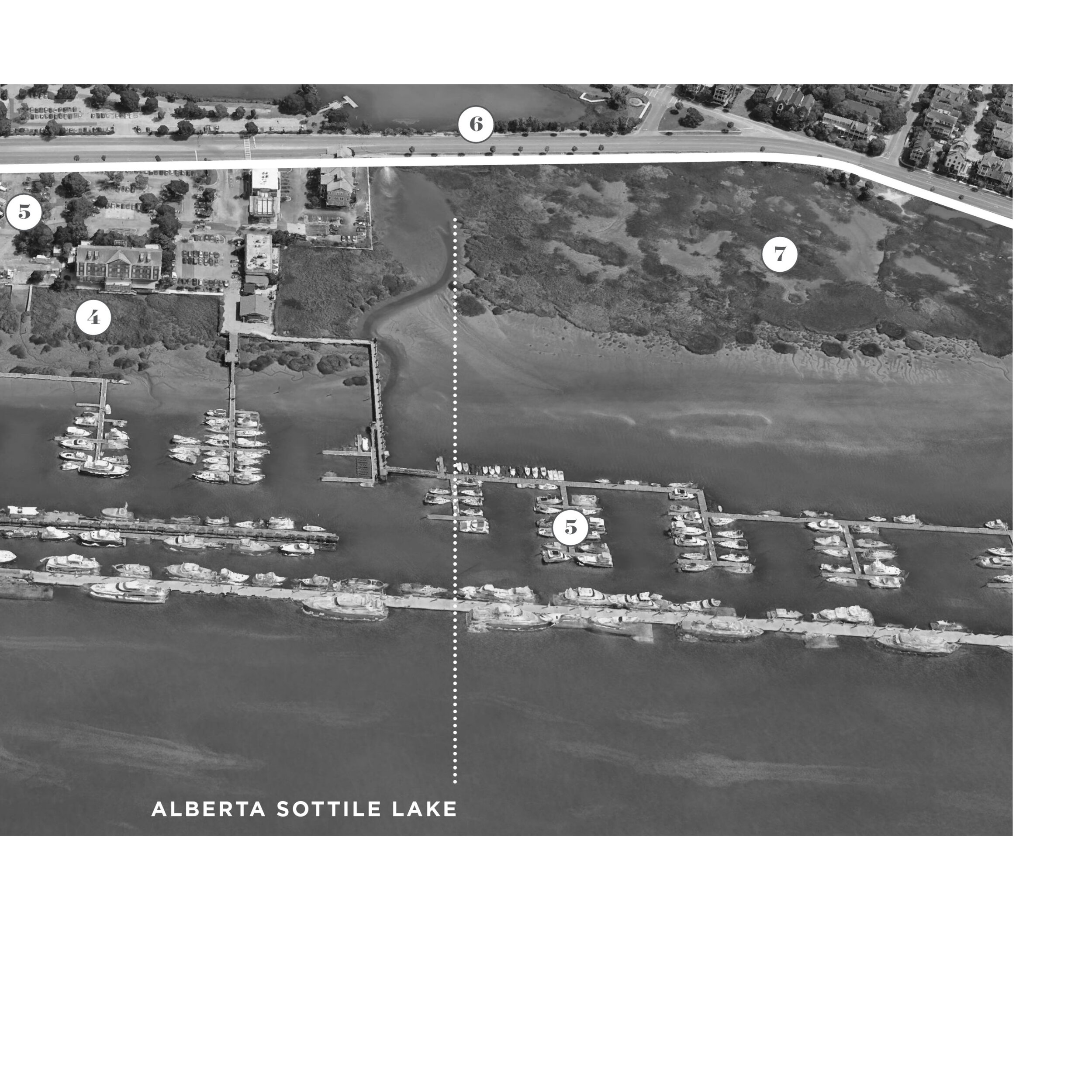
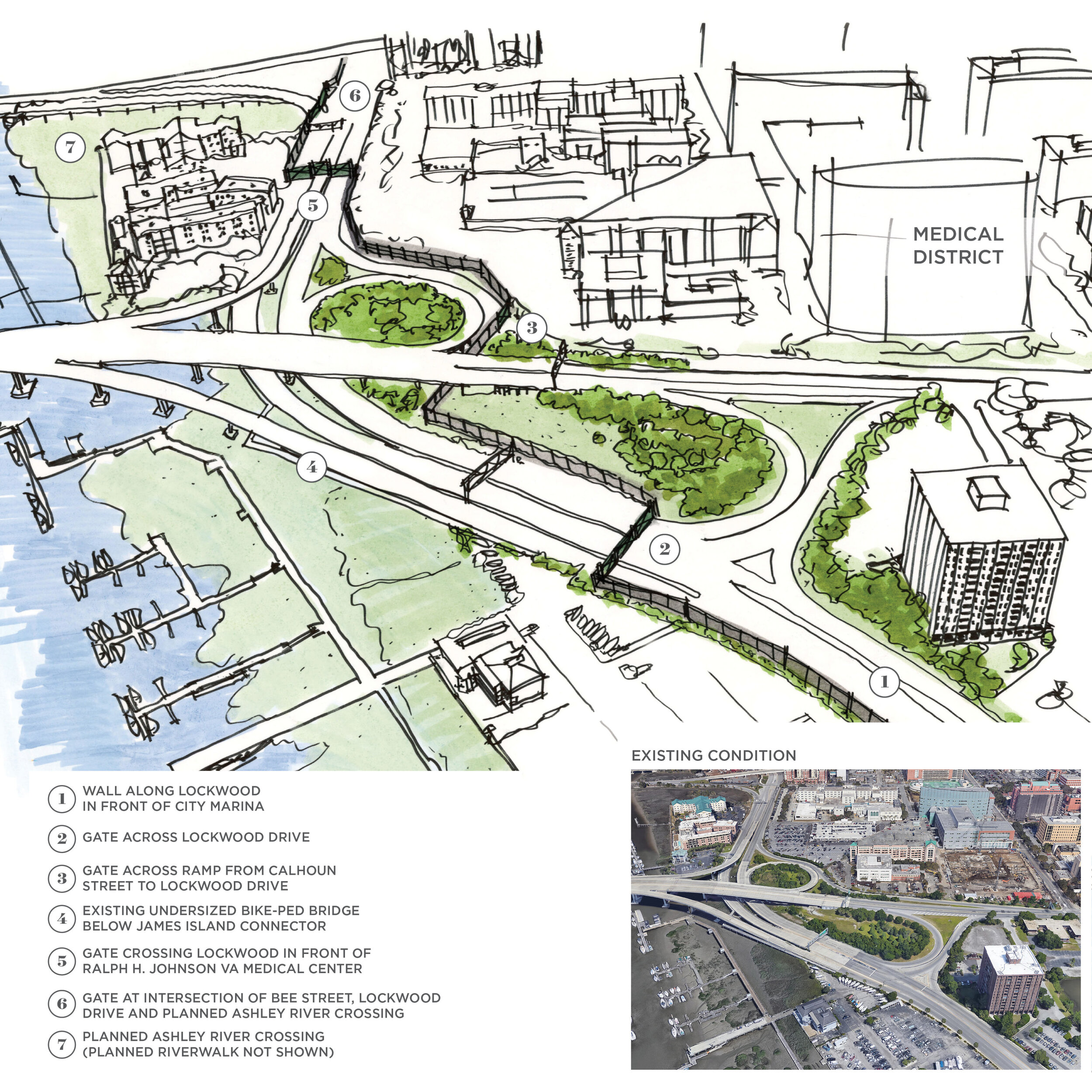
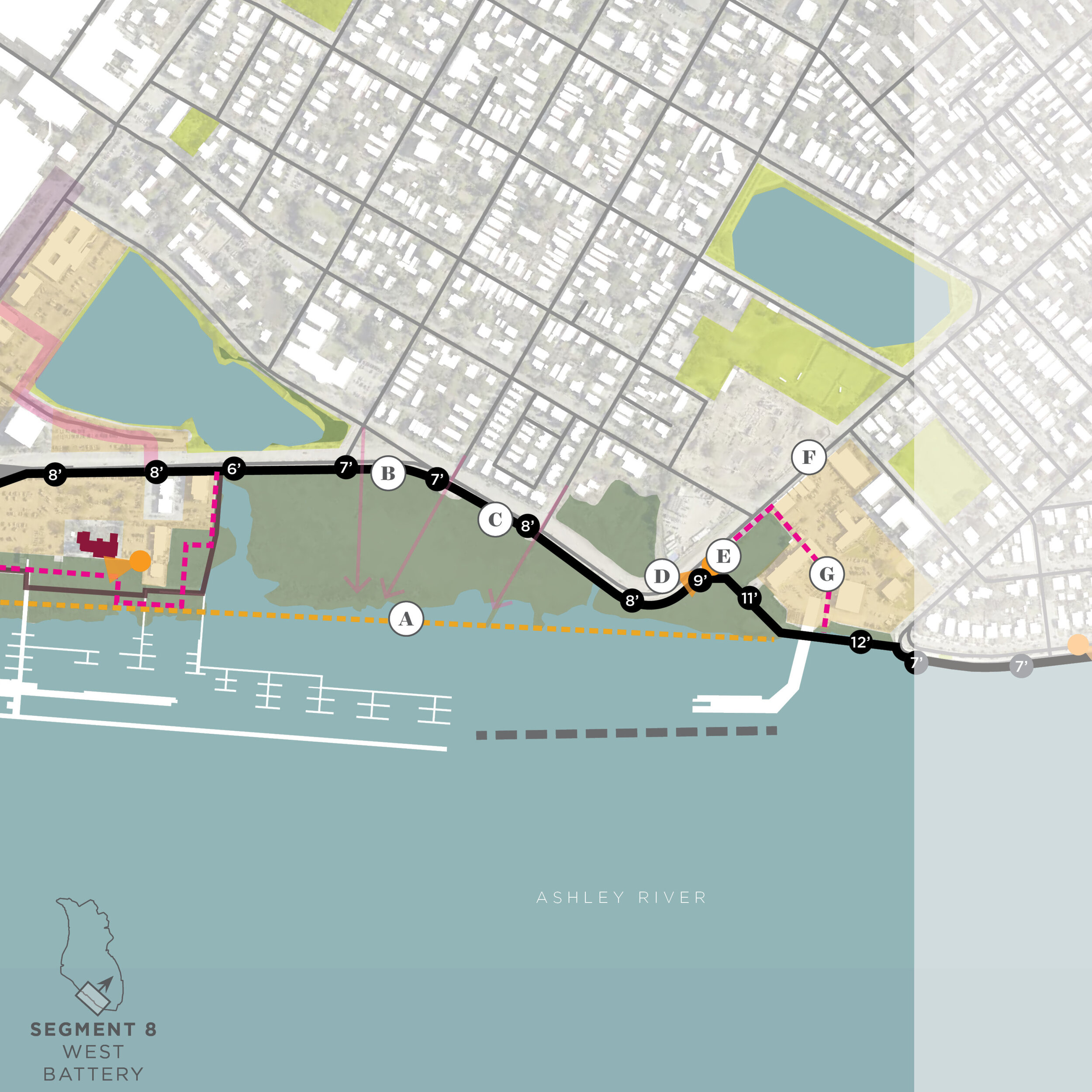
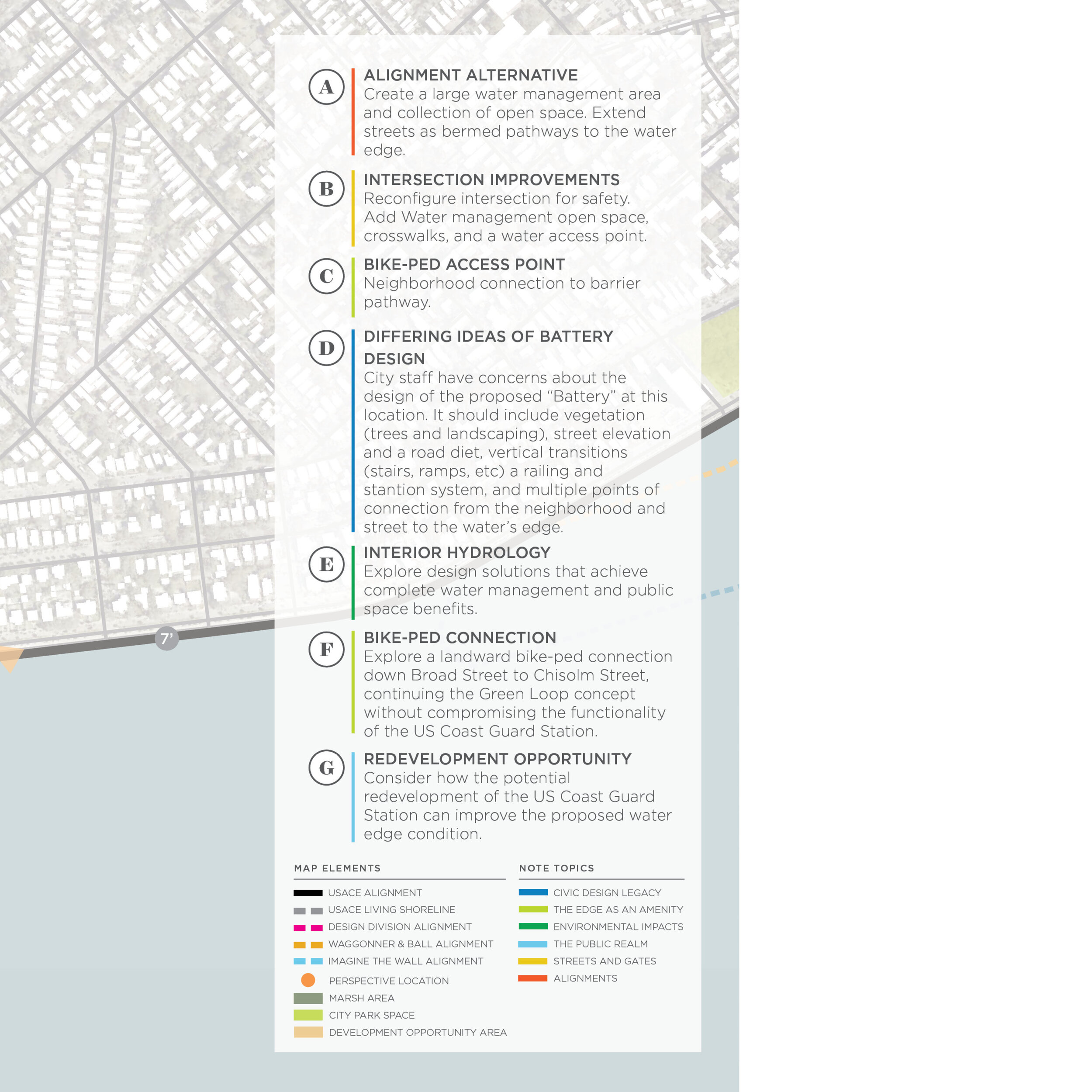
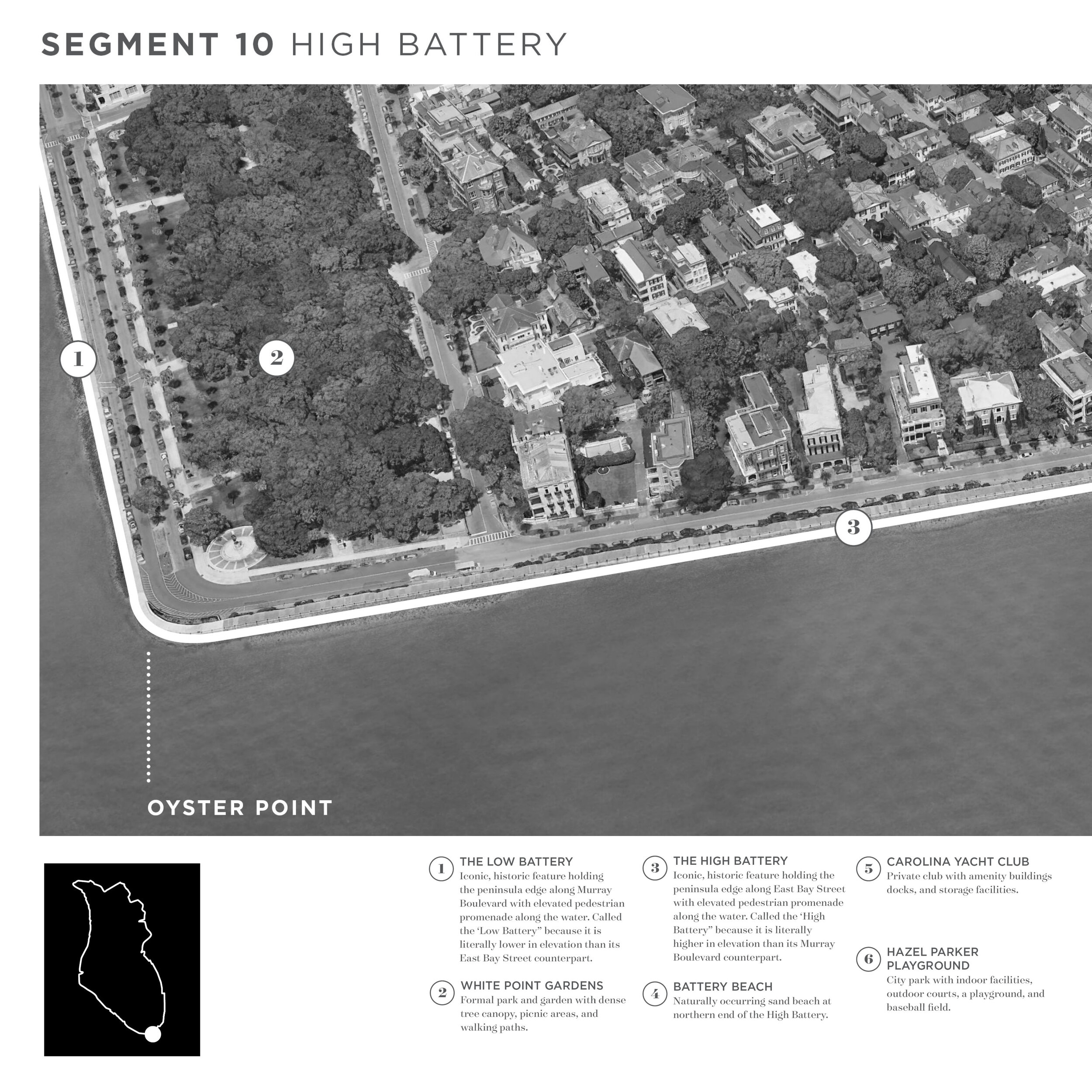
Segment Area Studies - Exploration of elements for 16 comprehensive geographic segments along the perimeter of the Charleston peninsula.
US Army Corps of Engineers Draft Report for Public Comment
The USACE 3x3x3 Coastal Flood Risk Management Study is a complex report and proposal for a storm surge barrier around the Charleston peninsula. The draft report, and its several appendices, are currently out for 45-day public comment period, ending on October 25th. The button below will take you to this report.
City Council Workshop Presentations
Below is a video of the City Council Workshop on October 20th. Presentations were made by the US Army Corps of Engineers, the Design Division (minute 38), the City’s Stormwater Director and the City’s Chief Resiliency Officer.

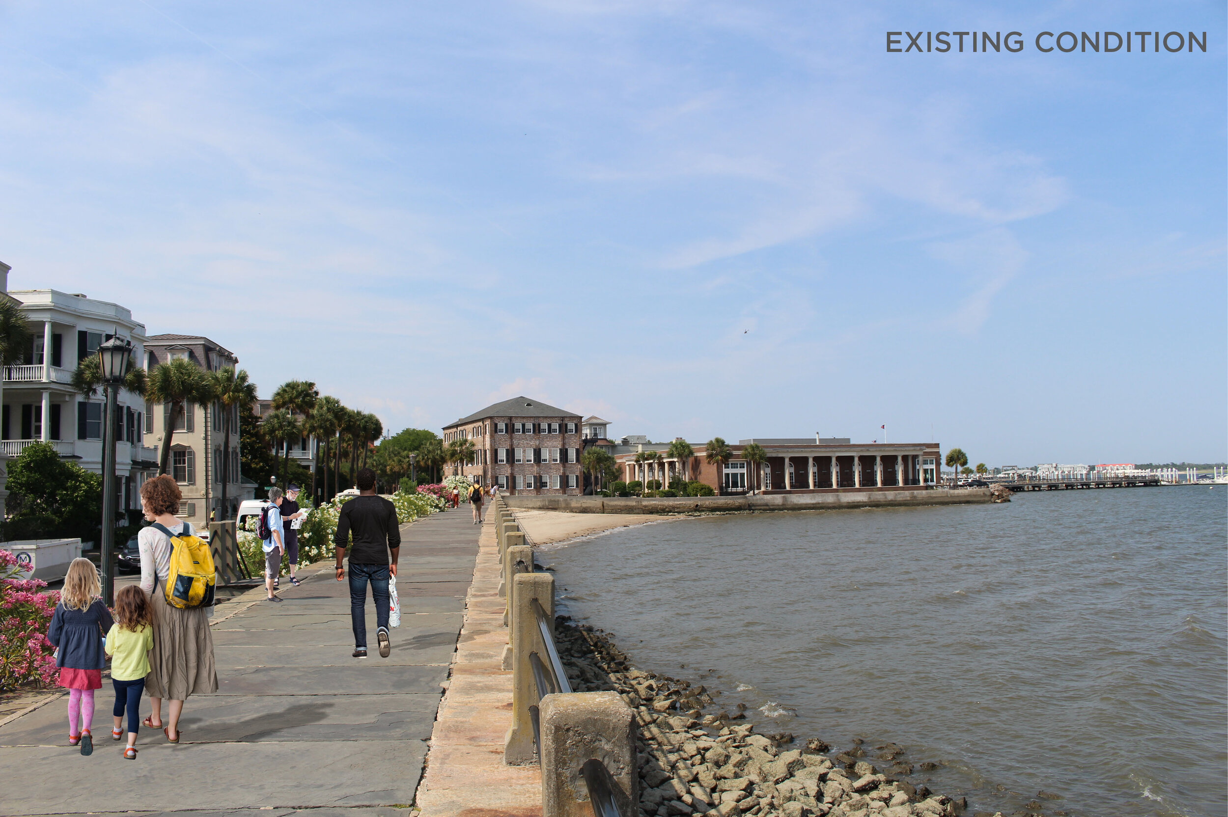
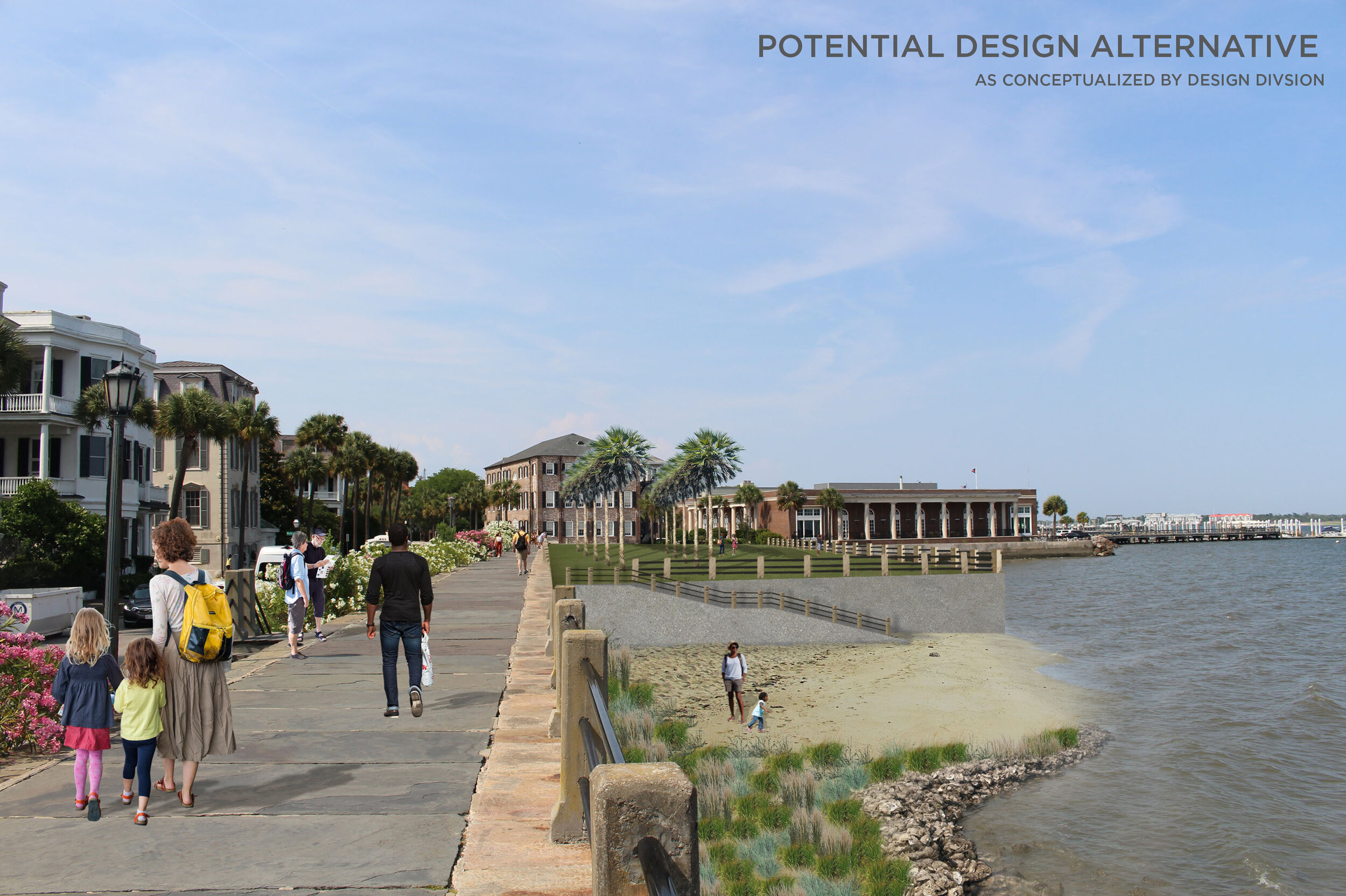
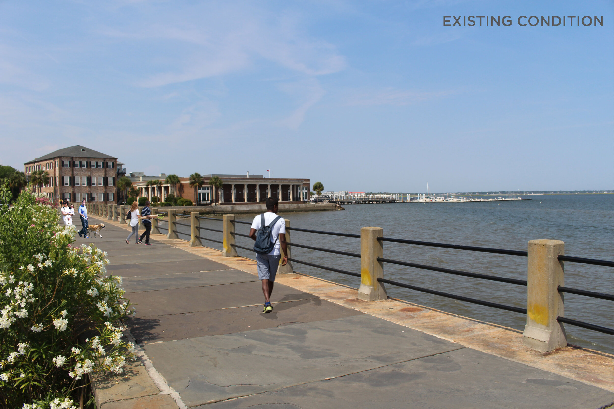
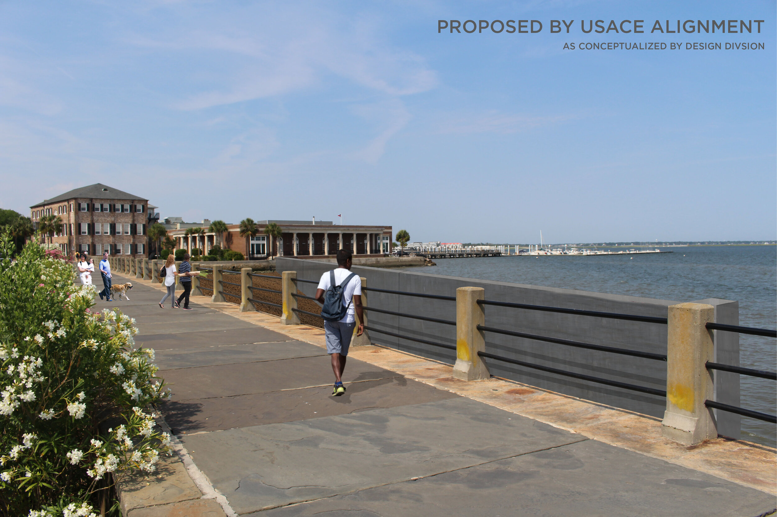
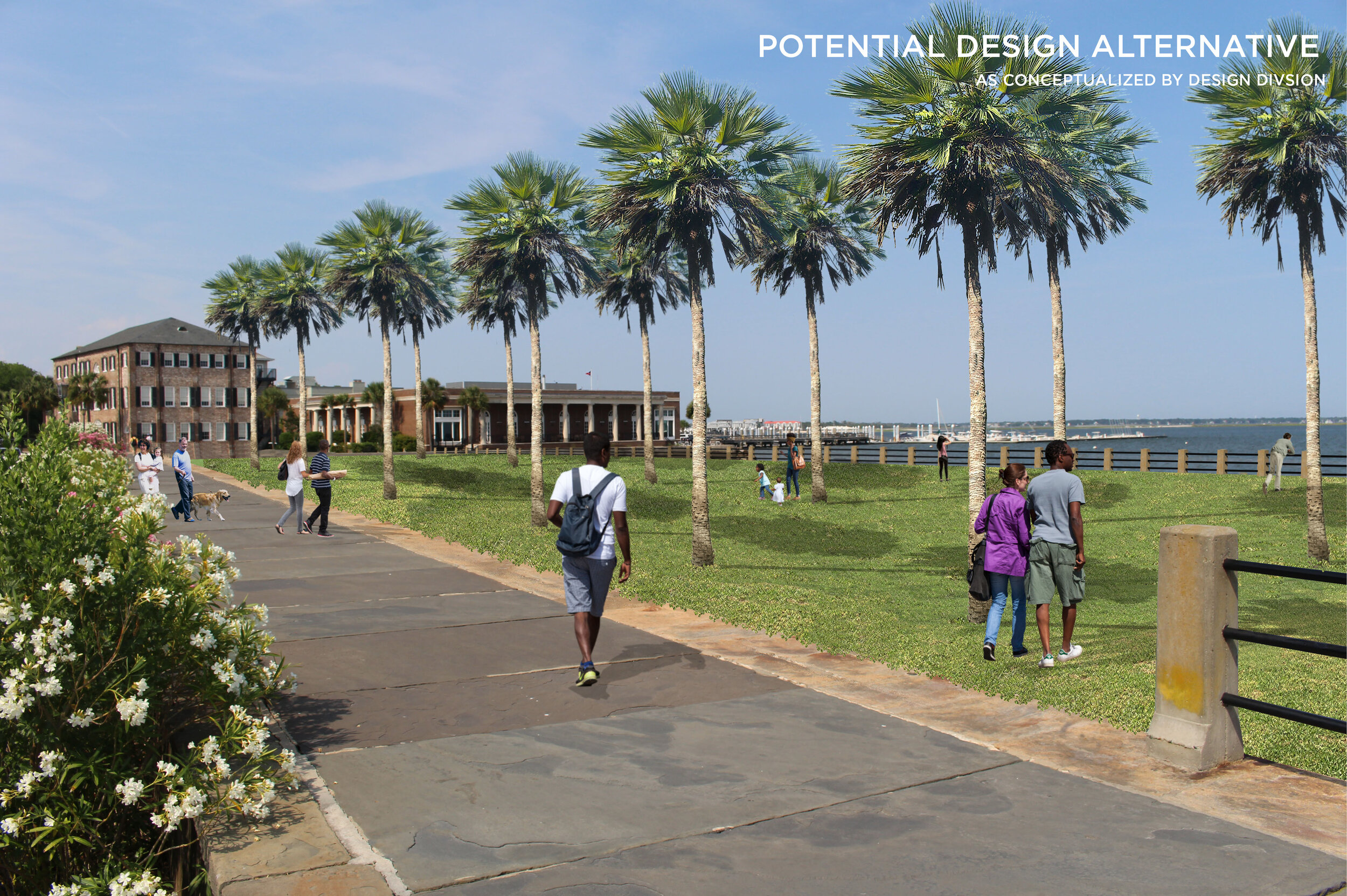
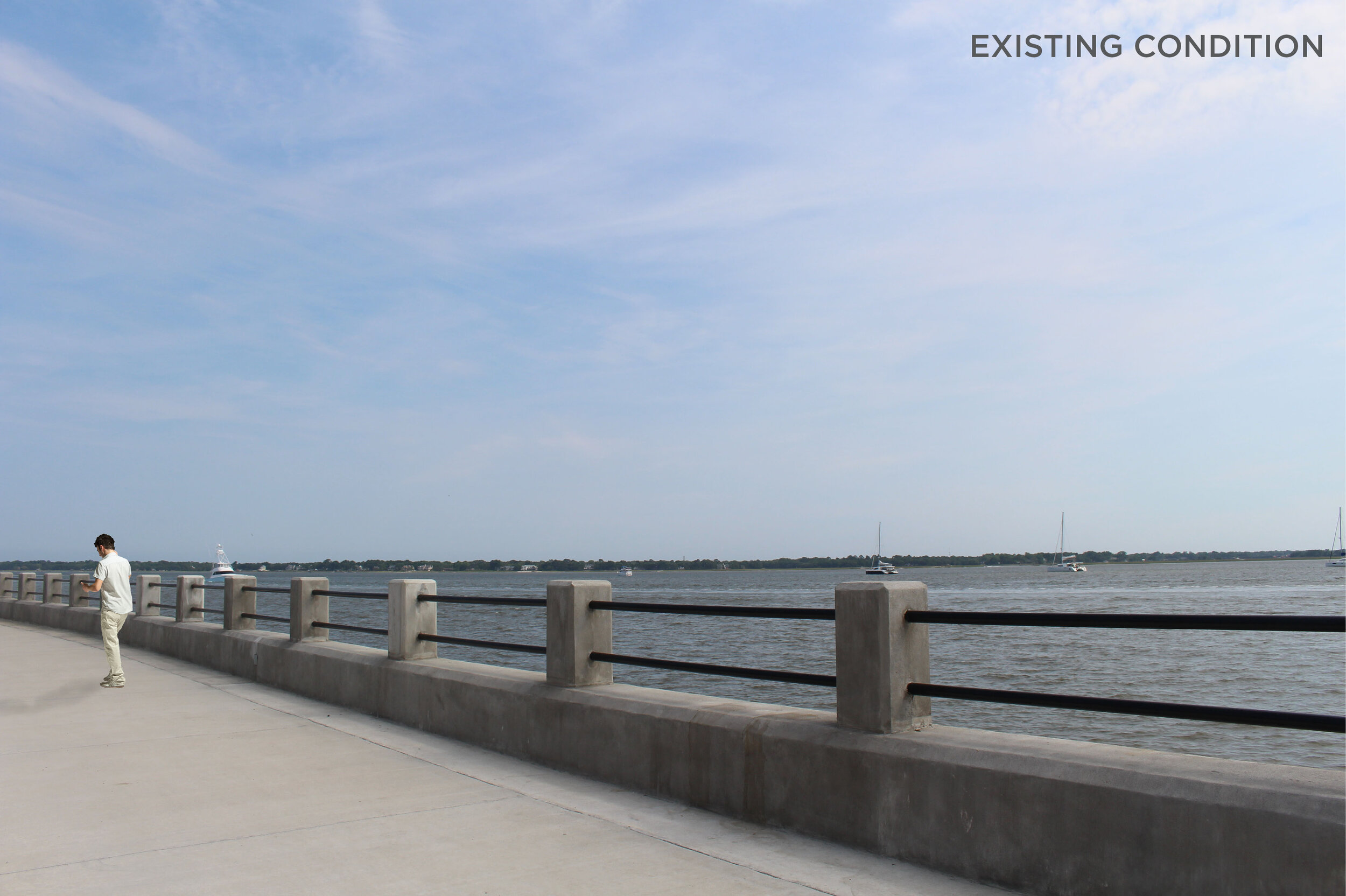
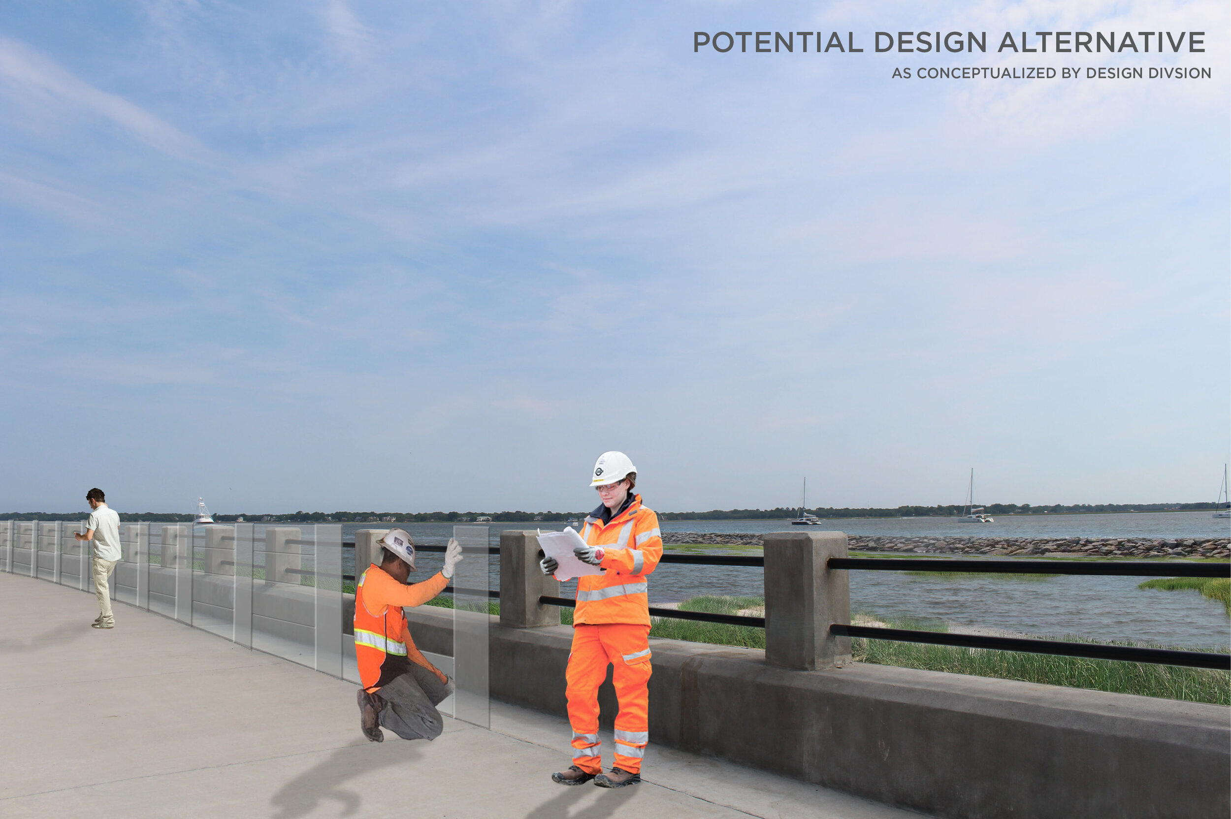
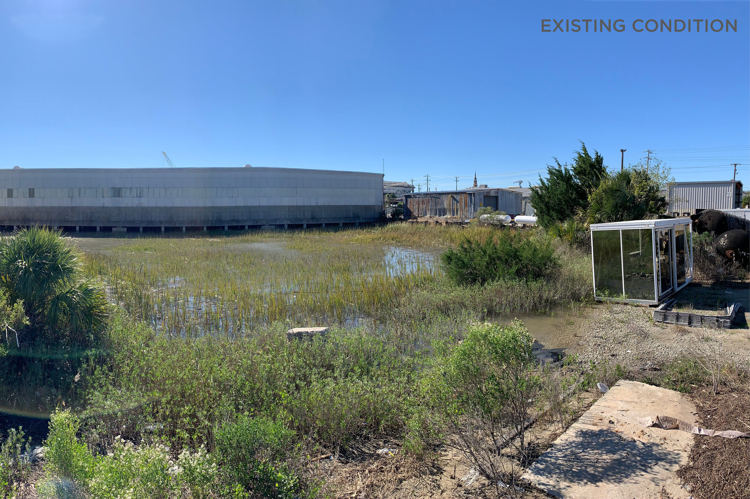
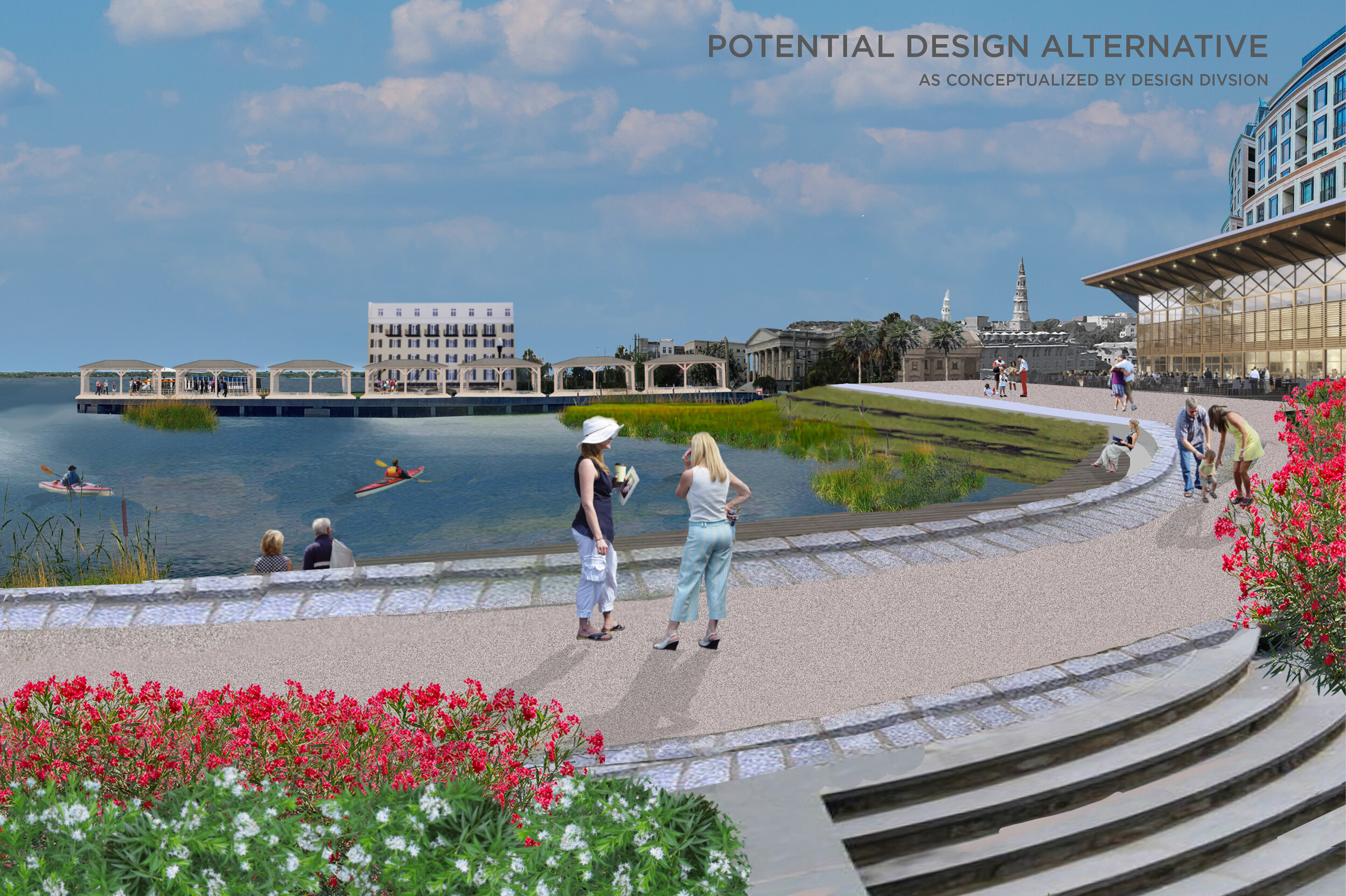
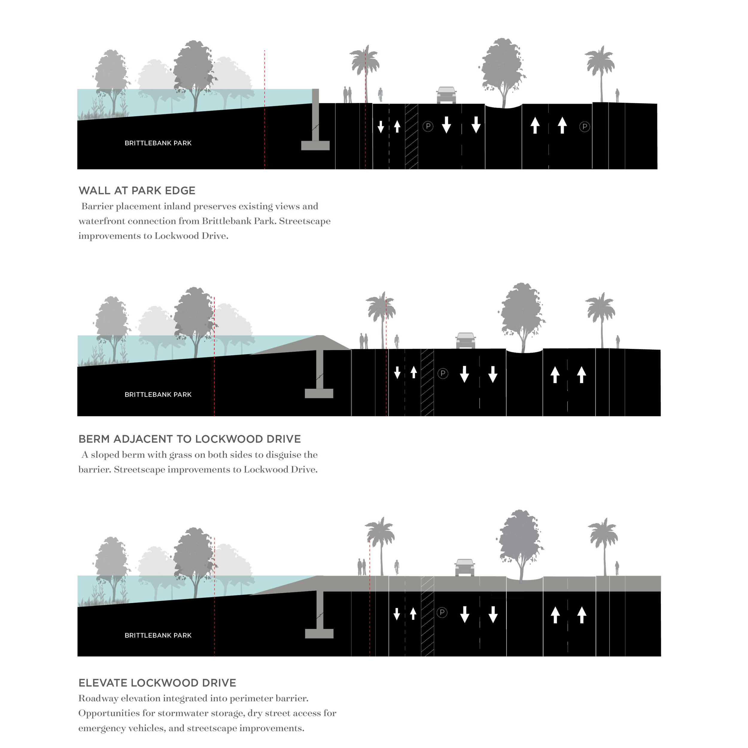
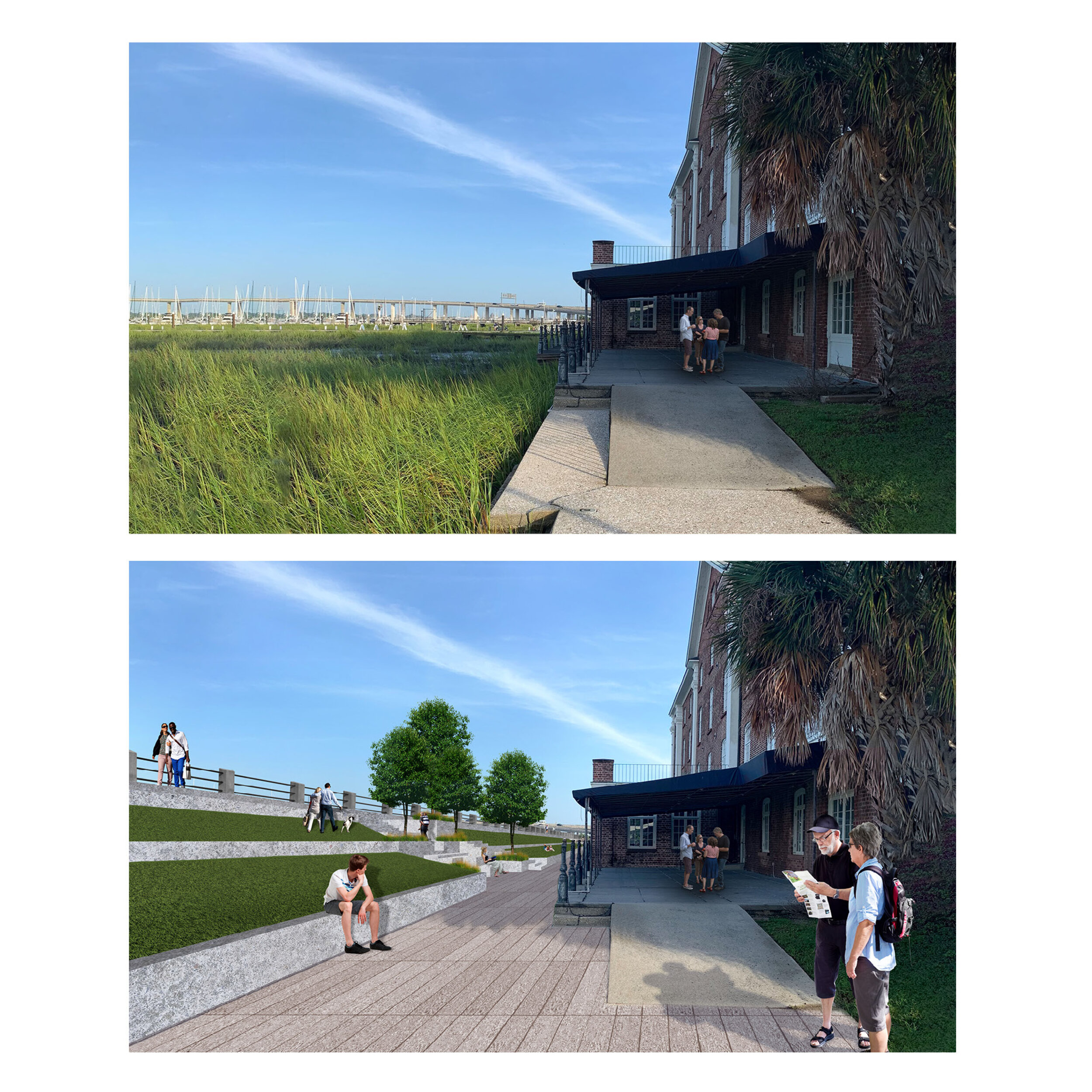
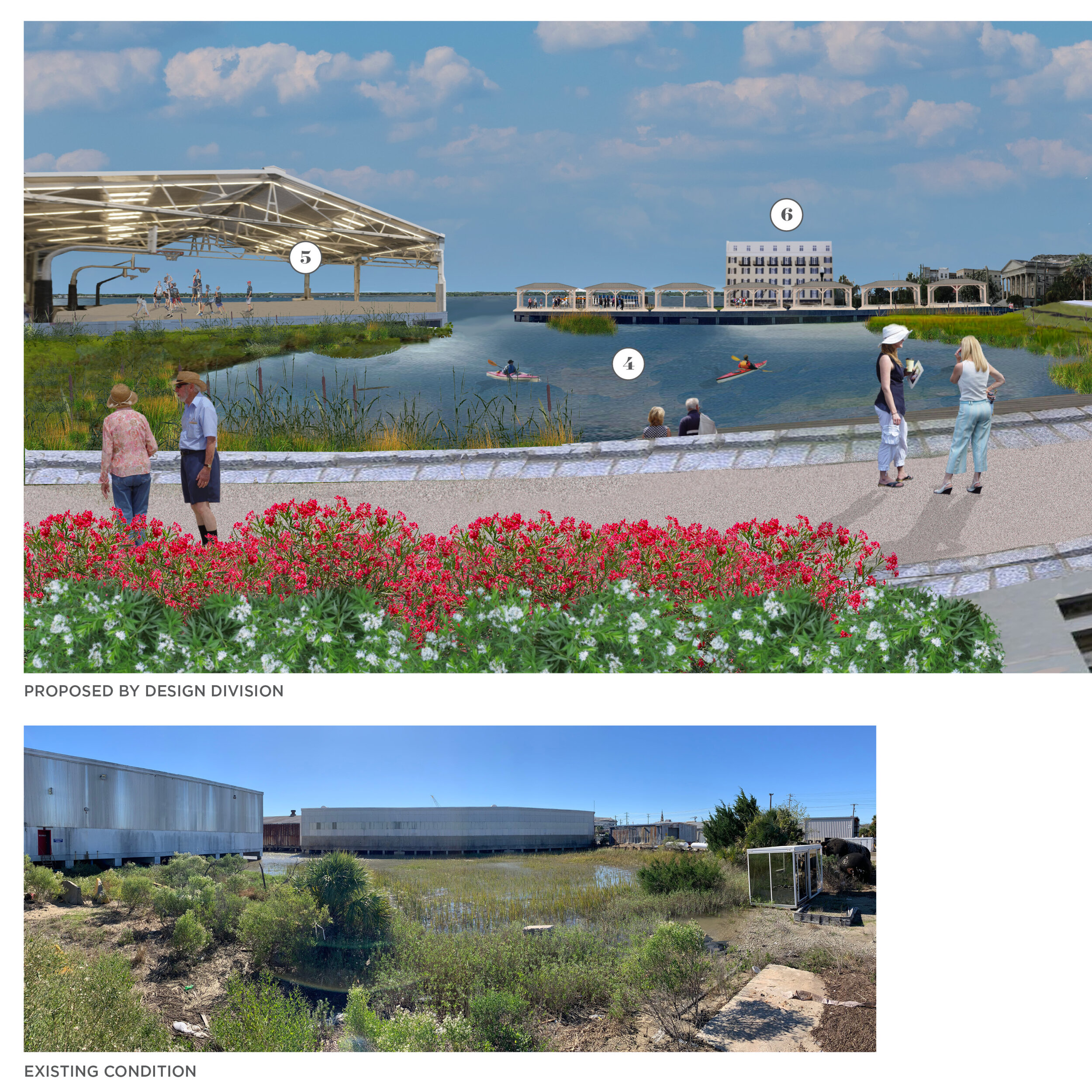
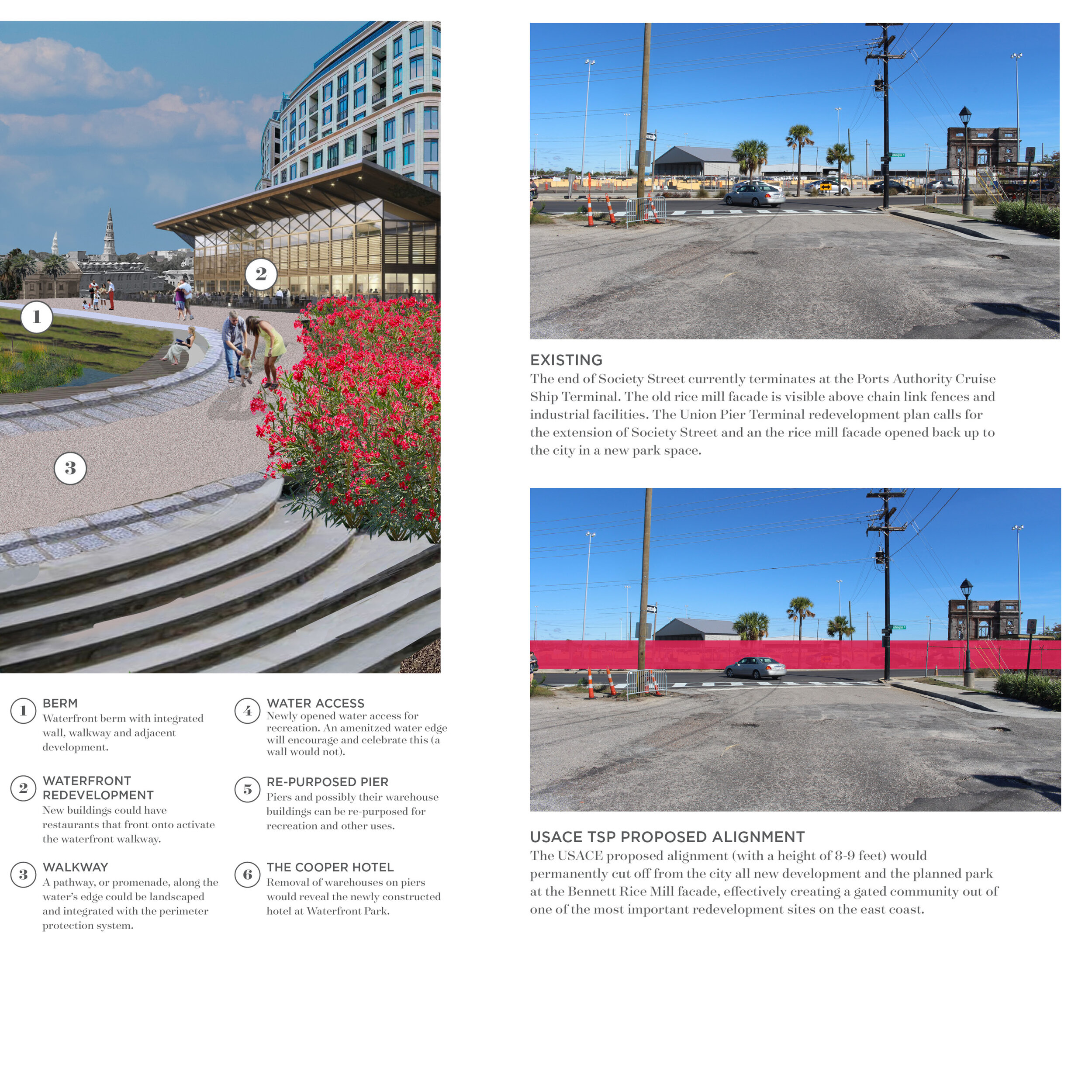
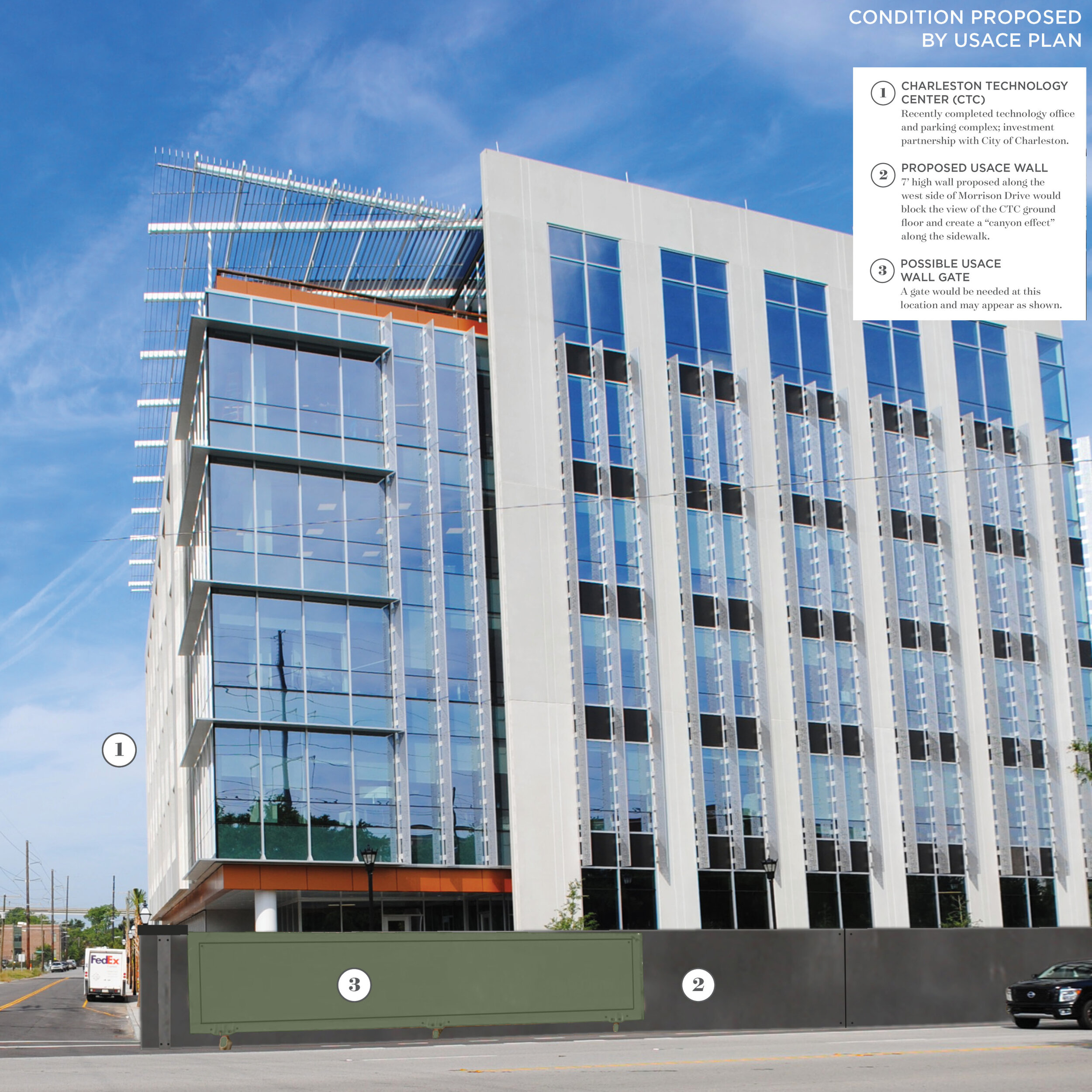
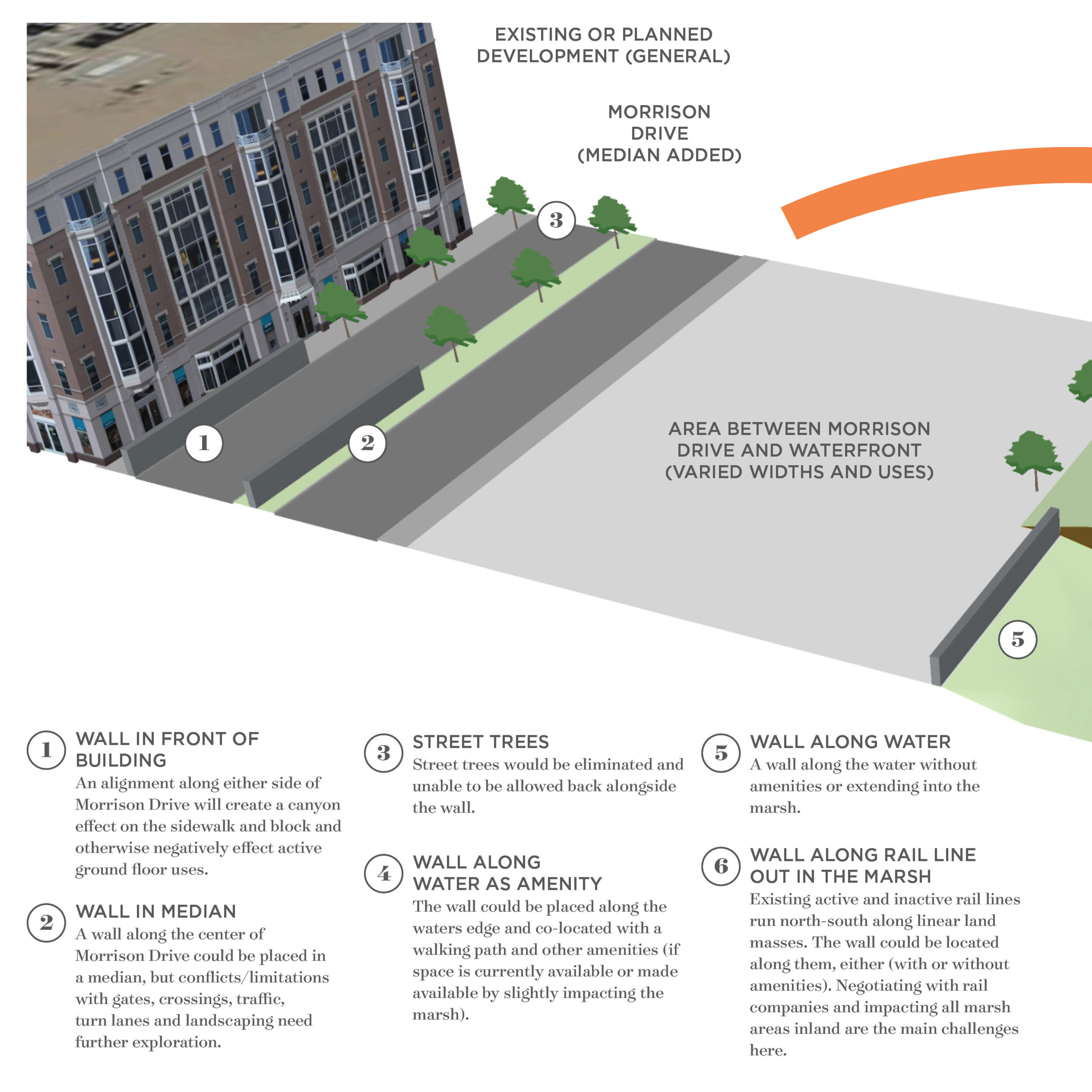
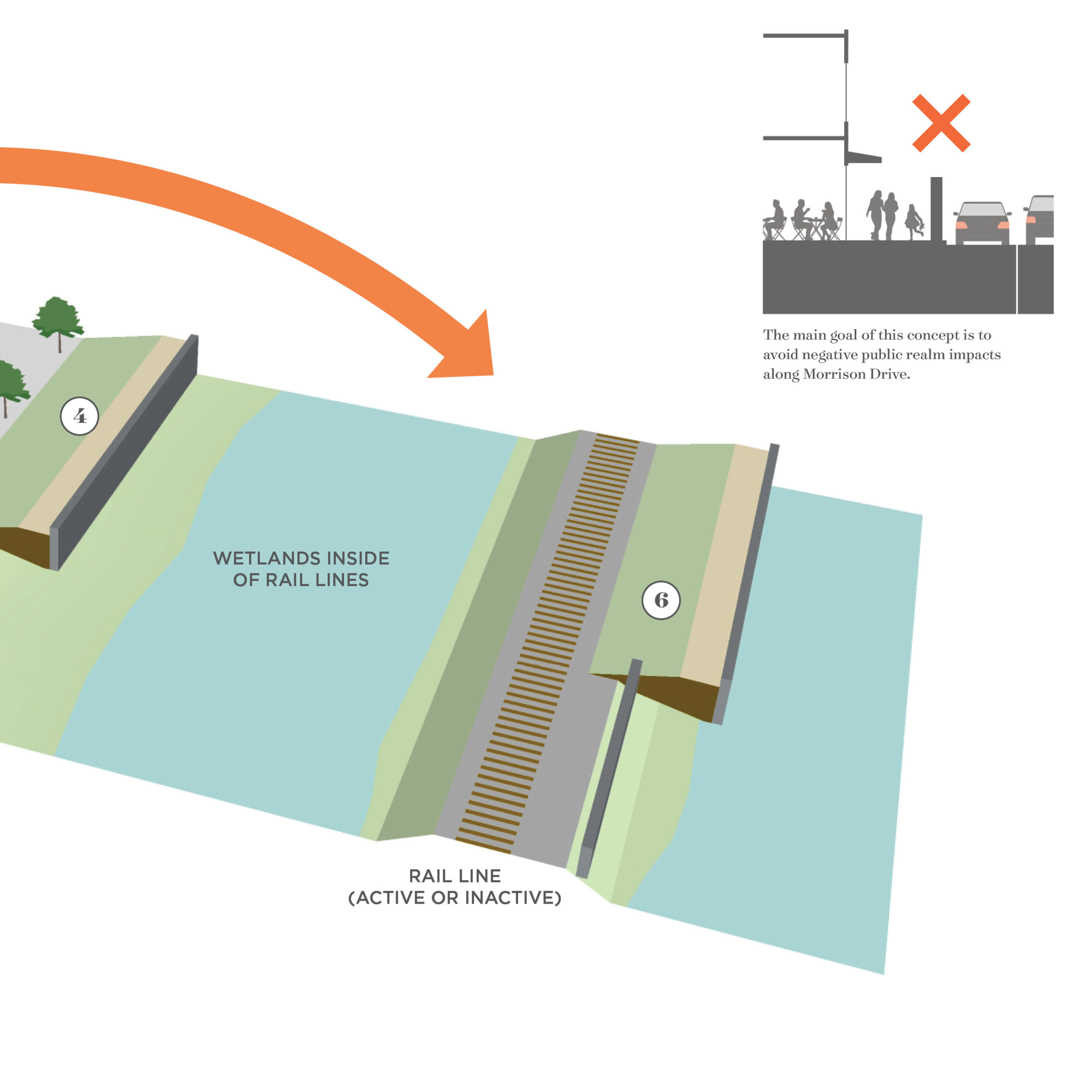
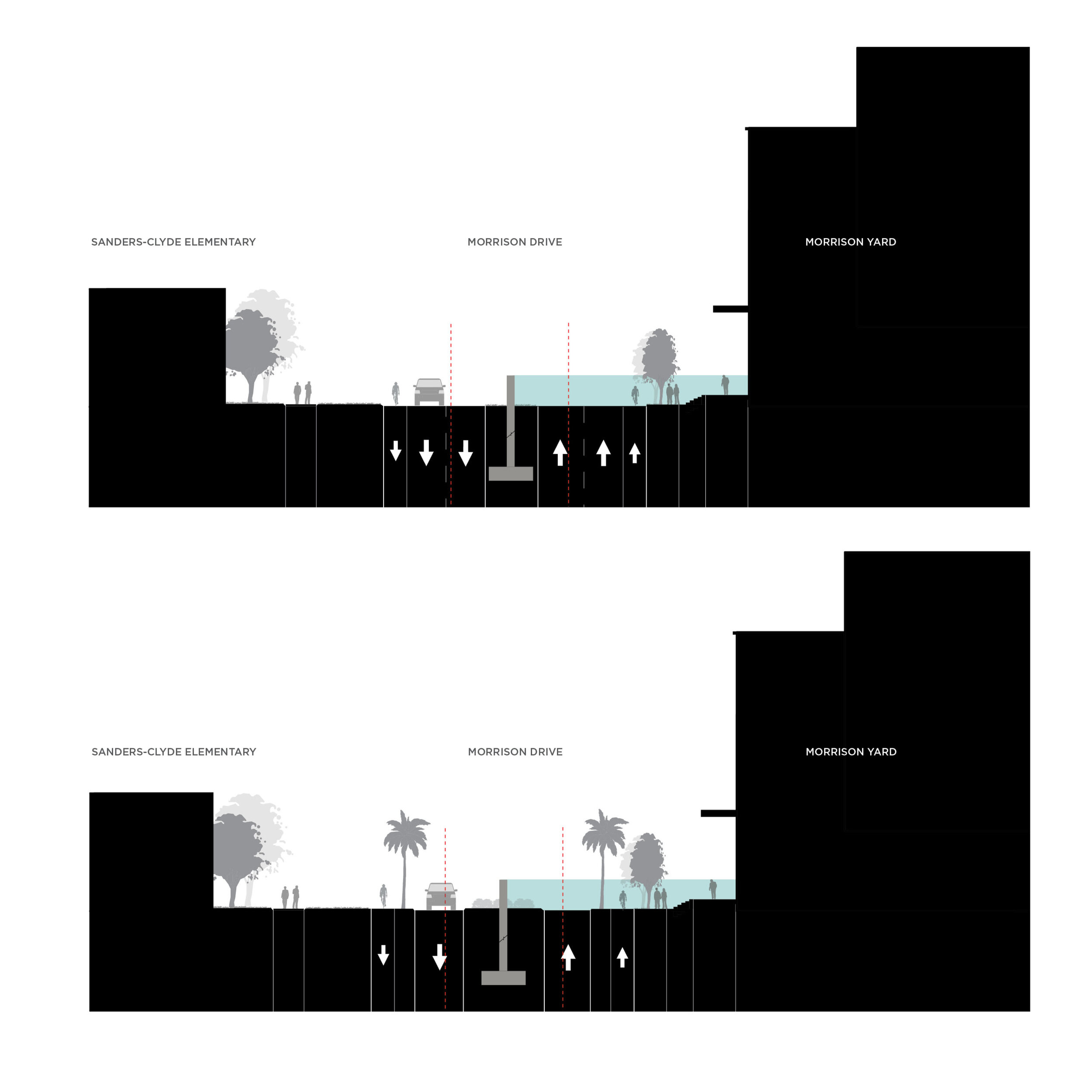
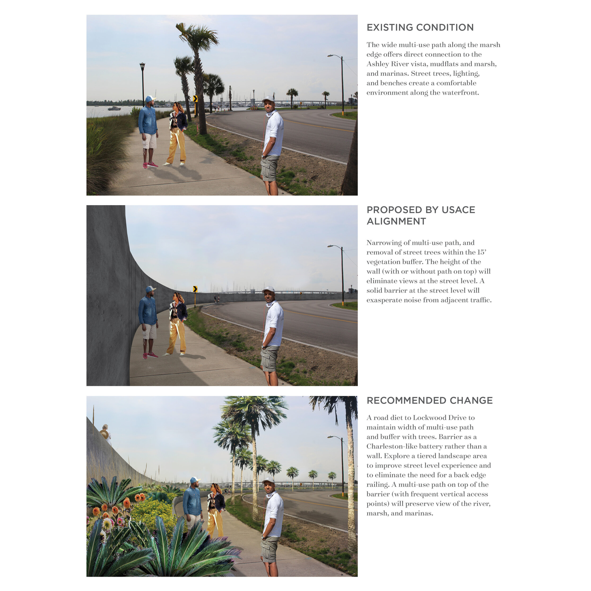
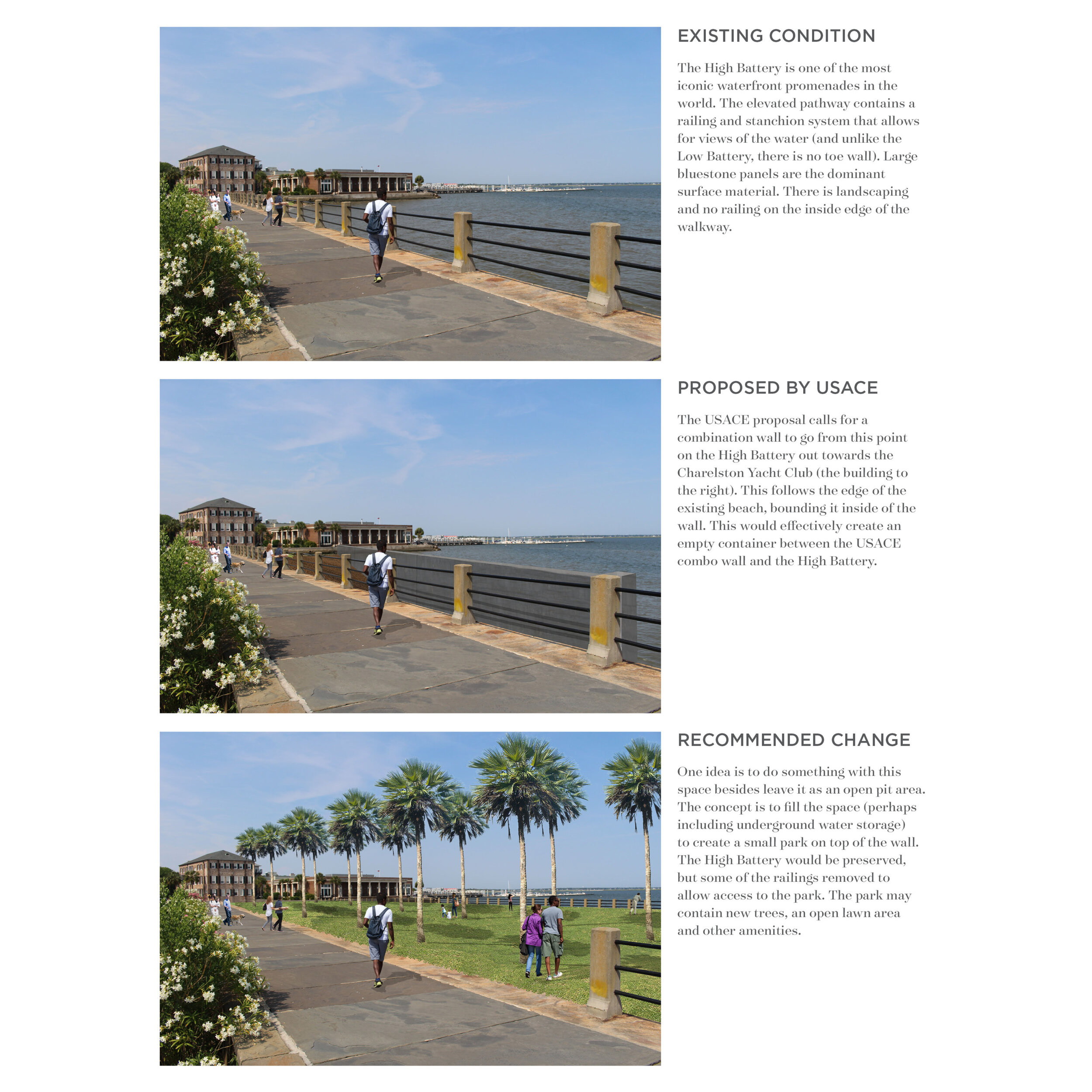
Perspective Renderings
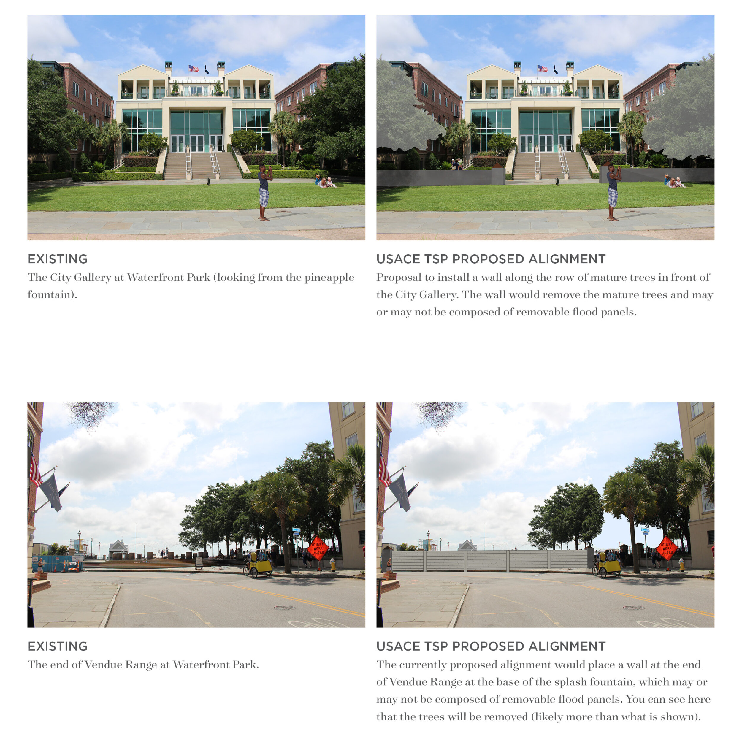
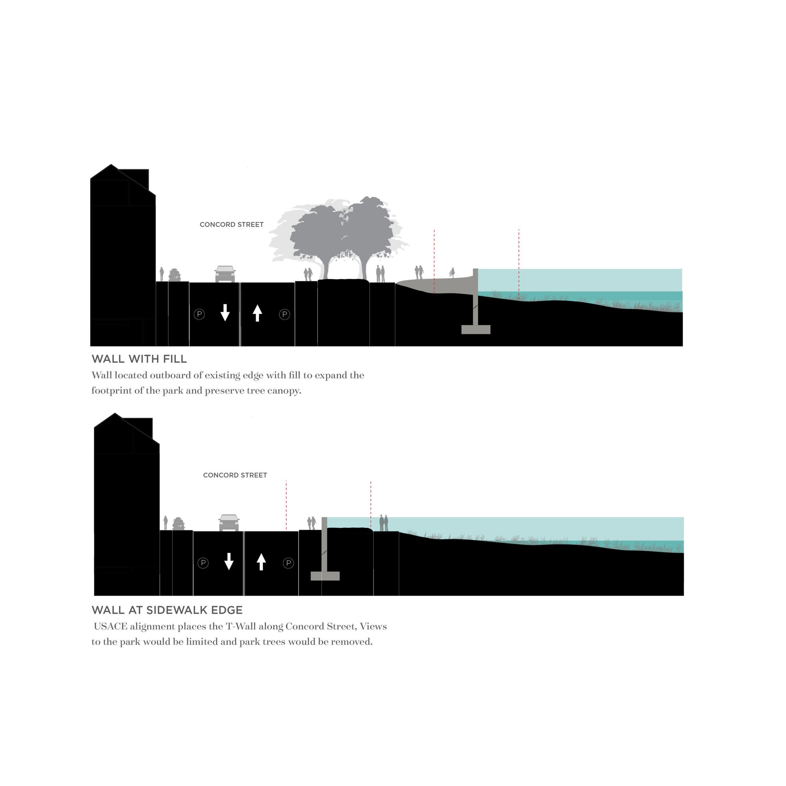
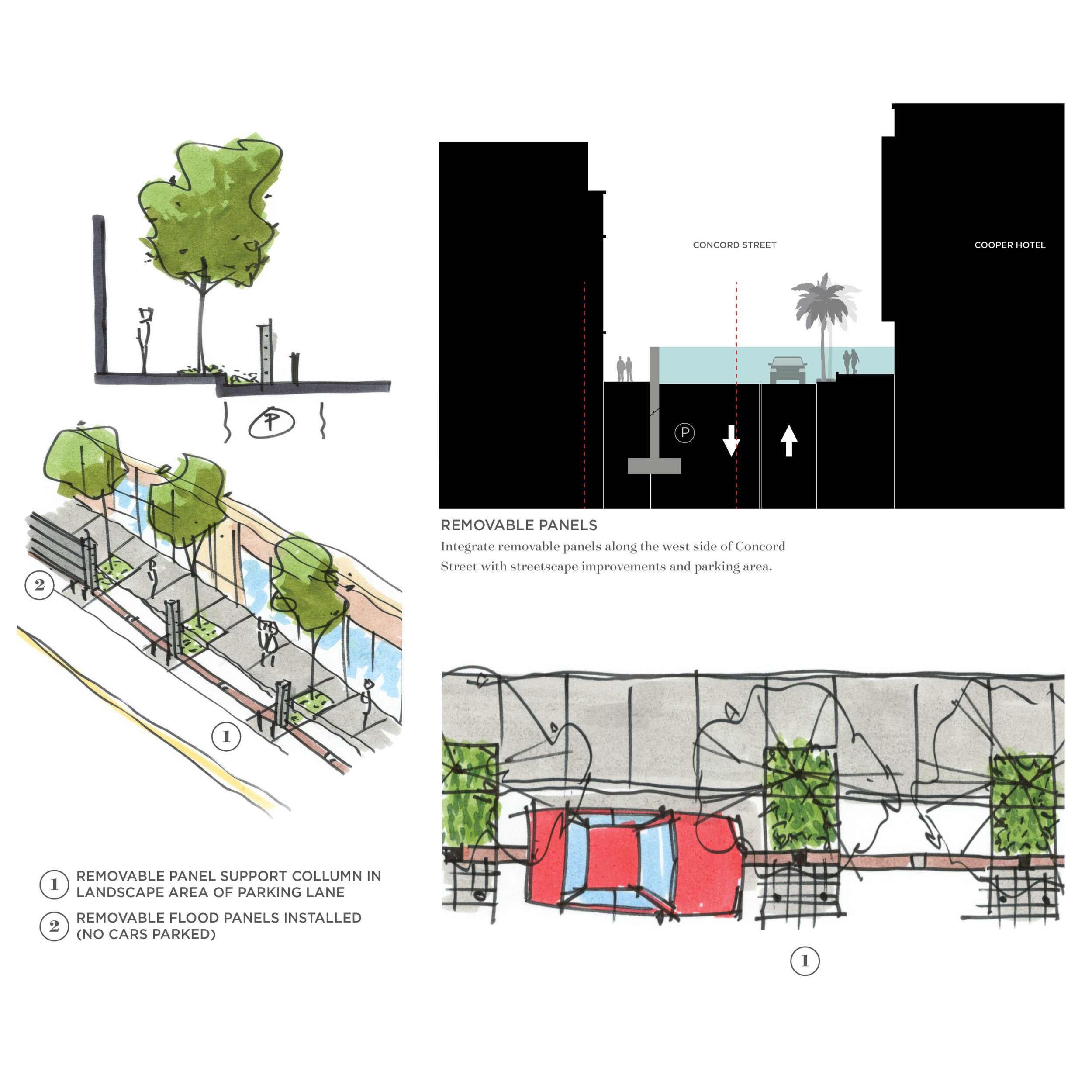
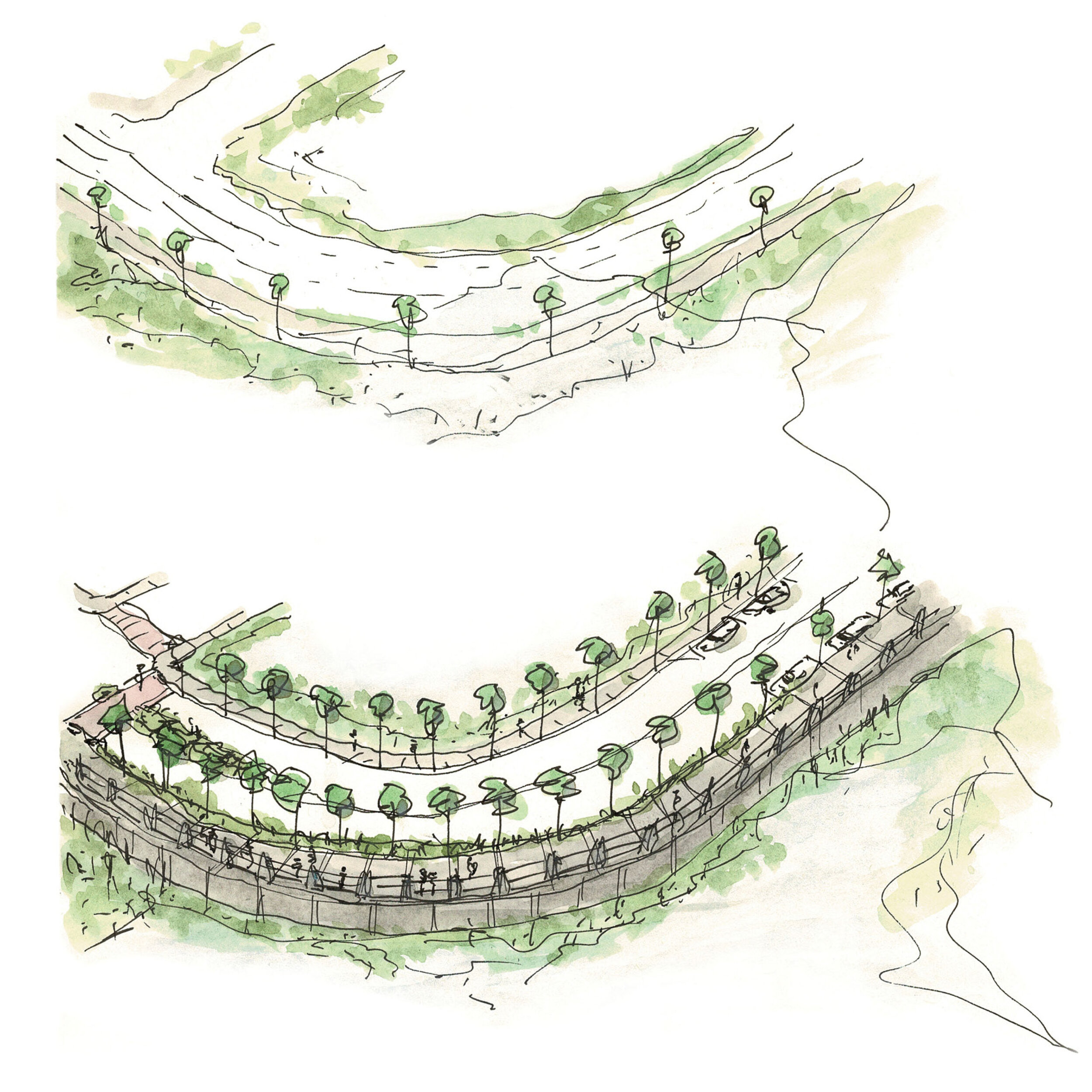
These conceptual street view renderings show important areas of the city potentially impacted by the USACE proposed design and alignment for the storm surge barrier around the Charleston peninsula. For each of the locations we show 1) the existing condition, 2) our interpretation of the proposed structure design and 3) a concept for possible improvements.


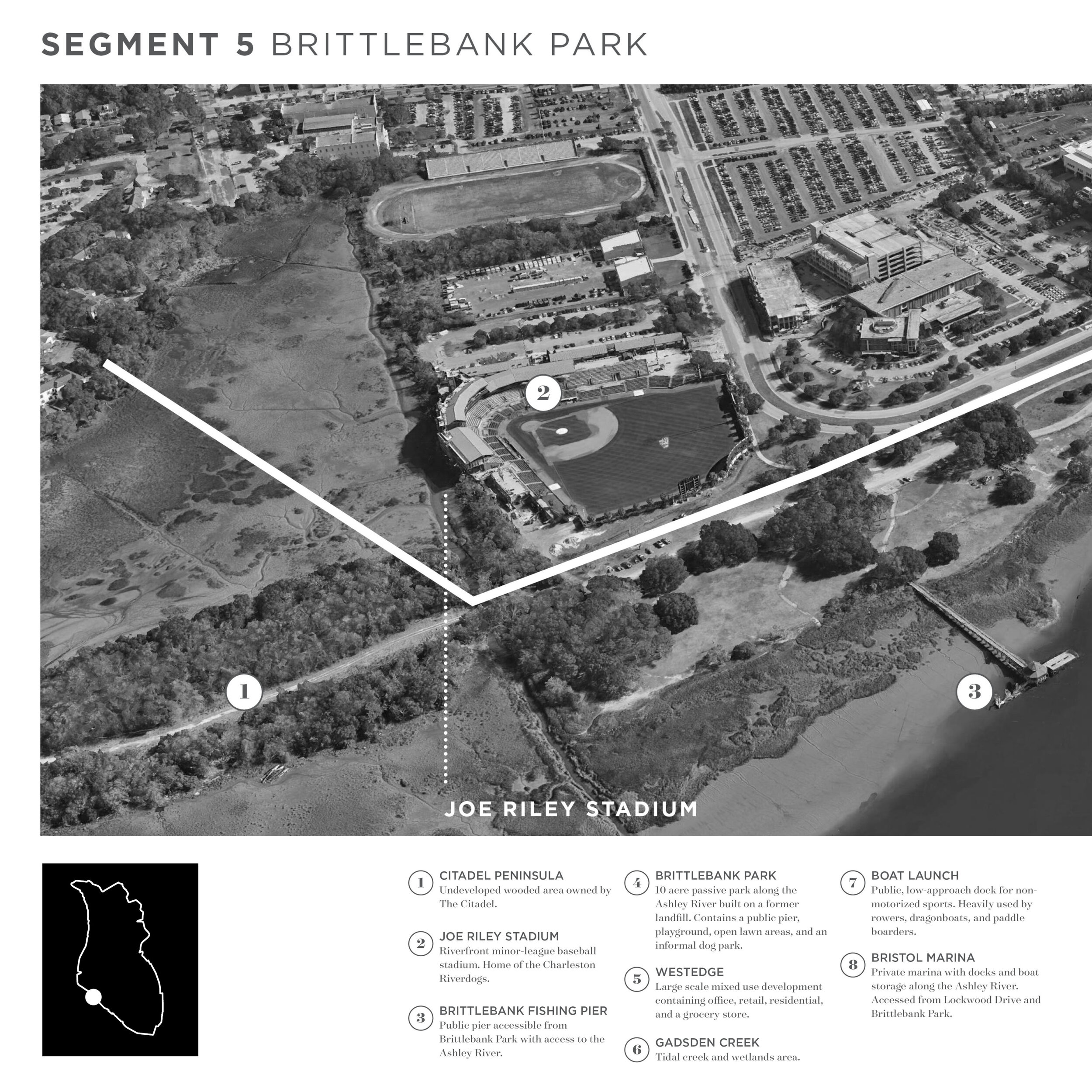
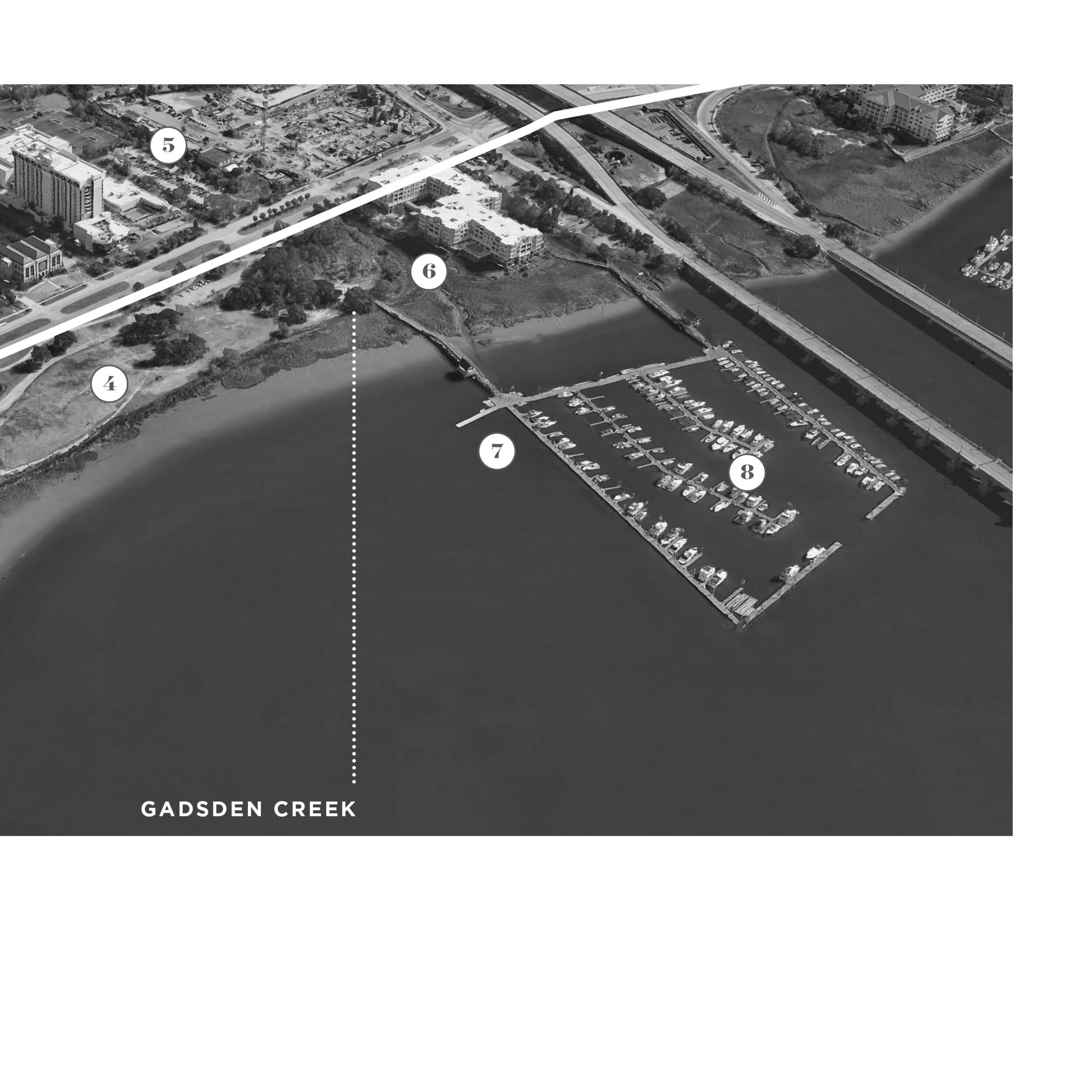
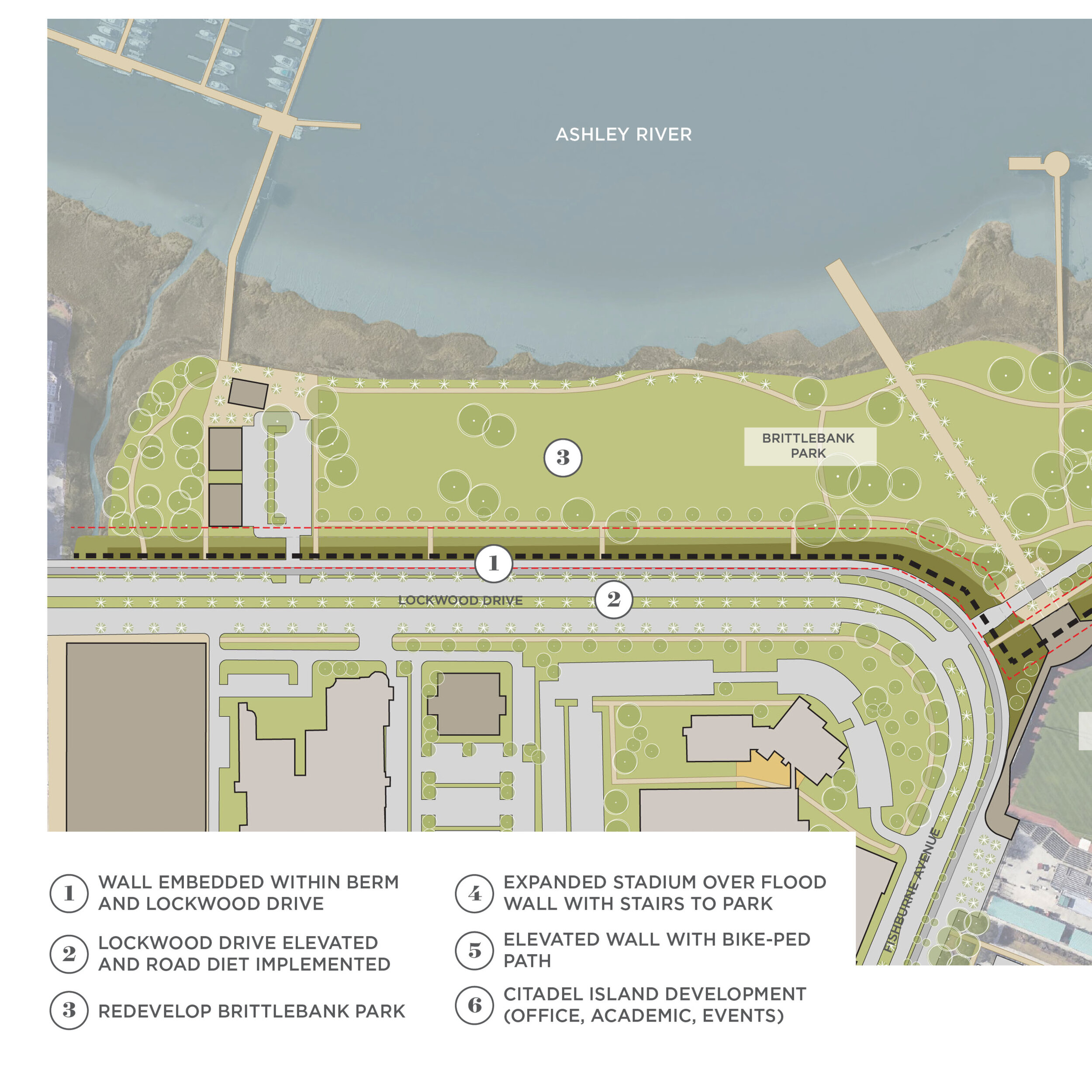
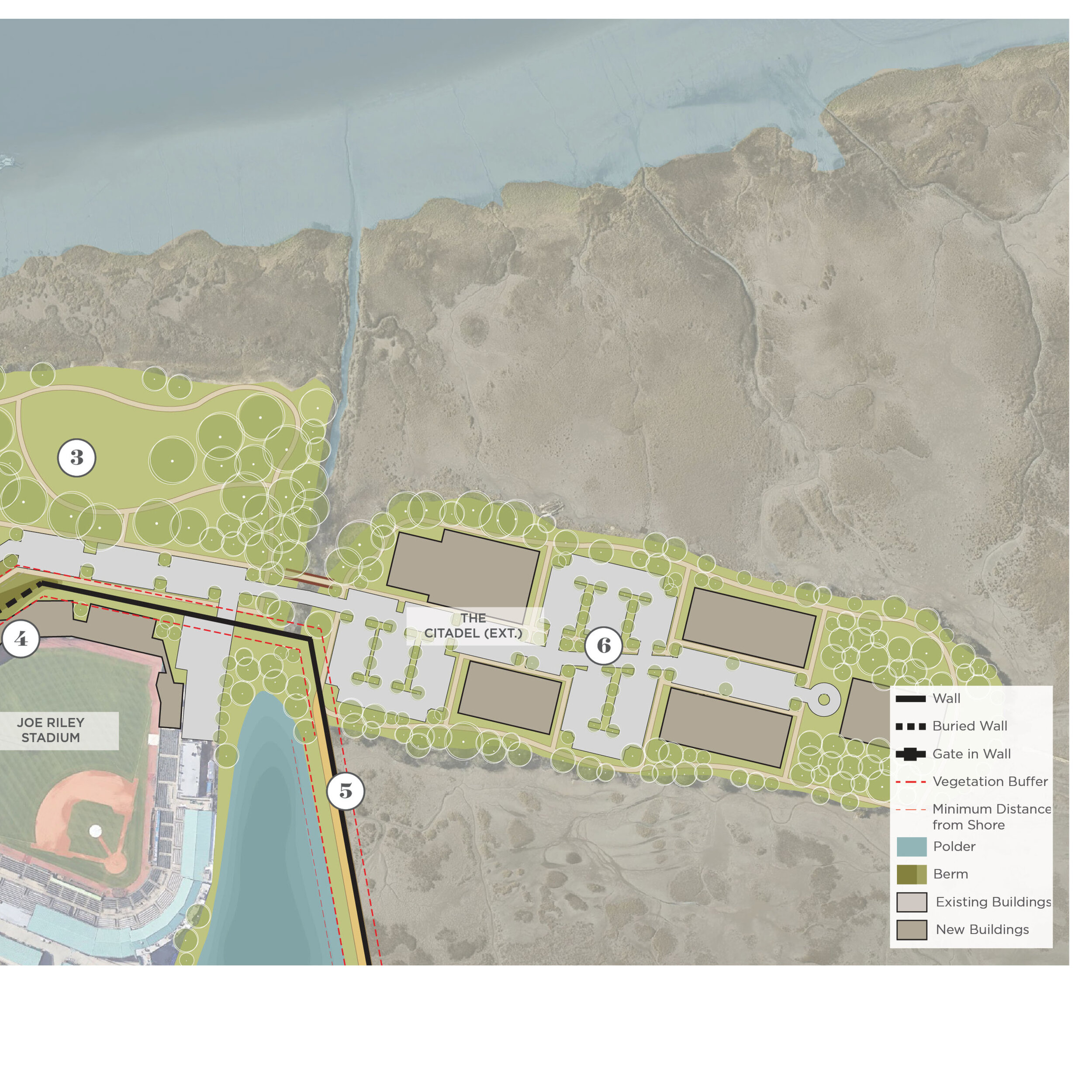
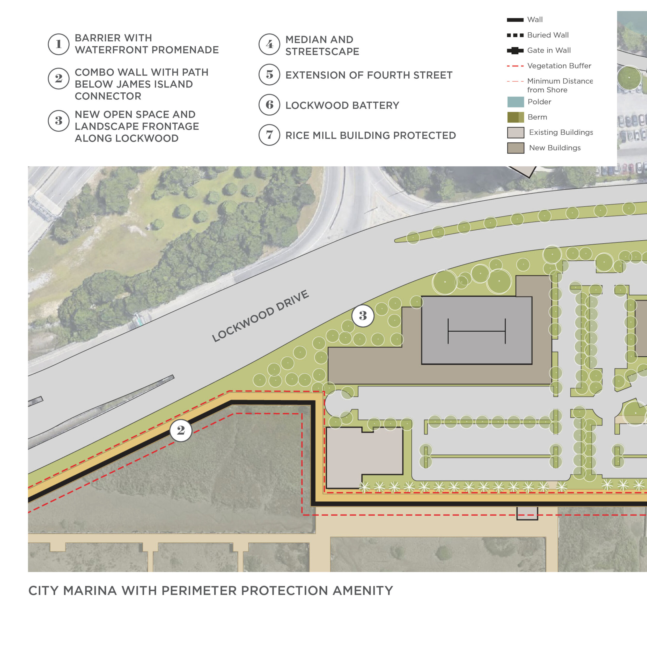
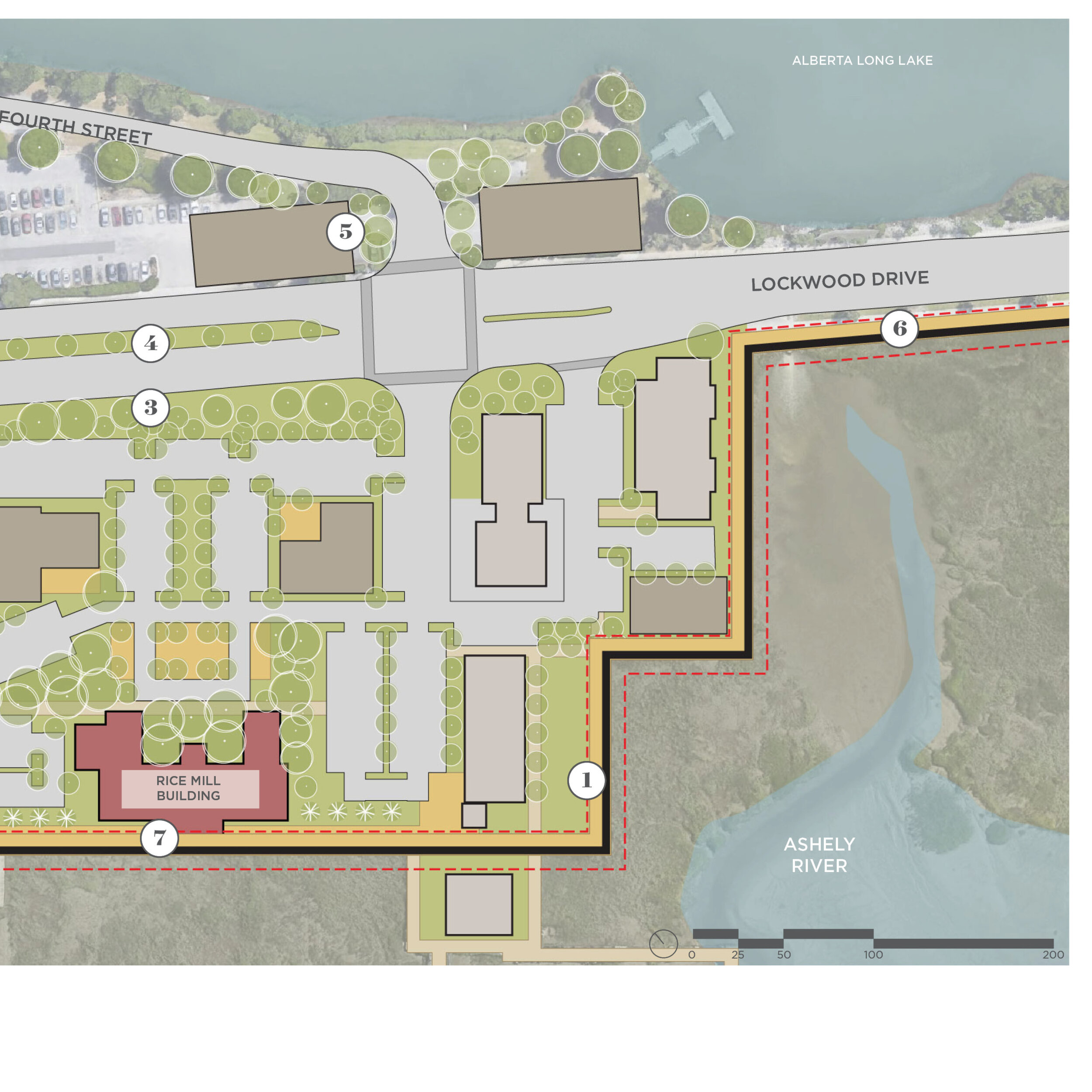
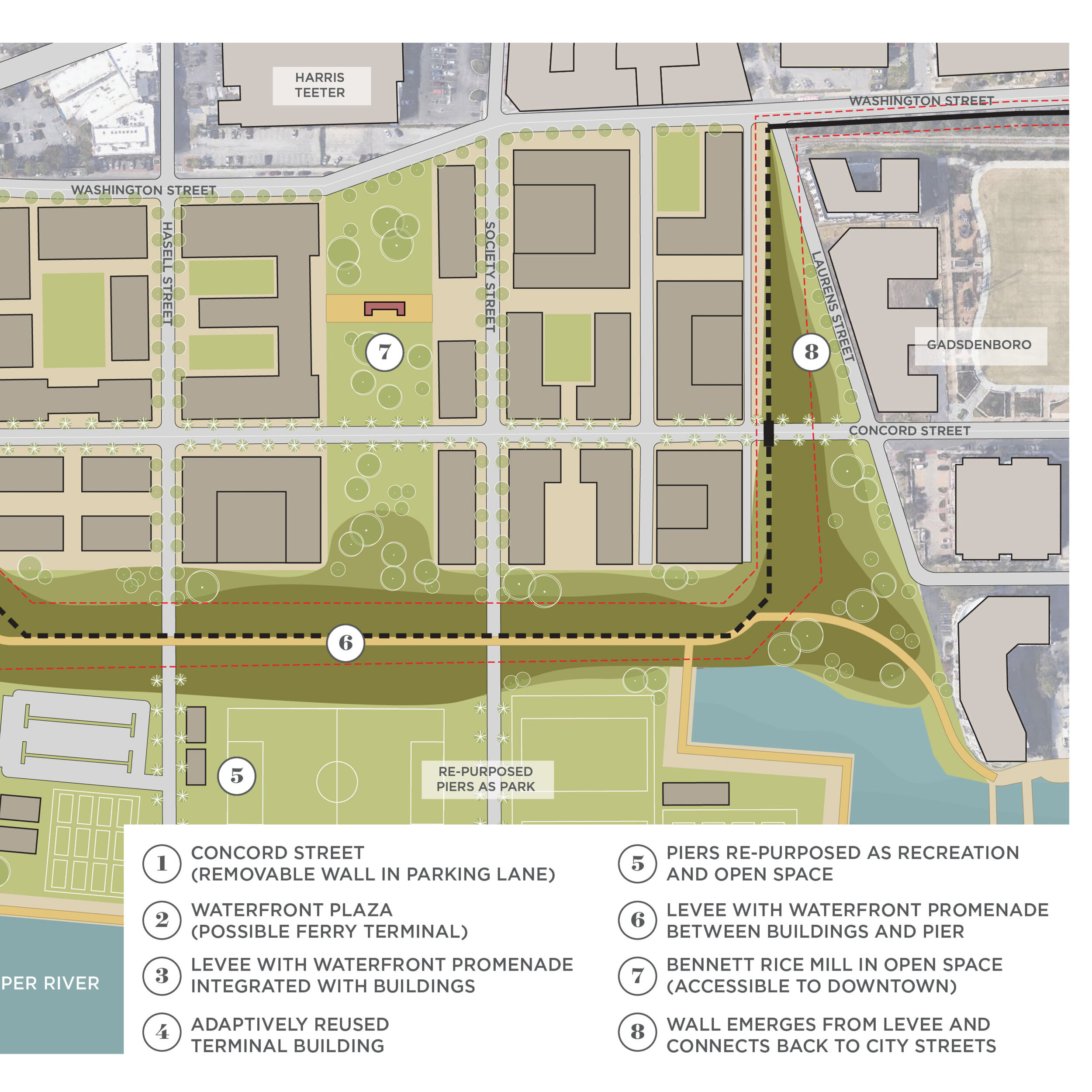
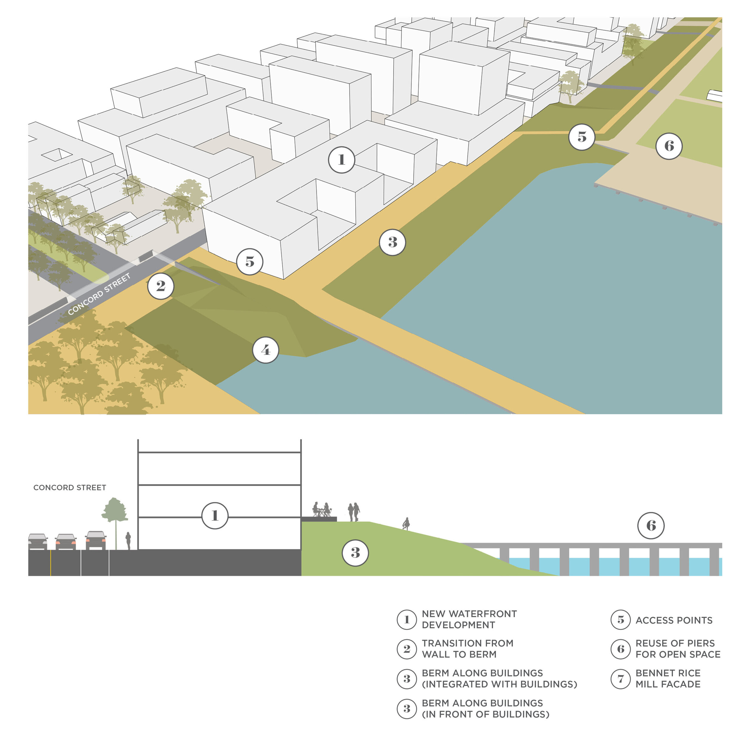
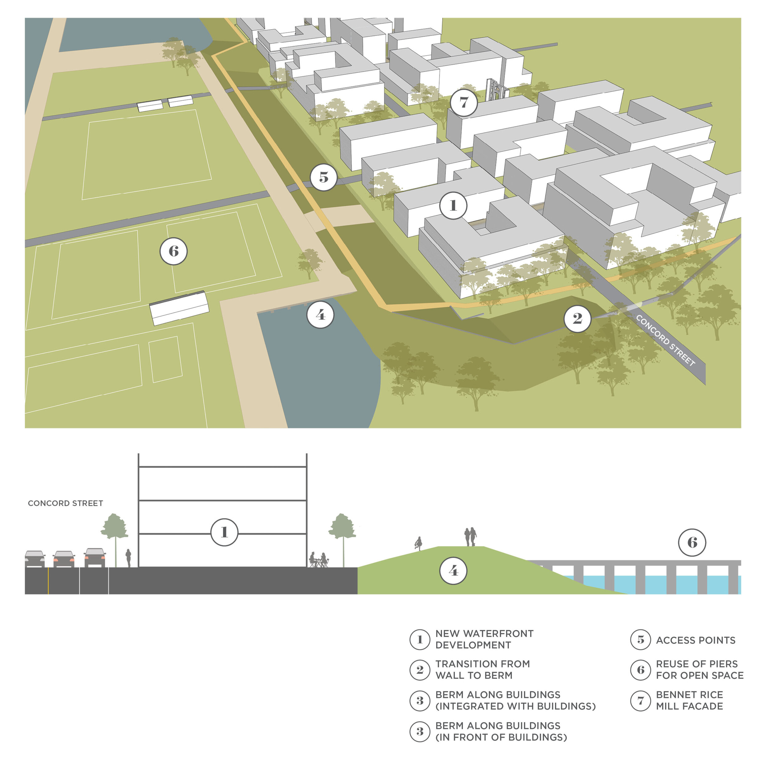
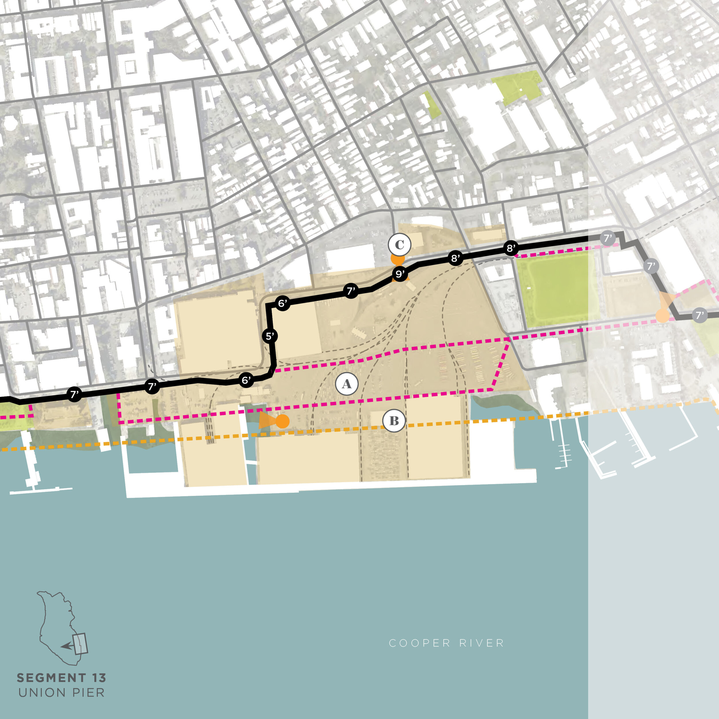
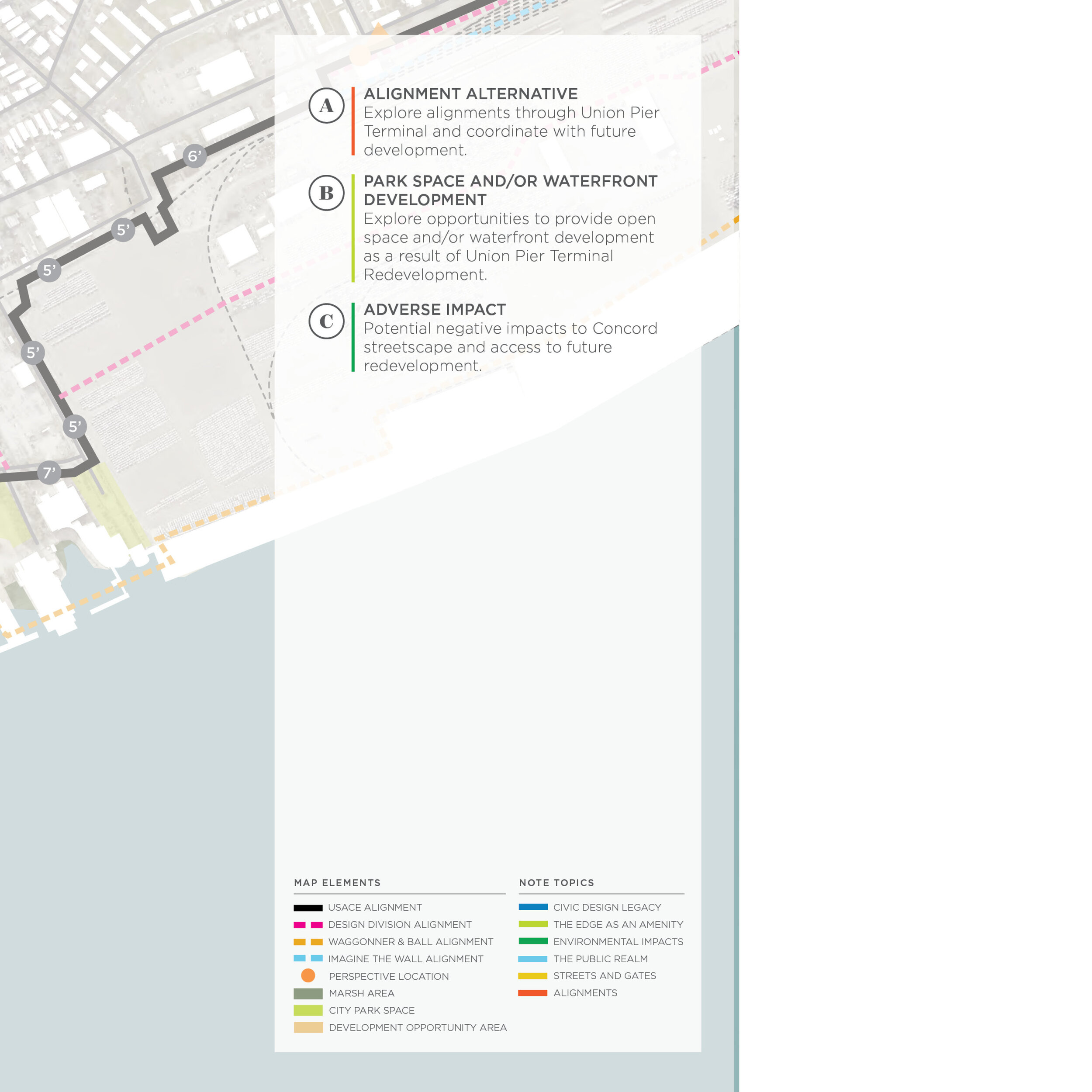
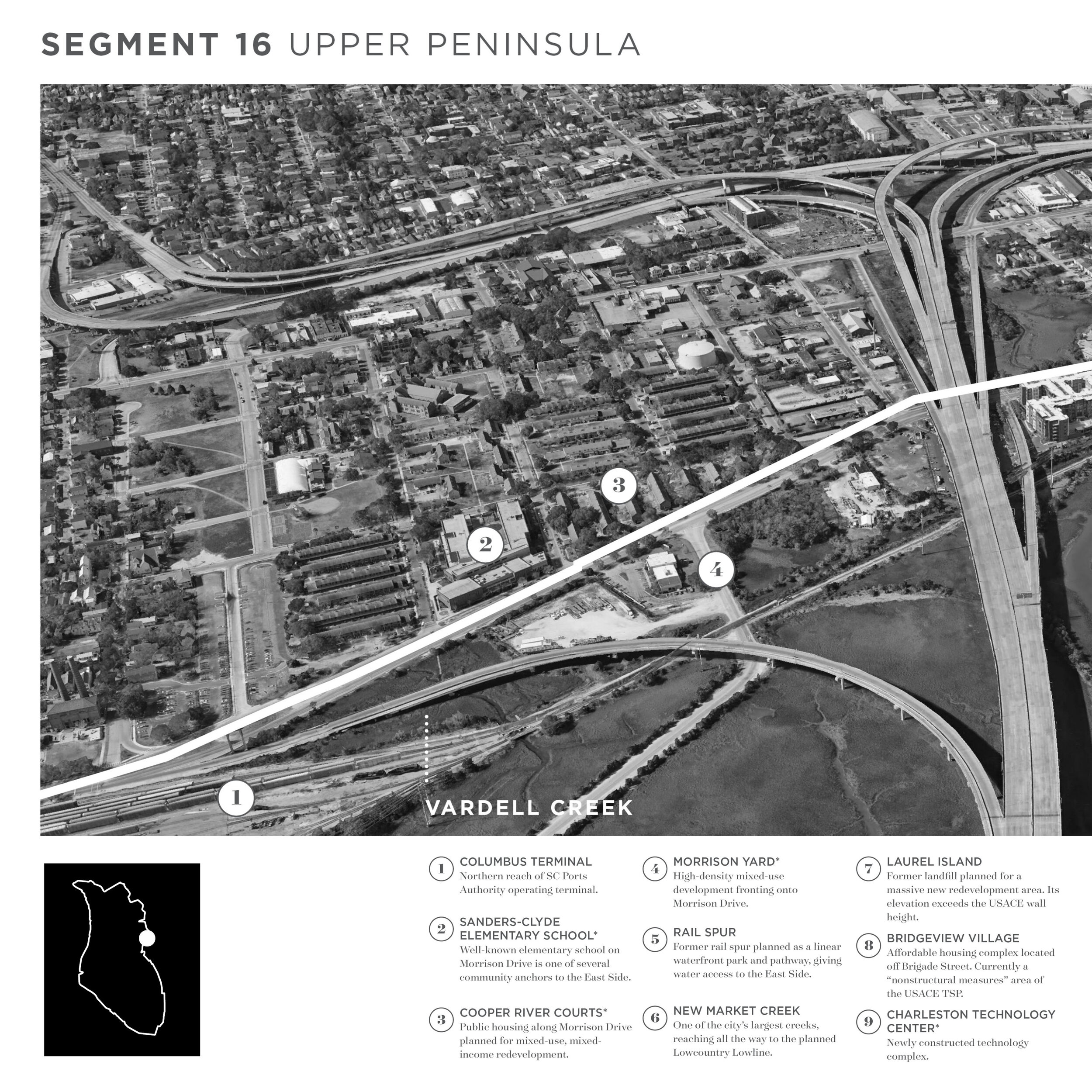
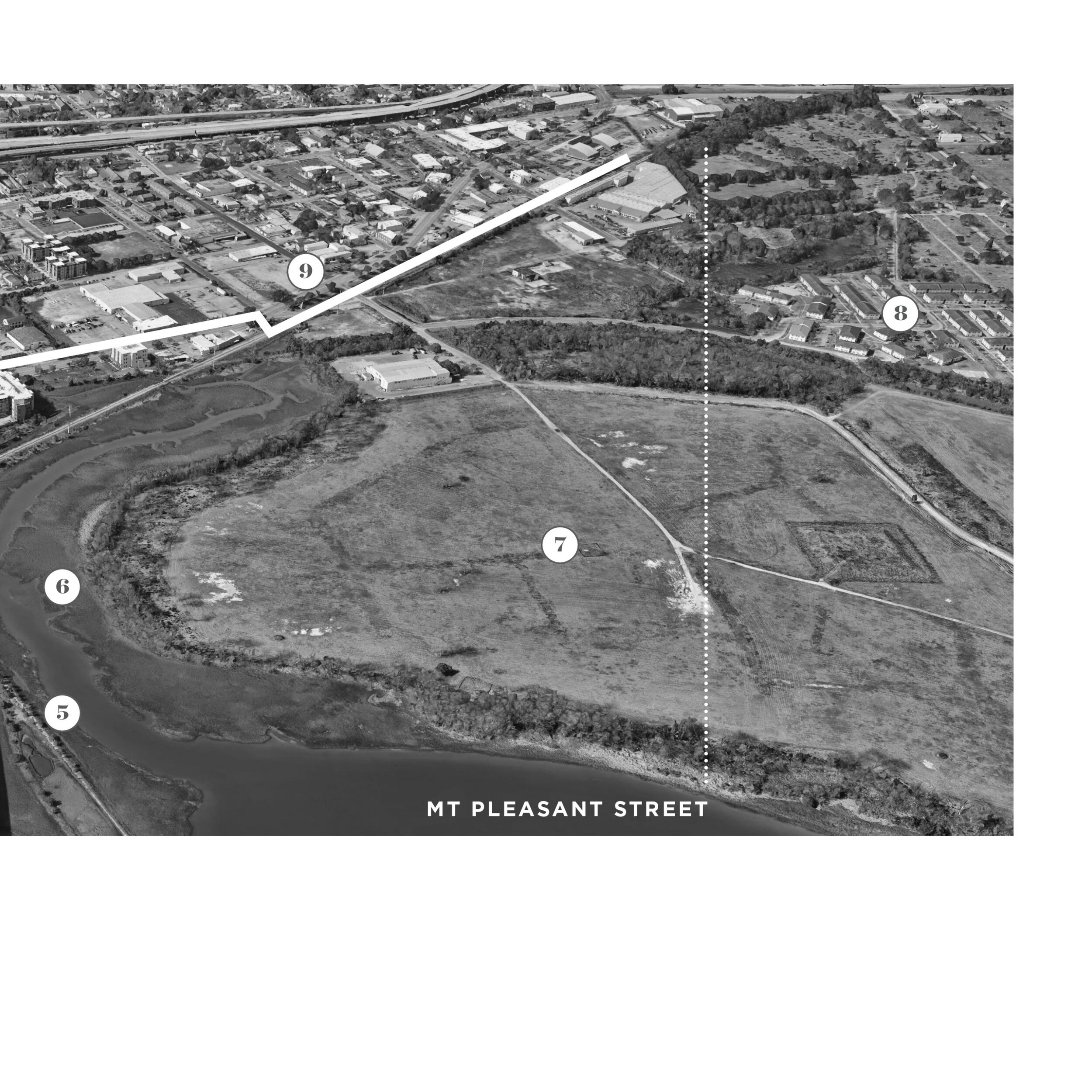
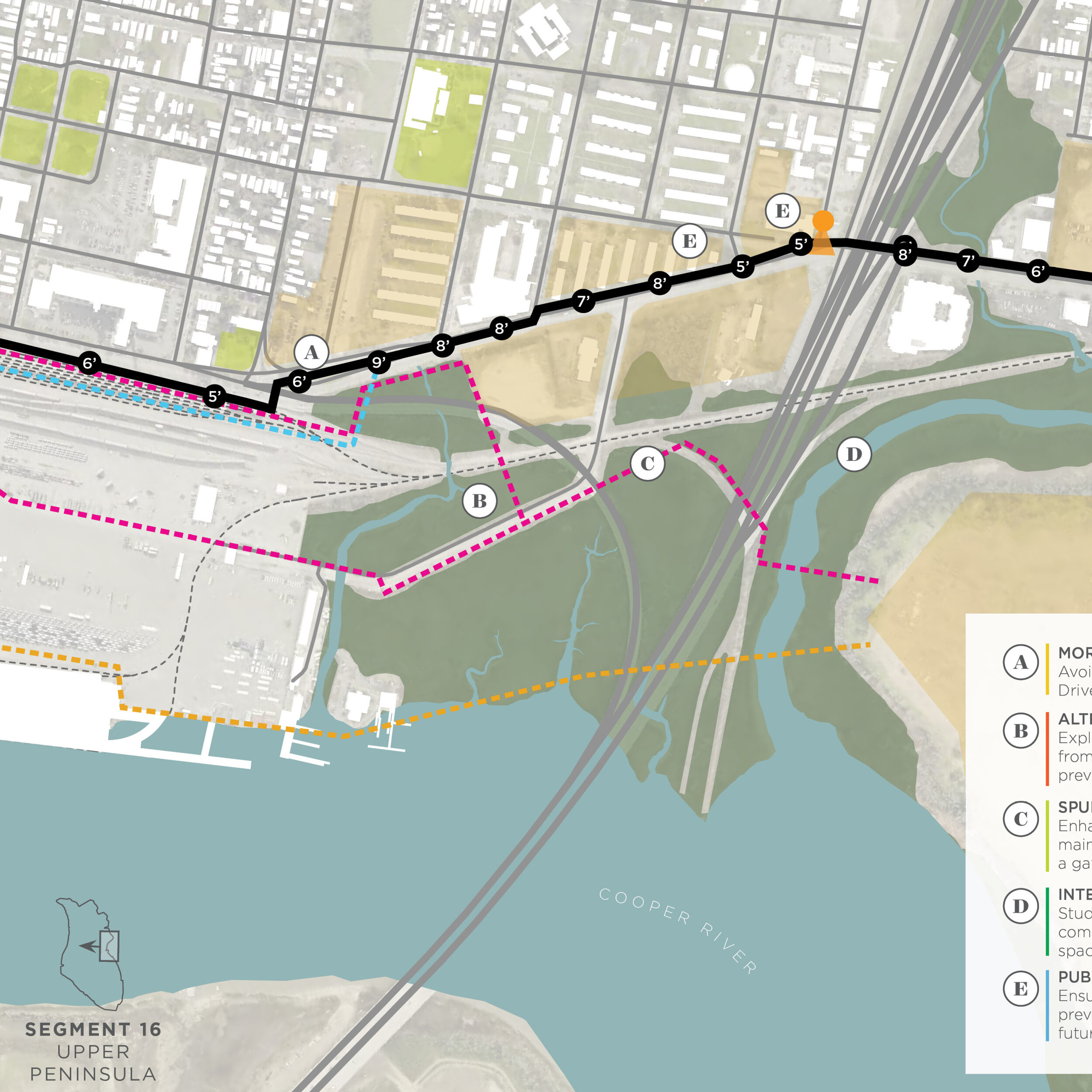
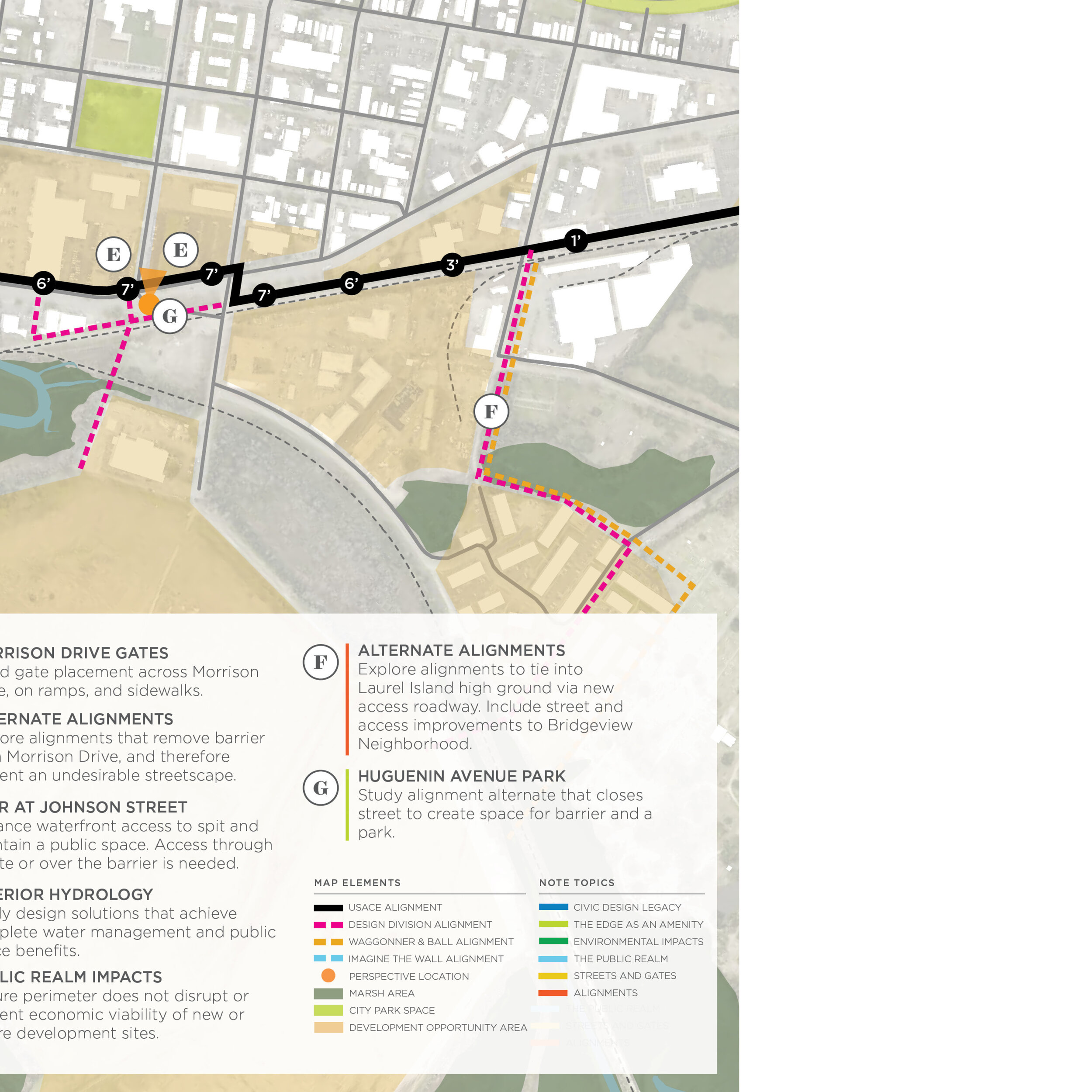
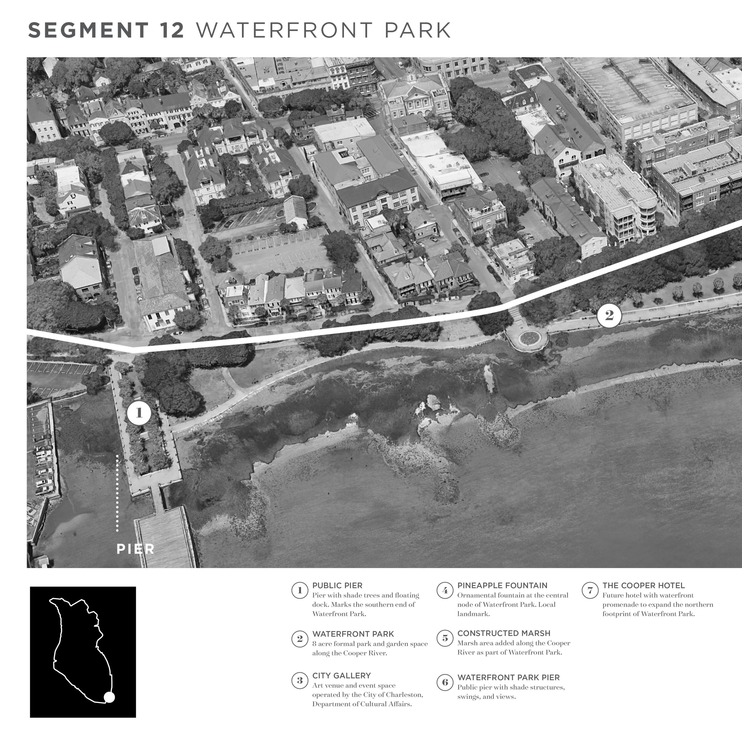
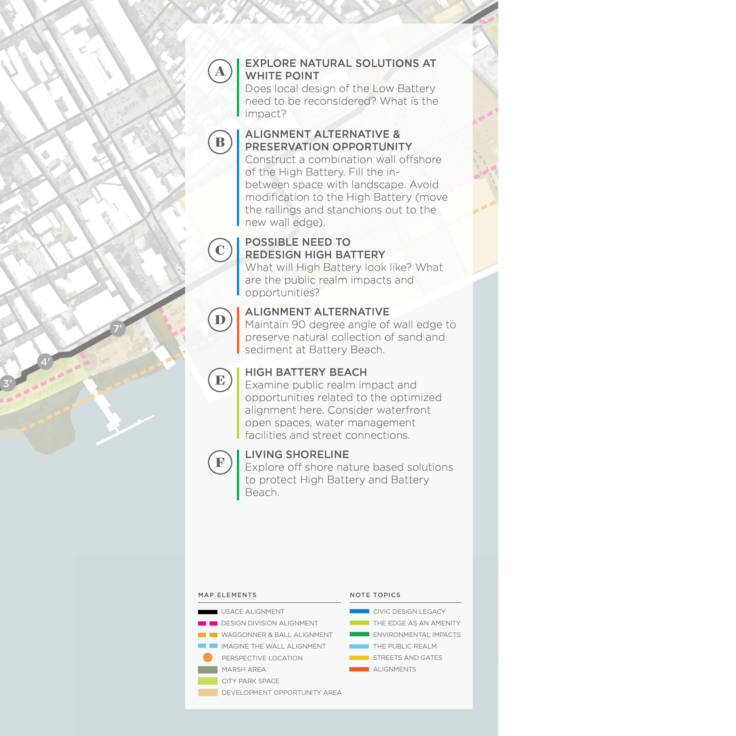
Segment Area Studies
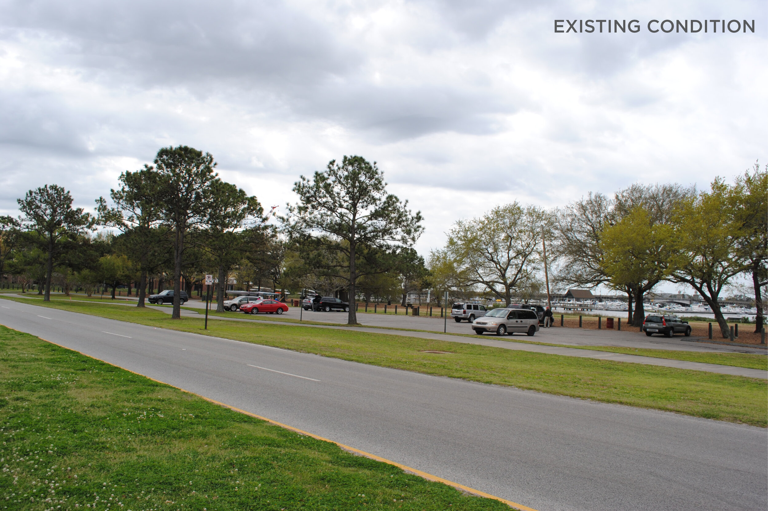
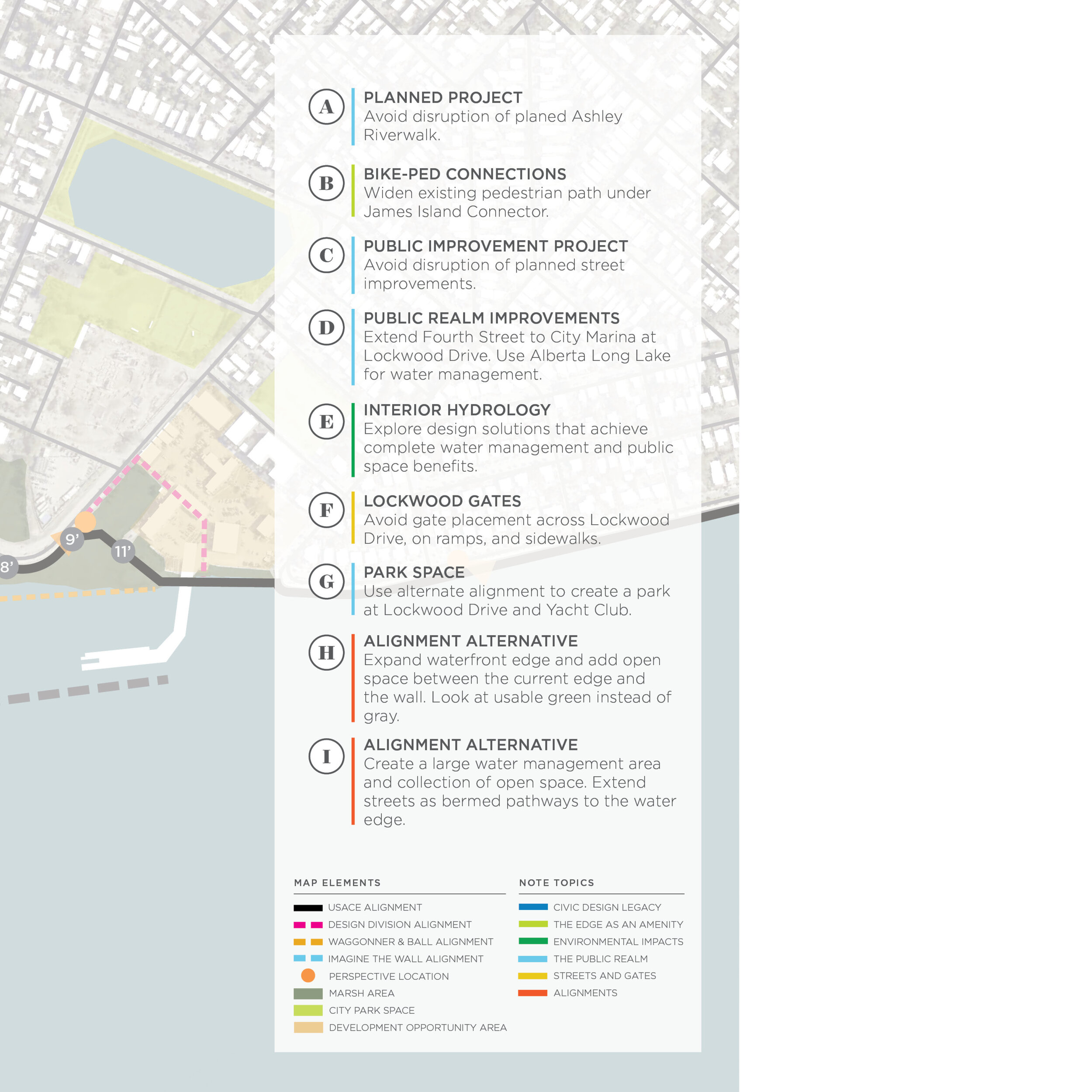
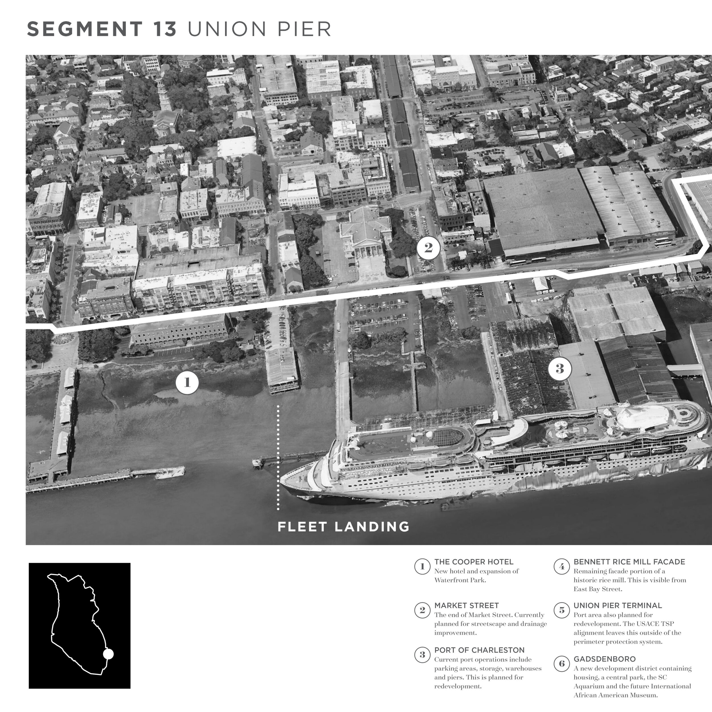
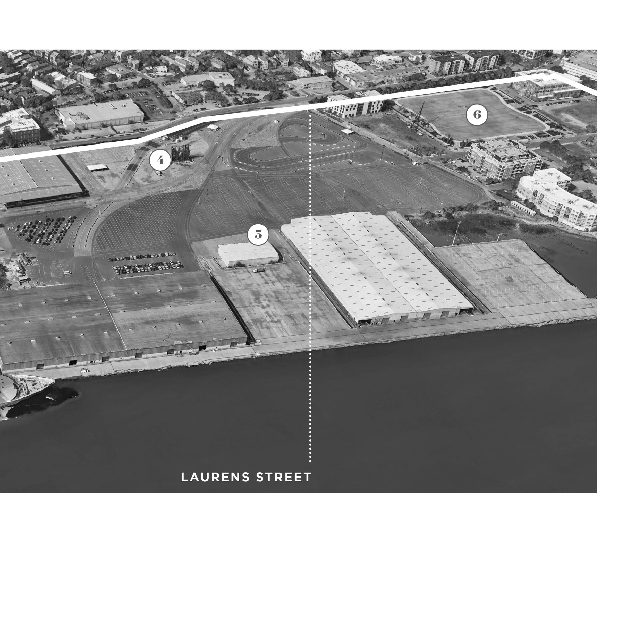
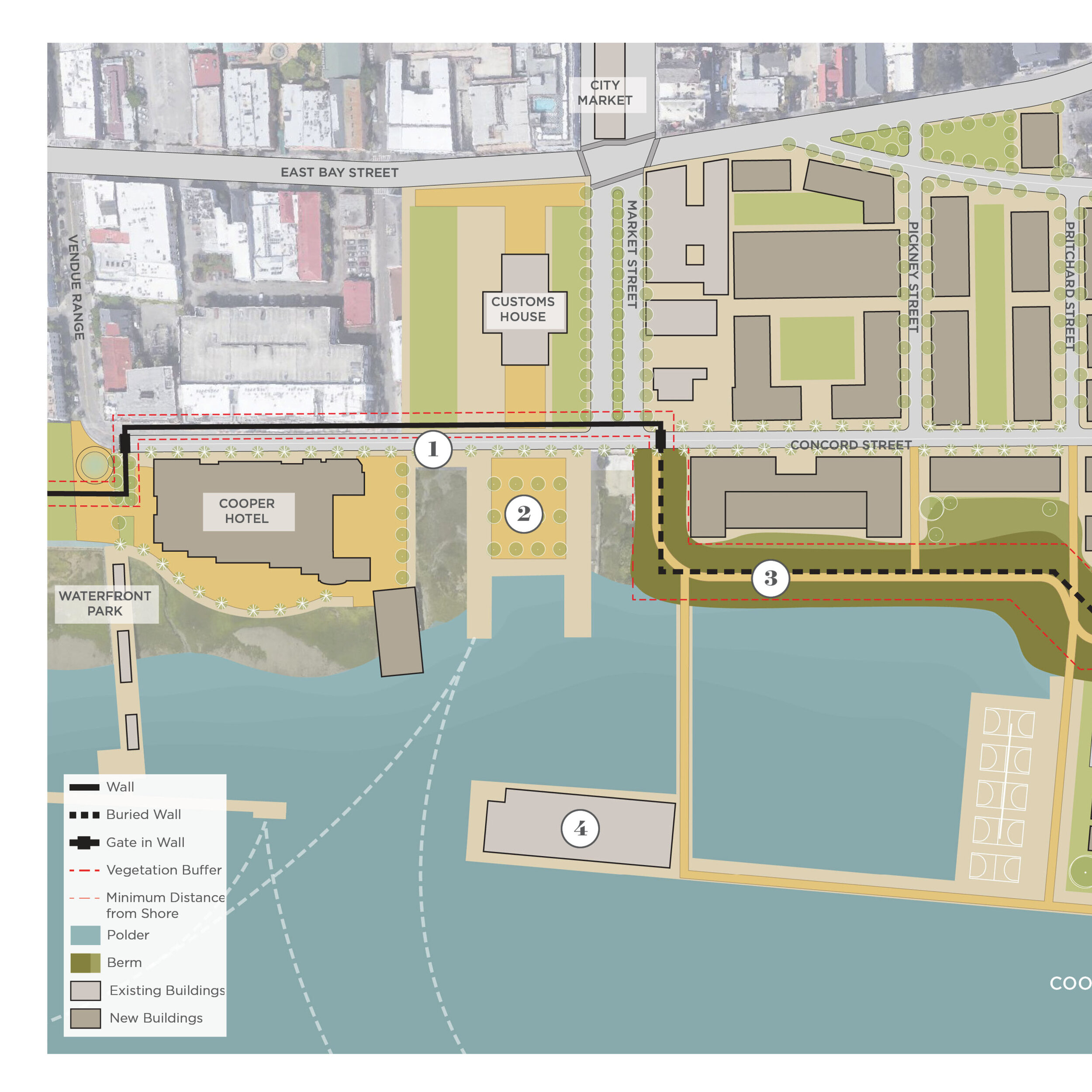
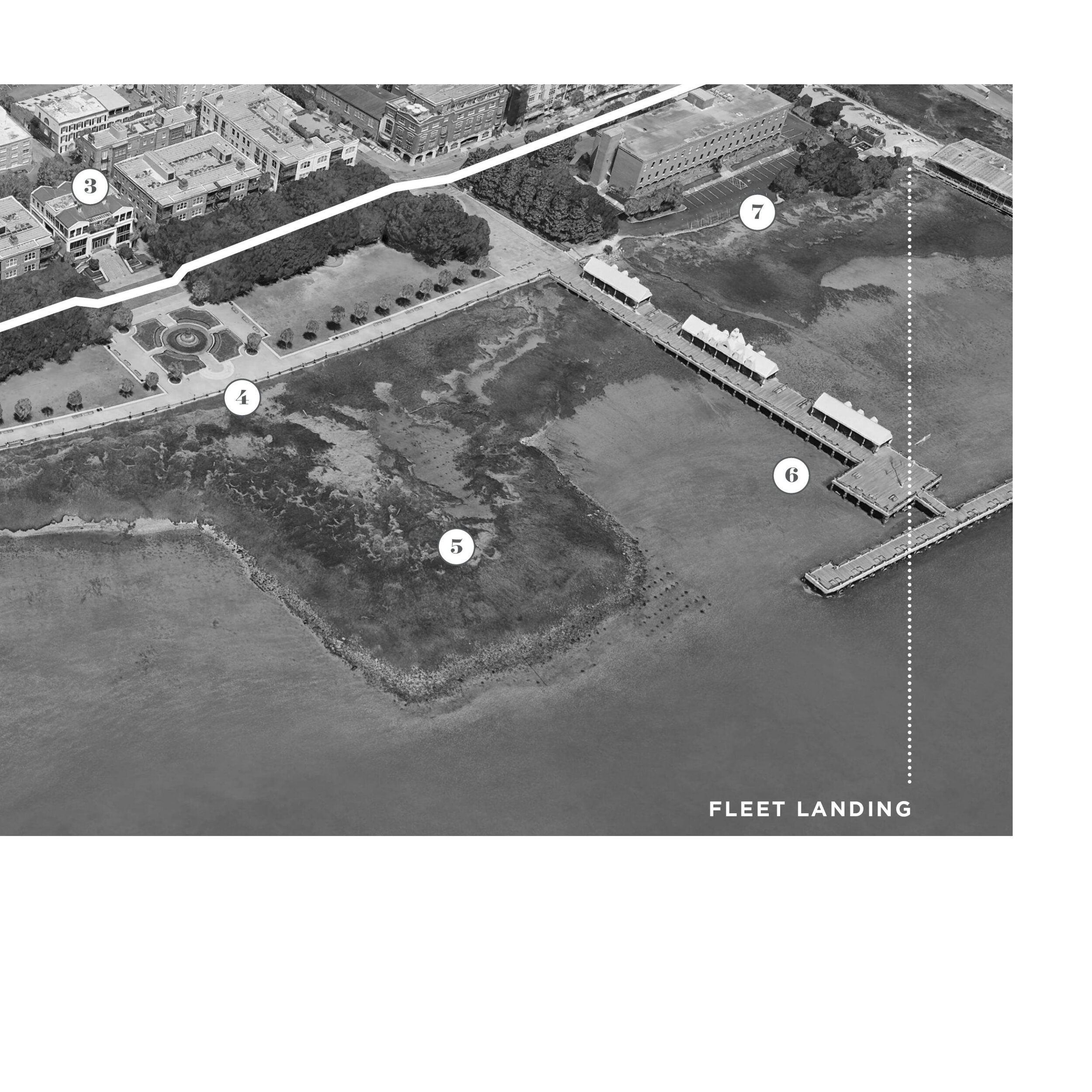
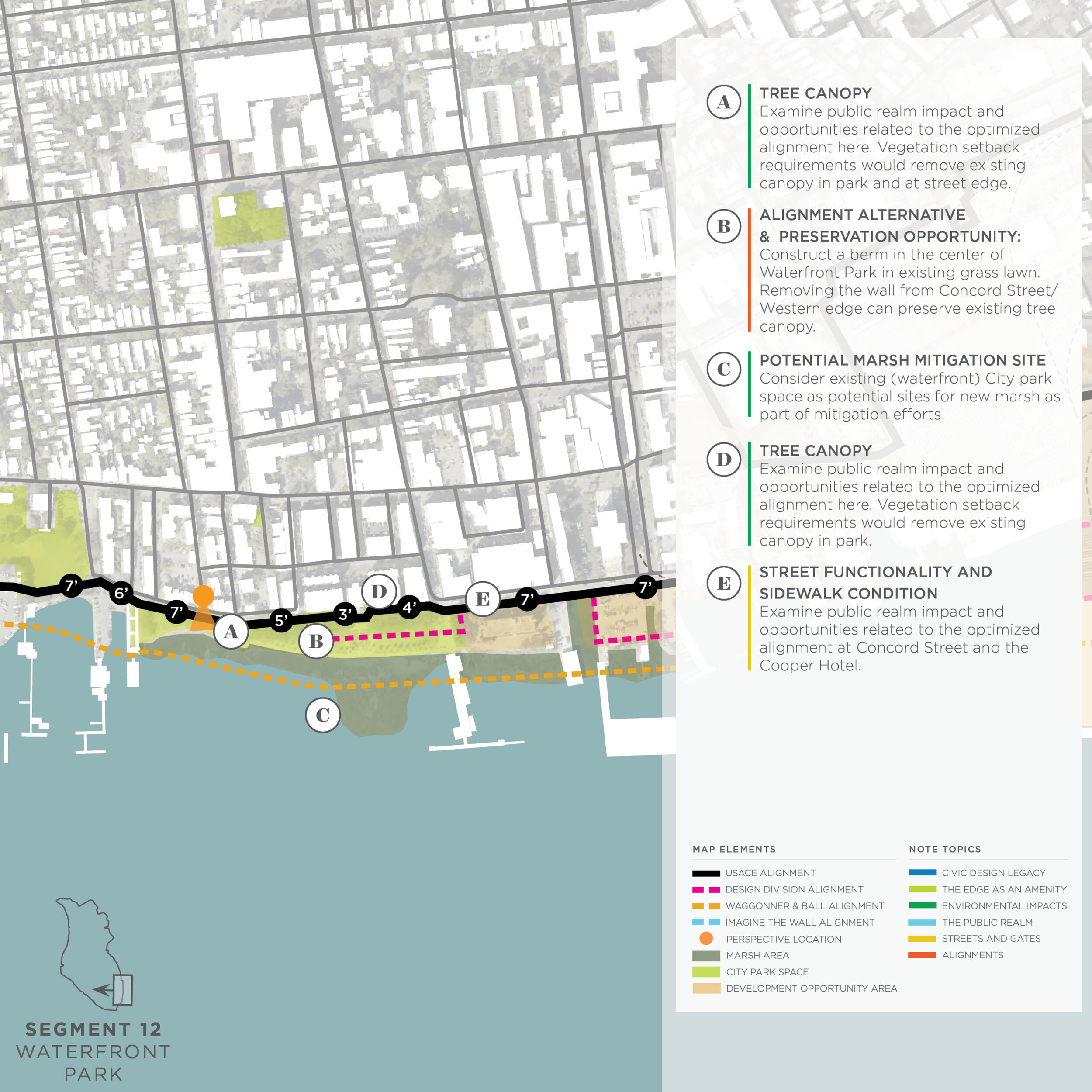
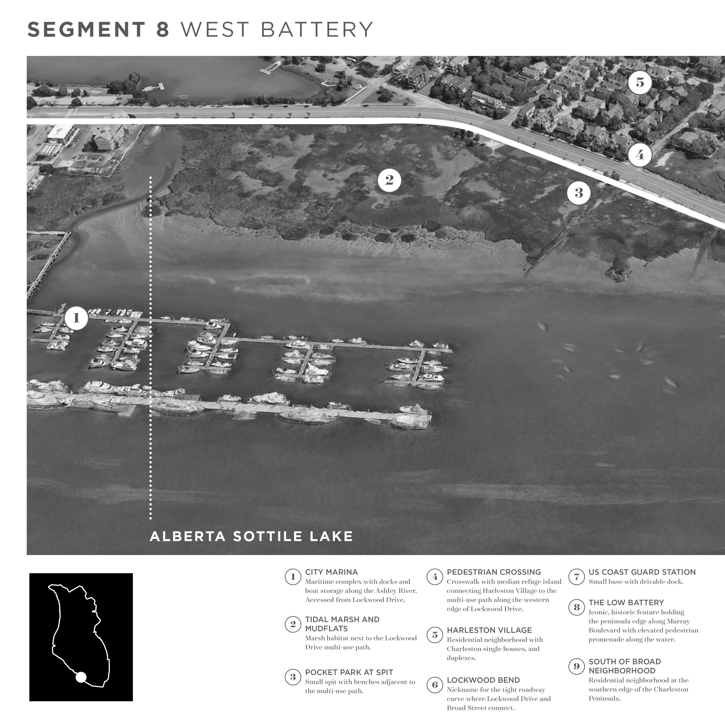
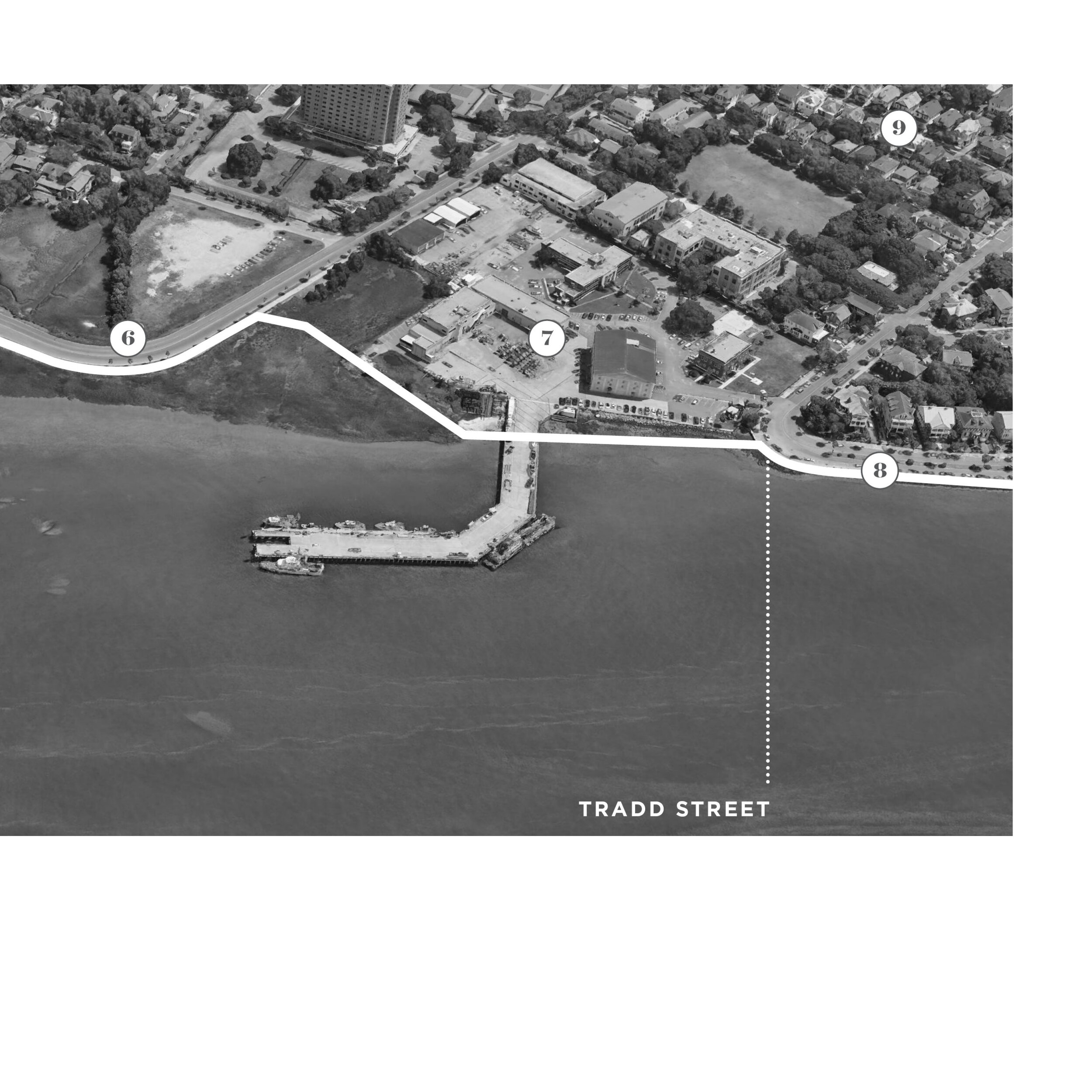
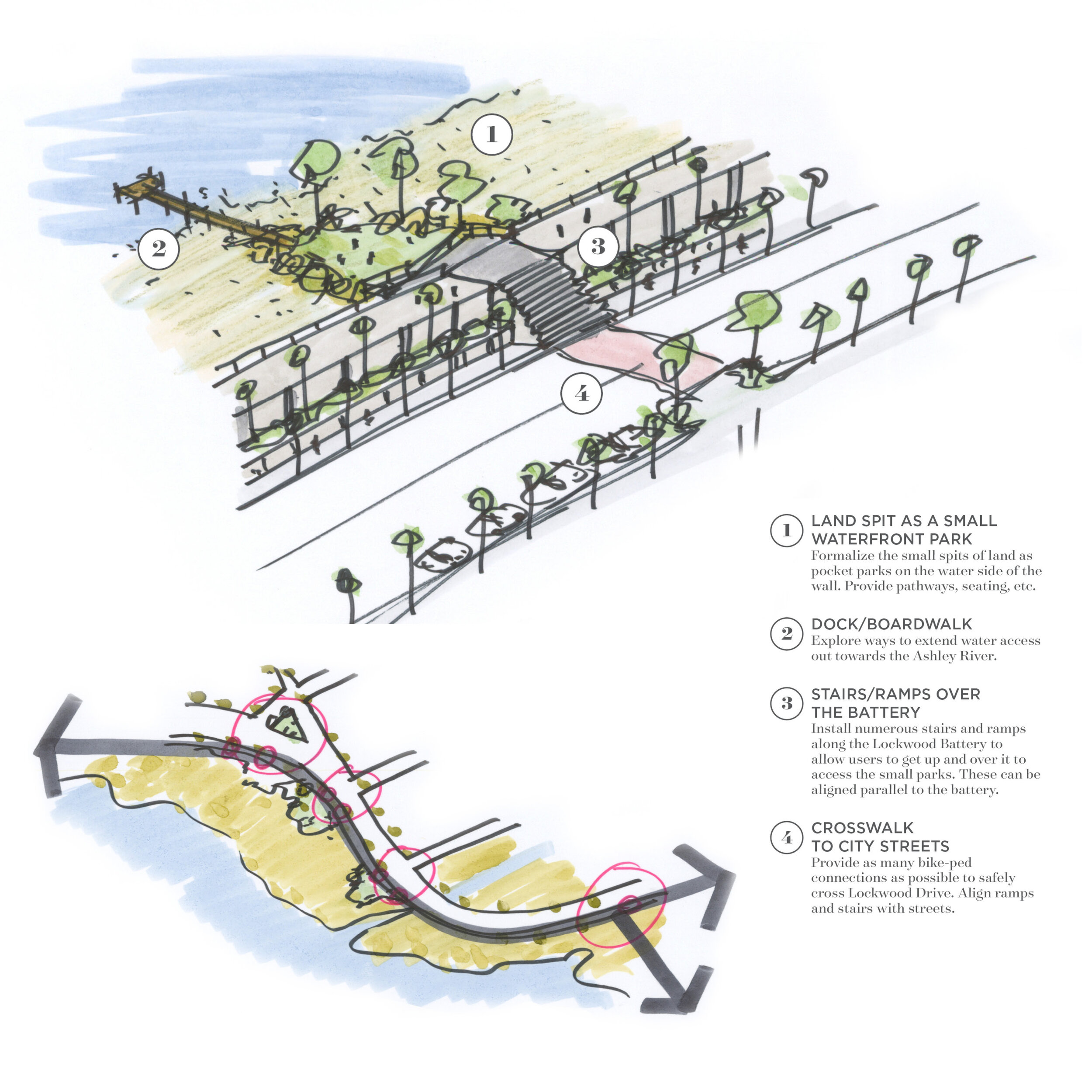
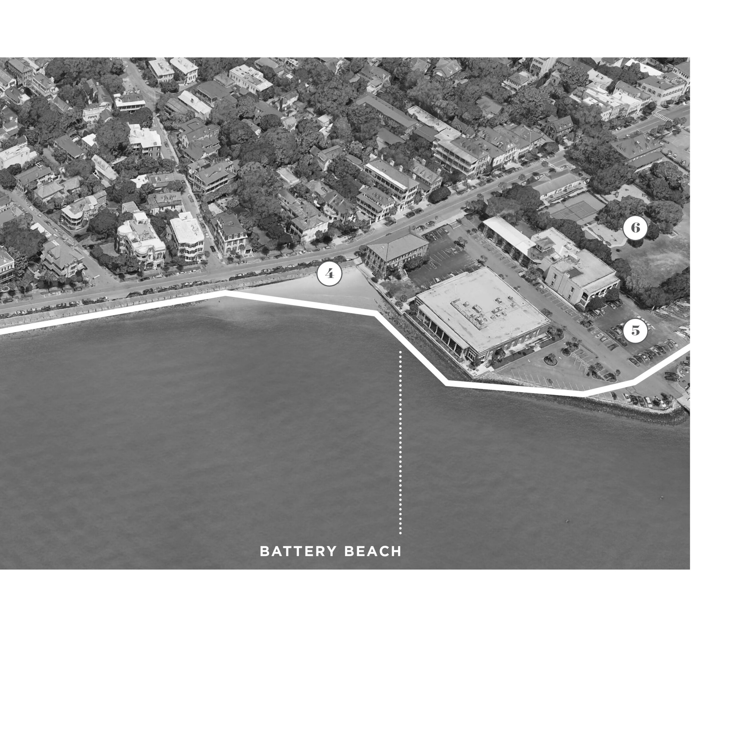
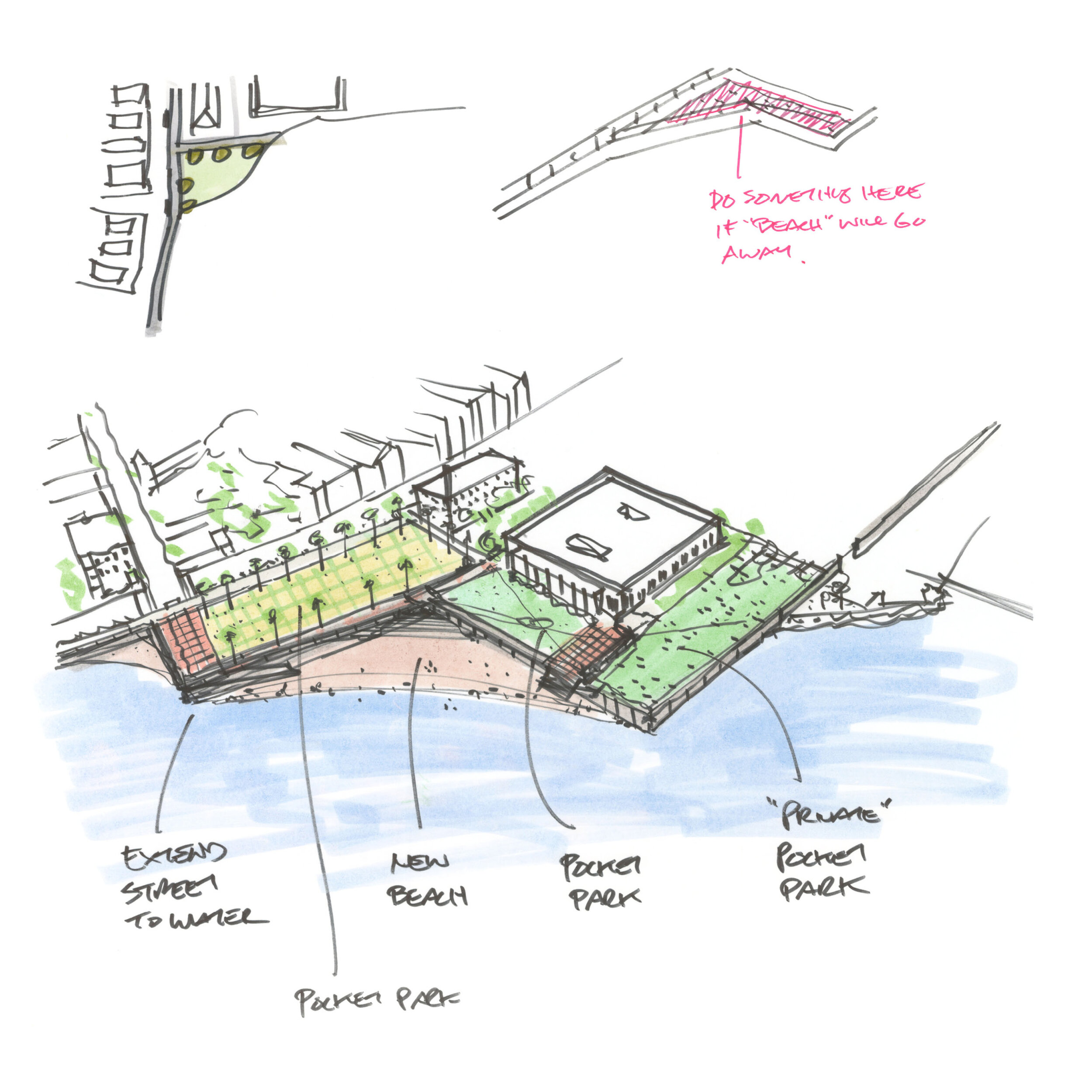
The Civic Design Opportunities report contains exploratory and conceptual design elements for 16 comprehensive geographic segments along the perimeter of the Charleston peninsula. The image gallery below shows some of this content for 7 of these important areas: Brittlebank Park at upper Lockwood Drive, the City Marina area at the James Island Connector and the Medical District, Union Pier Terminal, Upper Morrison and Upper Peninsula area, Waterfront Park, lower Lockwood Drive near Broad Street, and the High Battery.
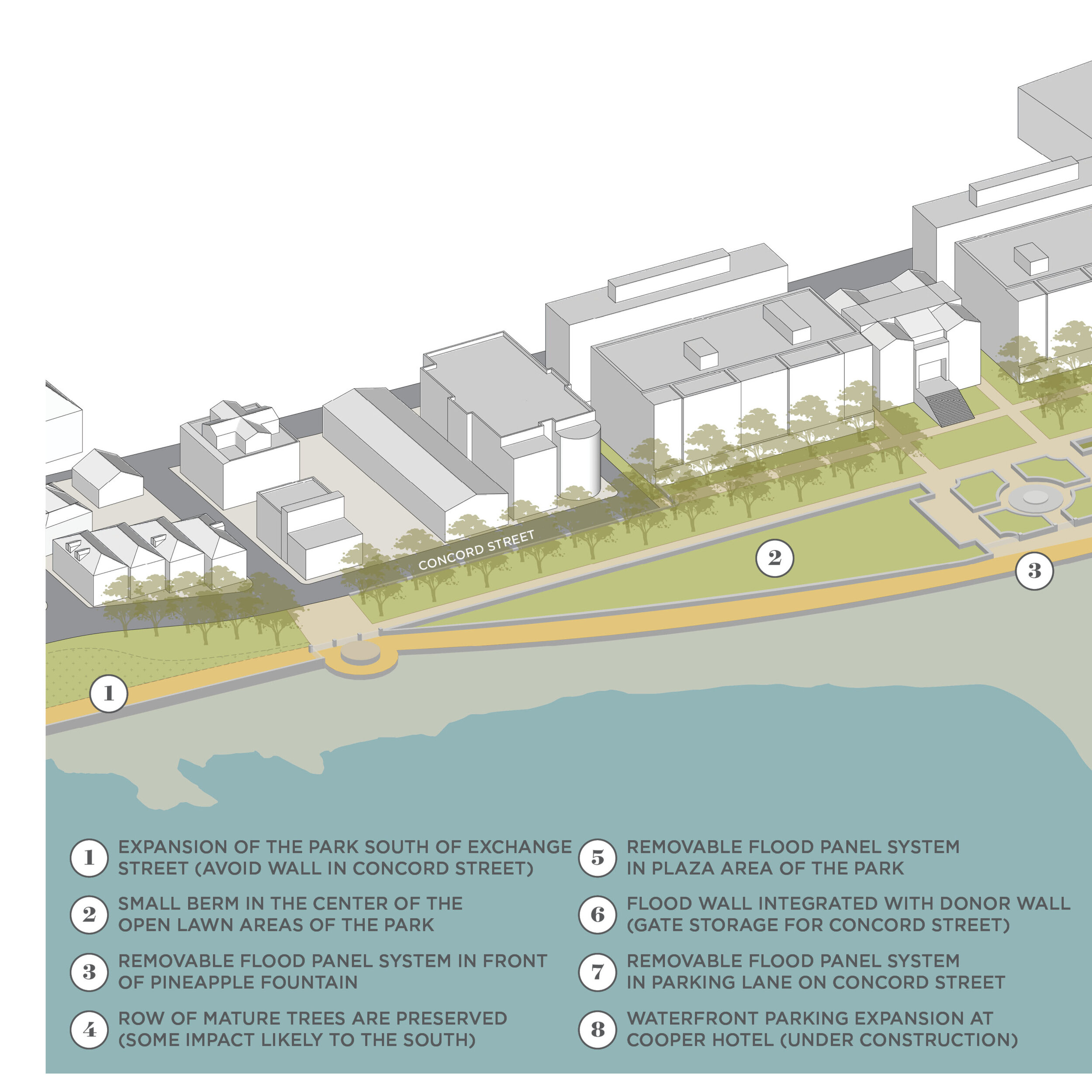
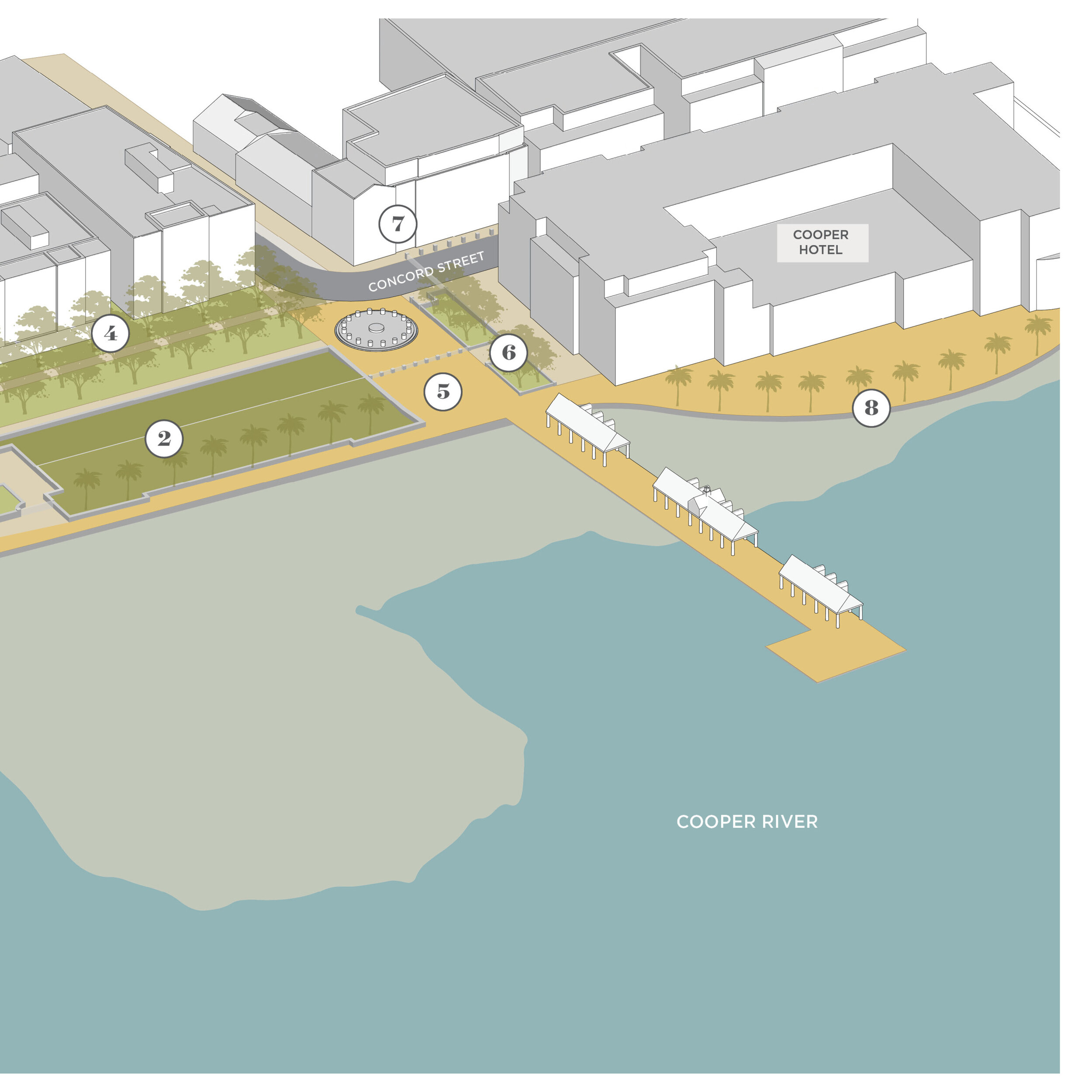
The visual dimensions of content should be considered as a collection of possible ideas and aspirations, not an ultimate final solution or grand proposal. The use of sketches is deliberate, intended to show ideas plainly and quickly as the concepts they are. The street level renderings in the report are our interpretation of the planned USACE barrier design based on precedent walls and gates, provided typical sections in the USACE report, wall height from ground, and TSP alignment map. We have also reinterpreted various maps and illustrations from the USACE TSP for better communication and understanding. Finally, the concept area plans are targeted for many years into the future (especially regarding the development pattern shown).


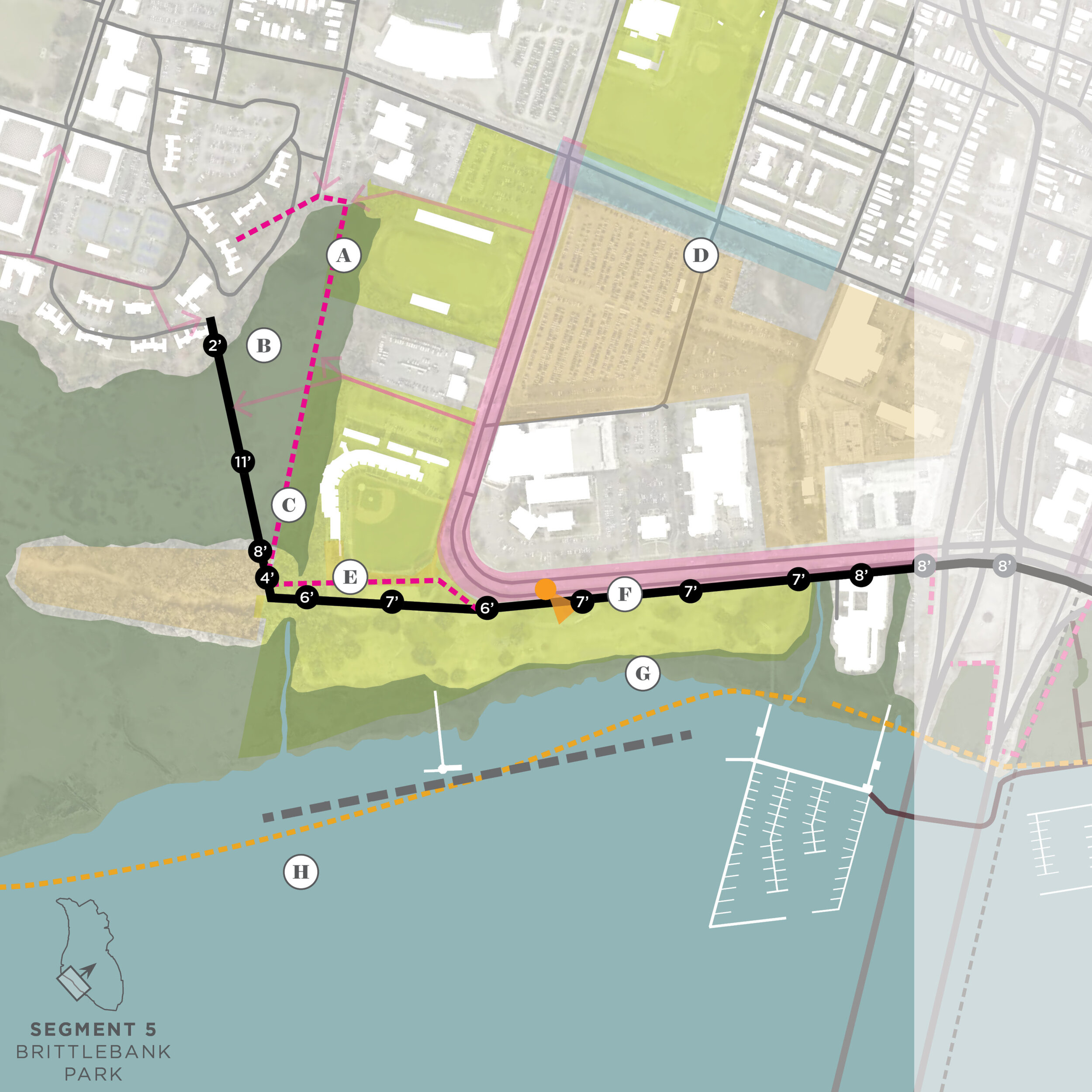

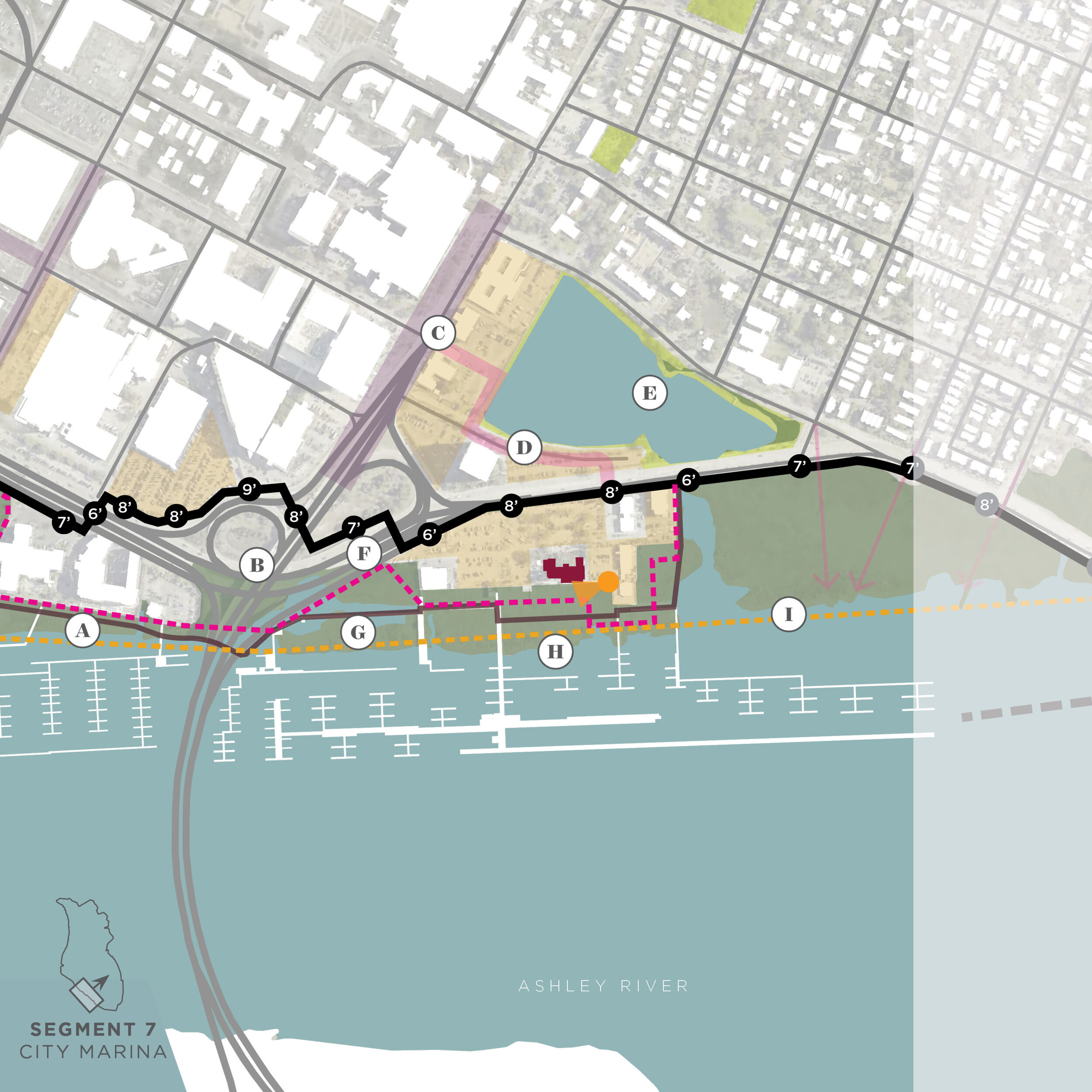


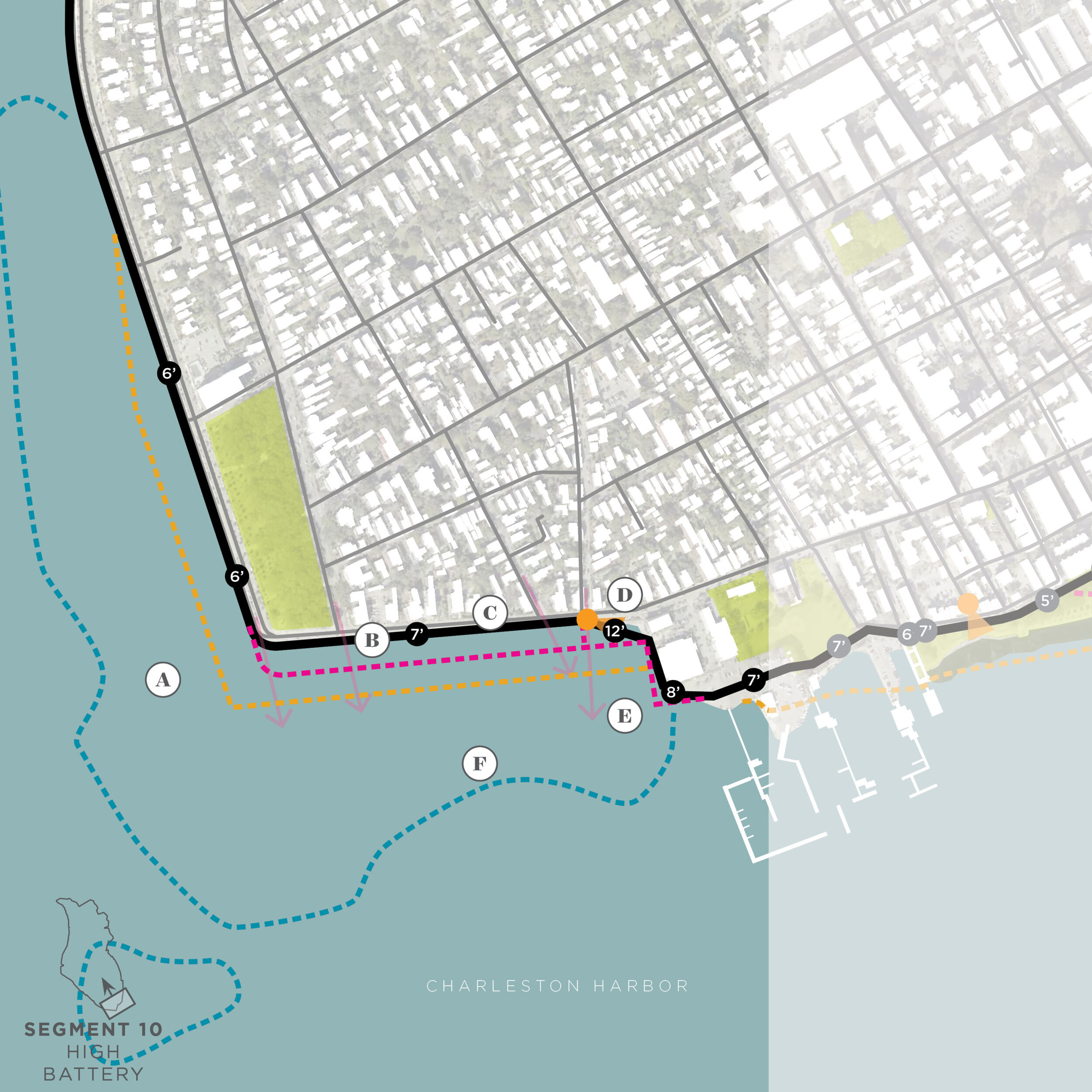
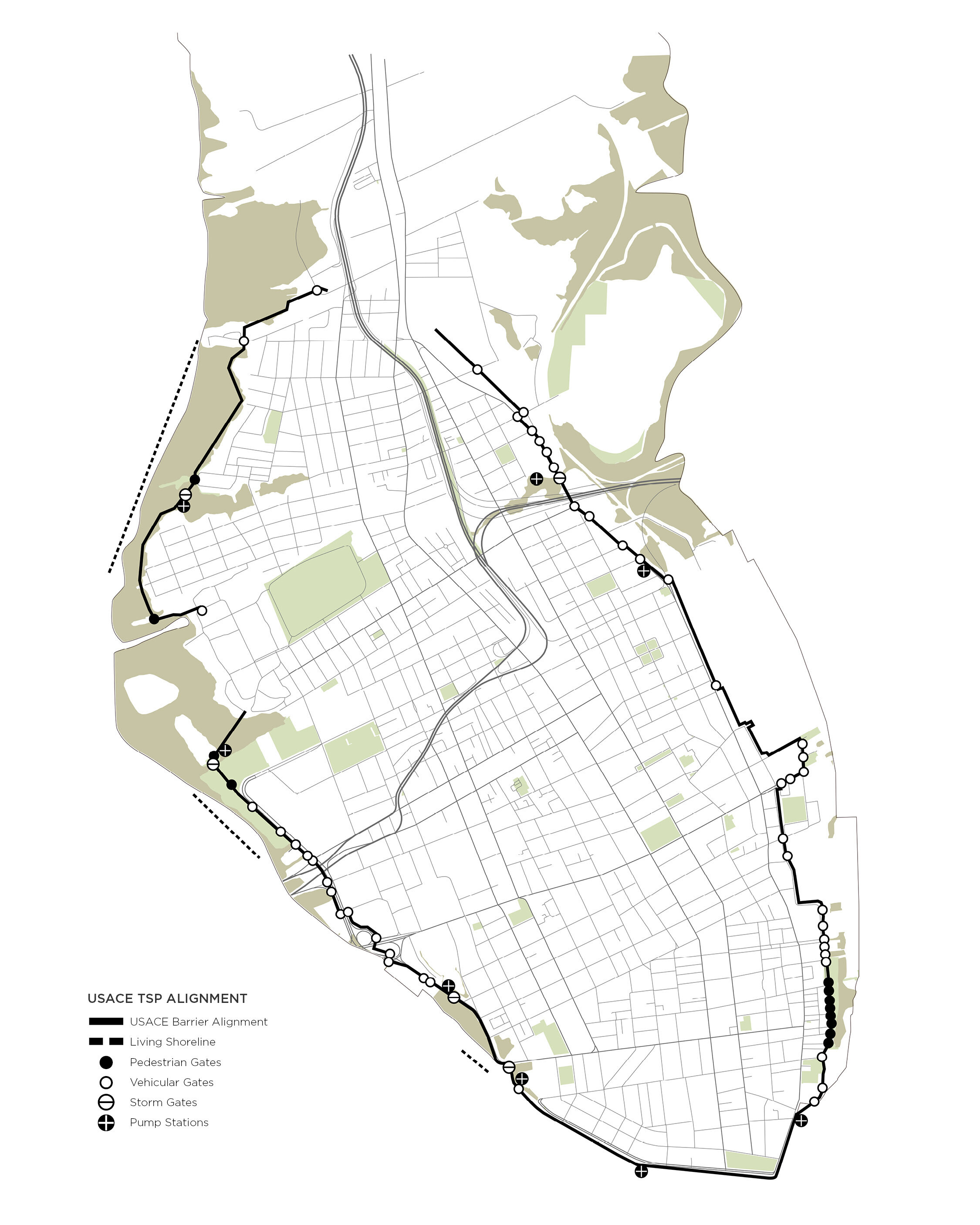
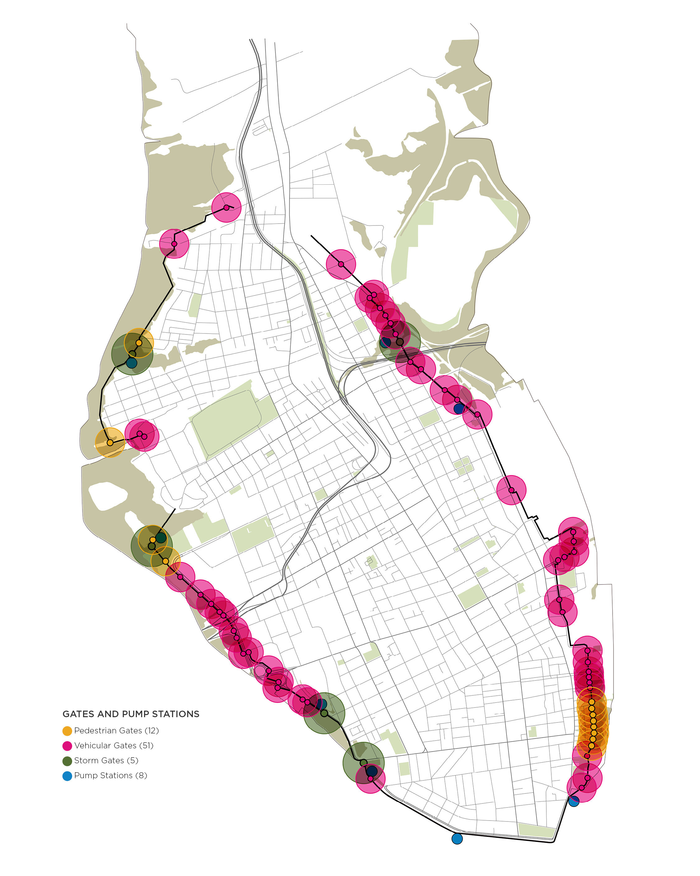
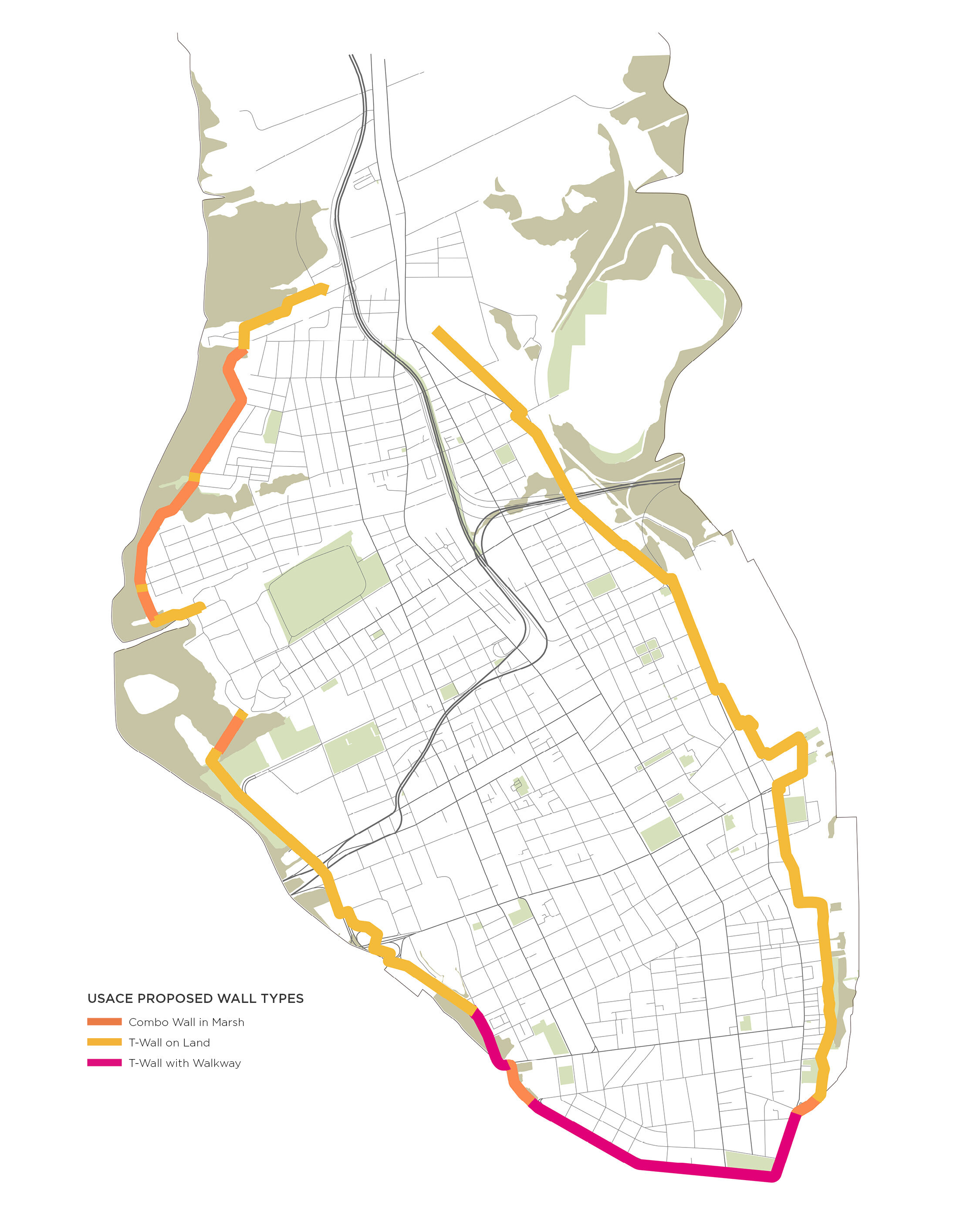
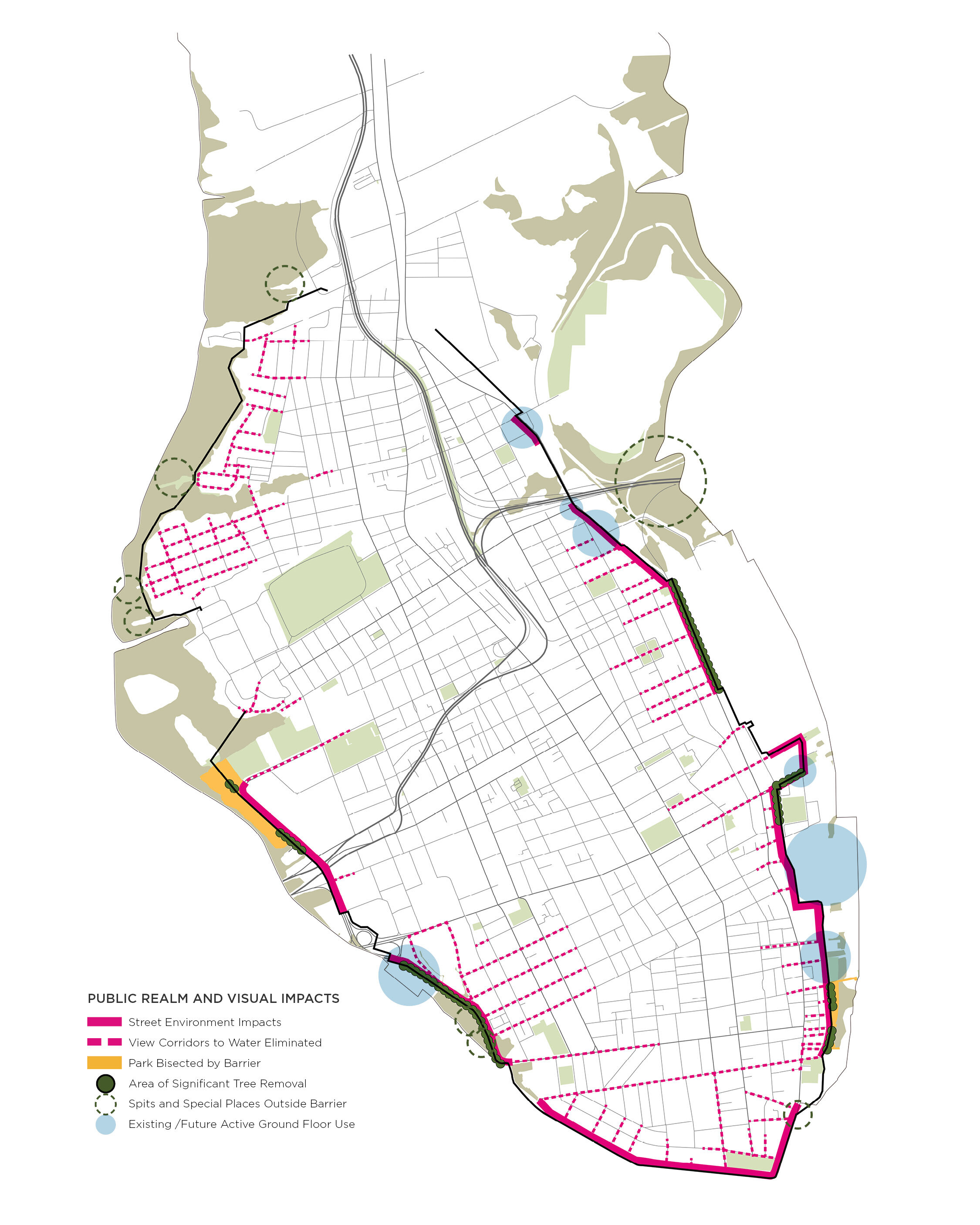
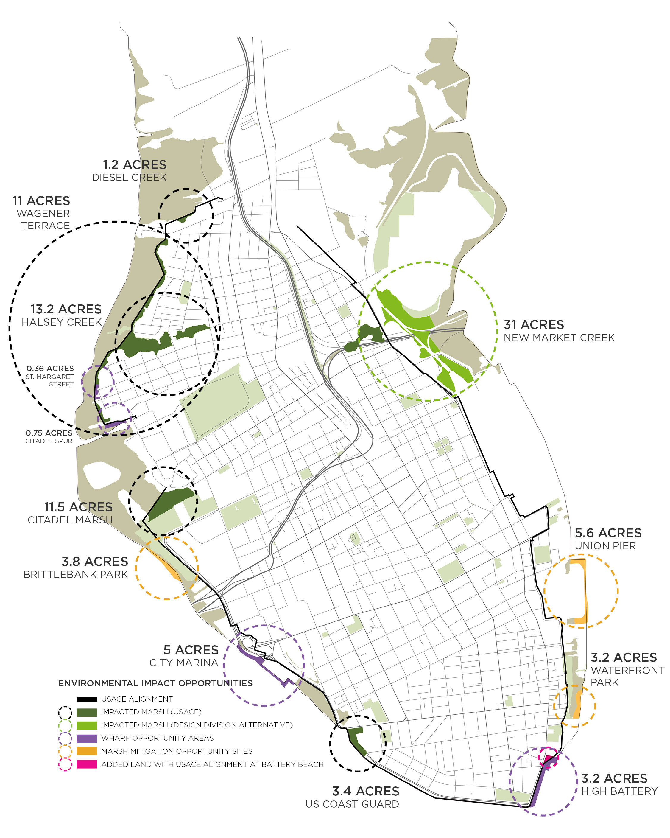
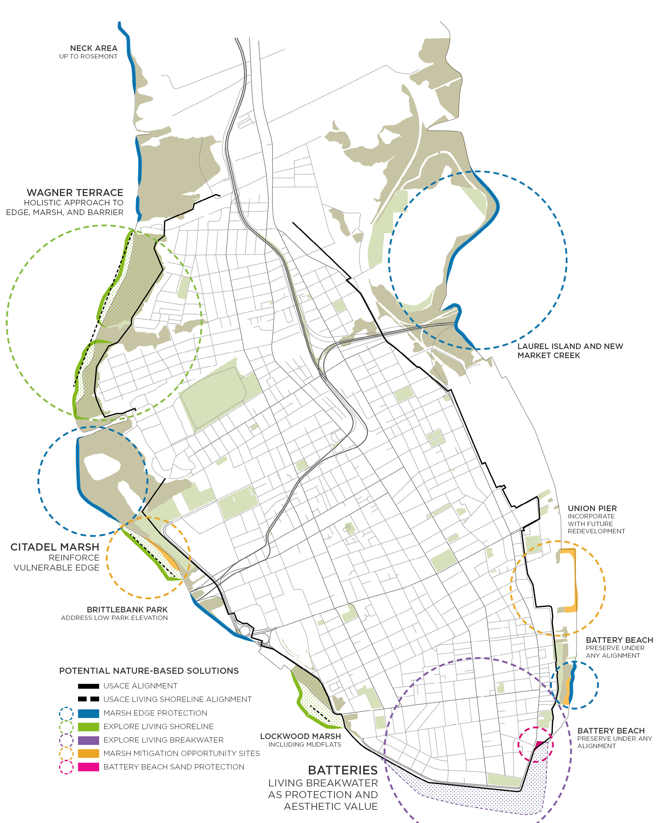
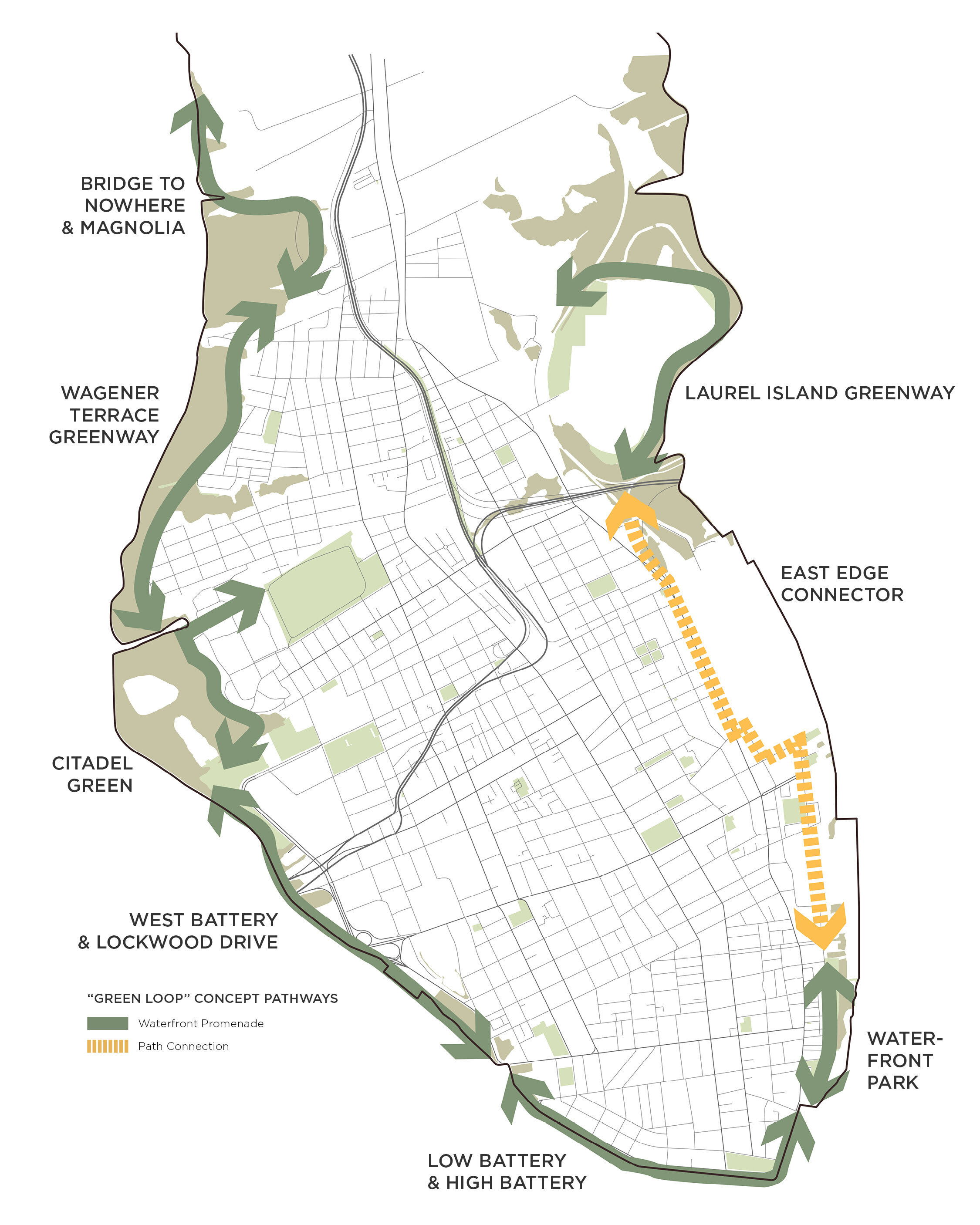
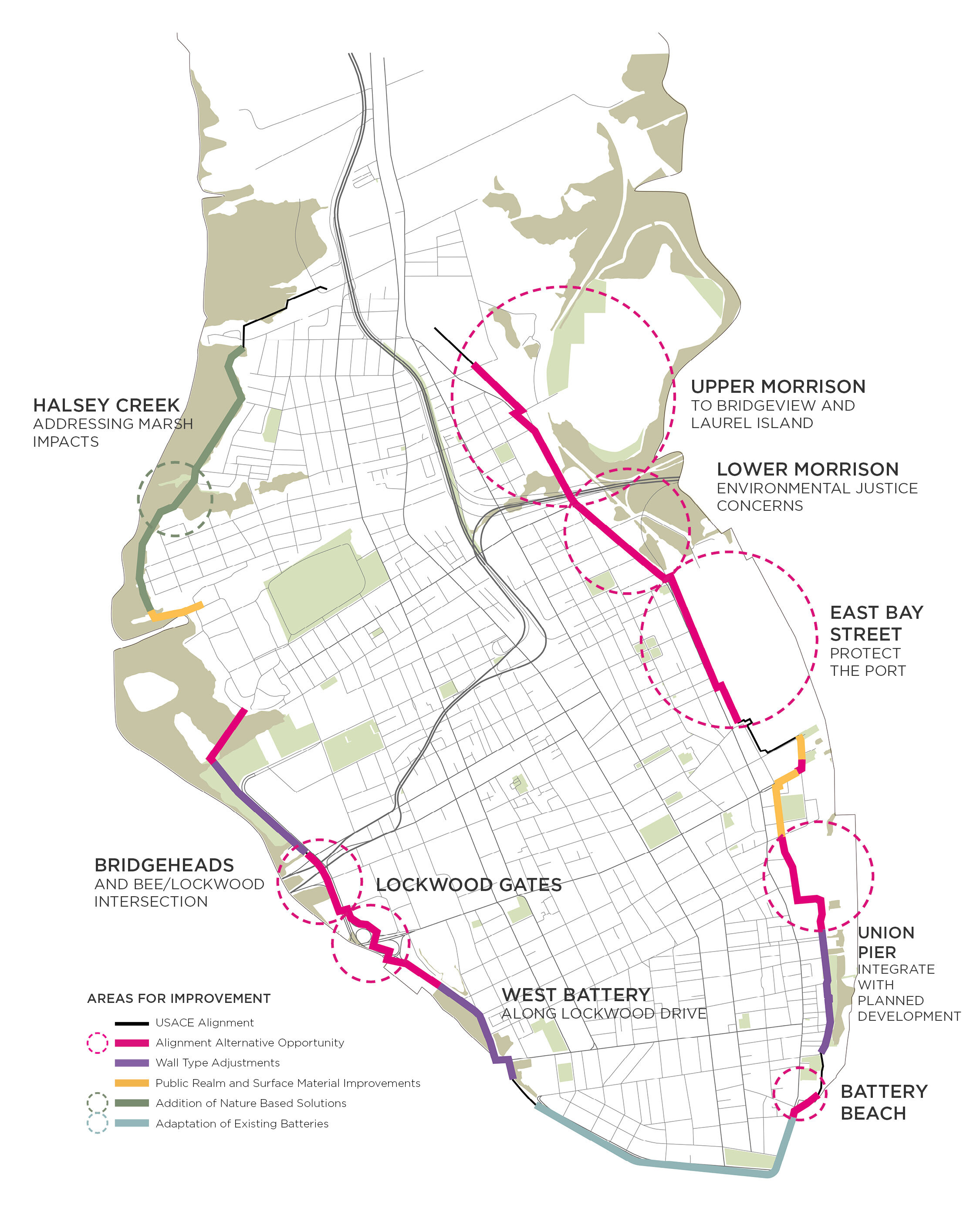
Peninsula Maps
Several Charleston peninsula maps show the USACE TSP alignment, the proposed wall types, the height of the wall from the ground, visual impacts, and areas we see for improvement. Other maps include opportunities for additional nature based solutions, environmental impacts, and a “green loop” around the peninsula. These maps are used to discuss key issues and opportunities for the overall project area.